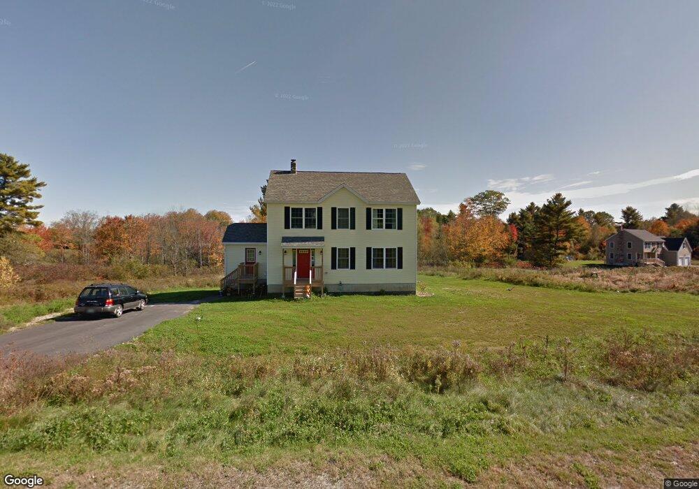
24 Fillions Way Gorham, ME 04038
Estimated Value: $680,761 - $742,000
5
Beds
4
Baths
2,612
Sq Ft
$276/Sq Ft
Est. Value
About This Home
This home is located at 24 Fillions Way, Gorham, ME 04038 and is currently estimated at $720,254, approximately $275 per square foot. 24 Fillions Way is a home located in Cumberland County with nearby schools including Village Elementary School, Gorham Middle School, and Gorham High School.
Ownership History
Date
Name
Owned For
Owner Type
Purchase Details
Closed on
Jan 18, 2011
Sold by
Grandview M & M Llc
Bought by
Pigeon Kathleen and Gabe Beverly A
Current Estimated Value
Home Financials for this Owner
Home Financials are based on the most recent Mortgage that was taken out on this home.
Original Mortgage
$246,678
Outstanding Balance
$161,133
Interest Rate
4.46%
Mortgage Type
FHA
Estimated Equity
$559,121
Purchase Details
Closed on
Oct 6, 2006
Sold by
Sprague Jack E and Sprague Michelle M
Bought by
Jes Llc
Create a Home Valuation Report for This Property
The Home Valuation Report is an in-depth analysis detailing your home's value as well as a comparison with similar homes in the area
Home Values in the Area
Average Home Value in this Area
Purchase History
We collect this data history from publicly available records. To have your information removed, we recommend requesting removal directly through your county’s website.
| Date | Buyer | Sale Price | Title Company |
|---|---|---|---|
| Pigeon Kathleen | -- | -- | |
| Jes Llc | -- | -- |
Source: Public Records
Mortgage History
We collect this data history from publicly available records. To have your information removed, we recommend requesting removal directly through your county’s website.
| Date | Status | Borrower | Loan Amount |
|---|---|---|---|
| Open | Pigeon Kathleen | $246,678 |
Source: Public Records
Tax History
| Year | Tax Paid | Tax Assessment Tax Assessment Total Assessment is a certain percentage of the fair market value that is determined by local assessors to be the total taxable value of land and additions on the property. | Land | Improvement |
|---|---|---|---|---|
| 2025 | $7,289 | $492,500 | $122,200 | $370,300 |
| 2024 | $7,240 | $492,500 | $122,200 | $370,300 |
| 2023 | $5,060 | $368,000 | $122,200 | $245,800 |
| 2022 | $4,729 | $368,000 | $122,200 | $245,800 |
| 2021 | $4,414 | $227,500 | $84,300 | $143,200 |
| 2020 | $4,323 | $227,500 | $84,300 | $143,200 |
| 2019 | $4,311 | $227,500 | $84,300 | $143,200 |
| 2018 | $4,141 | $227,500 | $84,300 | $143,200 |
| 2017 | $3,890 | $227,500 | $84,300 | $143,200 |
| 2016 | $3,871 | $227,700 | $84,500 | $143,200 |
| 2015 | $3,712 | $227,700 | $84,500 | $143,200 |
| 2014 | $3,891 | $223,600 | $83,300 | $140,300 |
| 2013 | $3,868 | $223,600 | $83,300 | $140,300 |
Source: Public Records
Map
Nearby Homes
- 10 Old Orchard Rd
- 8 Elliott Rd
- 32 Spiller Rd
- 866 Parker Farm Lot A Rd
- 866 Parker Farm Lot B Rd
- 252 Ossipee Trail E
- 866 Parker Farm Rd Unit A
- 866 Parker Farm Rd Unit B
- 748 Parker Farm Rd
- 35 Rust Rd
- 11 Gloria St
- 19 Windswept Dr Unit 5
- 17 Christopher Rd
- 16 Captain's Way
- 63 Ossipee Trail E
- 27 Ossipee Trail E Unit 1
- 15 Ossipee Trail E
- 697 Fort Hill Rd
- 708 Fort Hill Rd
- 13 Cider Mill Ln
Your Personal Tour Guide
Ask me questions while you tour the home.