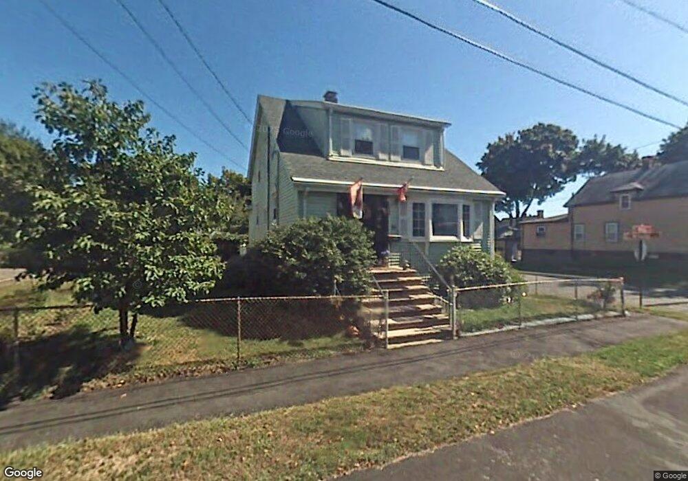
24 Newhall St Saugus, MA 01906
Cliftondale NeighborhoodEstimated Value: $632,191 - $704,000
3
Beds
2
Baths
1,500
Sq Ft
$442/Sq Ft
Est. Value
About This Home
This home is located at 24 Newhall St, Saugus, MA 01906 and is currently estimated at $662,298, approximately $441 per square foot. 24 Newhall St is a home located in Essex County with nearby schools including Saugus High School and Sacred Heart School.
Ownership History
Date
Name
Owned For
Owner Type
Purchase Details
Closed on
Apr 30, 2013
Sold by
Smith Edward and Smith Linda
Bought by
Cova Mary and Cova Brian
Current Estimated Value
Home Financials for this Owner
Home Financials are based on the most recent Mortgage that was taken out on this home.
Original Mortgage
$284,648
Outstanding Balance
$198,313
Interest Rate
3.64%
Mortgage Type
FHA
Estimated Equity
$463,985
Purchase Details
Closed on
Jun 29, 2001
Sold by
Lagattolla Peter and Lagattolla Elizabeth C
Bought by
Smith Edward and Smith Linda
Create a Home Valuation Report for This Property
The Home Valuation Report is an in-depth analysis detailing your home's value as well as a comparison with similar homes in the area
Home Values in the Area
Average Home Value in this Area
Purchase History
We collect this data history from publicly available records. To have your information removed, we recommend requesting removal directly through your county’s website.
| Date | Buyer | Sale Price | Title Company |
|---|---|---|---|
| Cova Mary | $289,900 | -- | |
| Smith Edward | $260,000 | -- |
Source: Public Records
Mortgage History
We collect this data history from publicly available records. To have your information removed, we recommend requesting removal directly through your county’s website.
| Date | Status | Borrower | Loan Amount |
|---|---|---|---|
| Open | Smith Edward | $284,648 | |
| Previous Owner | Smith Edward | $277,500 | |
| Previous Owner | Smith Edward | $246,000 | |
| Previous Owner | Smith Edward | $207,500 |
Source: Public Records
Tax History
| Year | Tax Paid | Tax Assessment Tax Assessment Total Assessment is a certain percentage of the fair market value that is determined by local assessors to be the total taxable value of land and additions on the property. | Land | Improvement |
|---|---|---|---|---|
| 2025 | $5,946 | $556,700 | $297,100 | $259,600 |
| 2024 | $5,697 | $534,900 | $280,100 | $254,800 |
| 2023 | $5,568 | $494,500 | $246,200 | $248,300 |
| 2022 | $5,324 | $443,300 | $225,800 | $217,500 |
| 2021 | $4,925 | $399,100 | $196,100 | $203,000 |
| 2020 | $4,557 | $382,300 | $186,800 | $195,500 |
| 2019 | $4,449 | $365,300 | $169,800 | $195,500 |
| 2018 | $4,059 | $350,500 | $164,700 | $185,800 |
| 2017 | $3,809 | $316,100 | $153,600 | $162,500 |
| 2016 | $3,848 | $315,400 | $153,200 | $162,200 |
| 2015 | $3,611 | $300,400 | $145,900 | $154,500 |
| 2014 | $3,405 | $293,300 | $145,900 | $147,400 |
Source: Public Records
Map
Nearby Homes
- 8 Ballard St
- 54 Dudley St
- 0 Hampton St
- 1 Rhodes St
- 21 Margin St Unit 33
- 28 Margin St Unit A
- 3 Phillips Ave
- 17 Margin St Unit 14
- 16 Margin St Unit 8
- 56 Raddin Grove Ave
- 76 River St
- 19 Harlow St
- 11 Willis Ct
- 6 Lindsell St
- 51 Laurel St
- 24 Curtis Rd
- 1 Twin Springs Dr
- 4 Oneil Way
- 76-78 Linden St
- 86 Farrell Rd
Your Personal Tour Guide
Ask me questions while you tour the home.