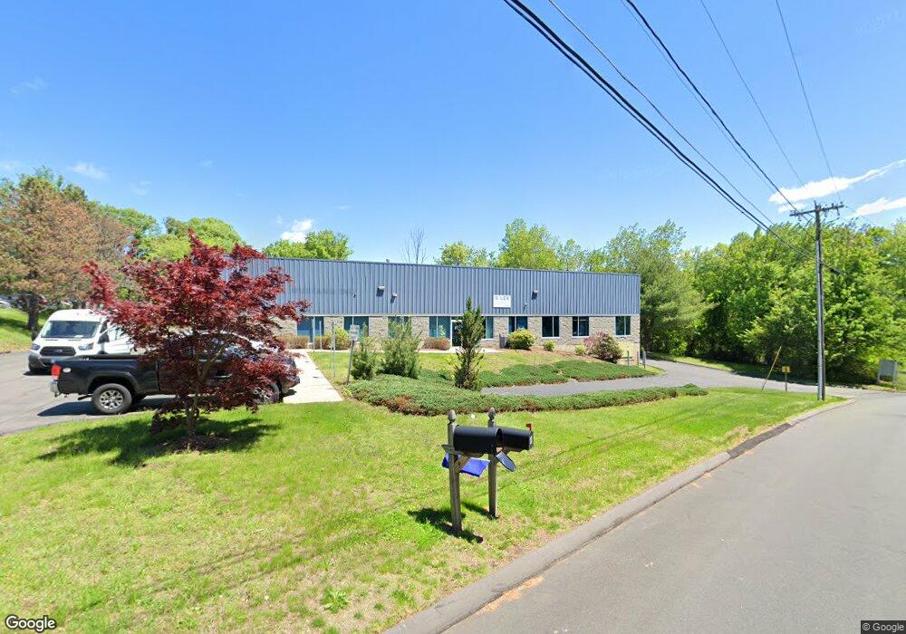
24 Robert Porter Rd Southington, CT 06489
West Southington NeighborhoodEstimated Value: $1,422,927
Studio
--
Bath
12,650
Sq Ft
$112/Sq Ft
Est. Value
About This Home
This home is located at 24 Robert Porter Rd, Southington, CT 06489 and is currently estimated at $1,422,927, approximately $112 per square foot. 24 Robert Porter Rd is a home located in Hartford County with nearby schools including Reuben E. Thalberg Elementary School, Joseph A. Depaolo Middle School, and Southington High School.
Ownership History
Date
Name
Owned For
Owner Type
Purchase Details
Closed on
Dec 29, 2014
Sold by
Delmic Enterprise Llc
Bought by
24 Robert Porter Road
Current Estimated Value
Purchase Details
Closed on
Apr 21, 2014
Sold by
Scranton David E
Bought by
Delmic Enterprise Llc
Create a Home Valuation Report for This Property
The Home Valuation Report is an in-depth analysis detailing your home's value as well as a comparison with similar homes in the area
Home Values in the Area
Average Home Value in this Area
Purchase History
| Date | Buyer | Sale Price | Title Company |
|---|---|---|---|
| 24 Robert Porter Road | -- | -- | |
| Delmic Enterprise Llc | $757,000 | -- |
Source: Public Records
Tax History
| Year | Tax Paid | Tax Assessment Tax Assessment Total Assessment is a certain percentage of the fair market value that is determined by local assessors to be the total taxable value of land and additions on the property. | Land | Improvement |
|---|---|---|---|---|
| 2025 | $13,991 | $421,290 | $101,300 | $319,990 |
| 2024 | $13,245 | $421,290 | $101,300 | $319,990 |
| 2023 | $12,790 | $421,290 | $101,300 | $319,990 |
| 2022 | $12,272 | $421,290 | $101,300 | $319,990 |
| 2021 | $12,230 | $421,290 | $101,300 | $319,990 |
| 2020 | $12,231 | $399,300 | $95,690 | $303,610 |
| 2019 | $12,235 | $399,300 | $95,690 | $303,610 |
| 2018 | $12,171 | $399,300 | $95,690 | $303,610 |
| 2017 | $12,171 | $399,300 | $95,690 | $303,610 |
| 2016 | $11,835 | $399,300 | $95,690 | $303,610 |
| 2015 | $12,451 | $427,280 | $102,480 | $324,800 |
| 2014 | $12,118 | $427,280 | $102,480 | $324,800 |
Source: Public Records
Map
Nearby Homes
- 24a Robert Porter Rd
- 300 & 320 Captain Lewis Dr
- 157 Industrial Dr
- 158 Industrial Dr
- 143 Industrial Dr
- 385 W Queen St
- 146 Industrial Dr
- 125 Robert Porter Rd
- 127 Industrial Dr
- 262 Westwood Rd
- 445 W Queen St
- 2 Westwood Rd
- 244 Westwood Rd
- 120 Industrial Dr
- 277 Captain Lewis Dr
- 254 West St
- 10 Elizabeth Dr
- 108 Industrial Dr
- 224 Westwood Rd
- 24 Elizabeth Dr
Your Personal Tour Guide
Ask me questions while you tour the home.