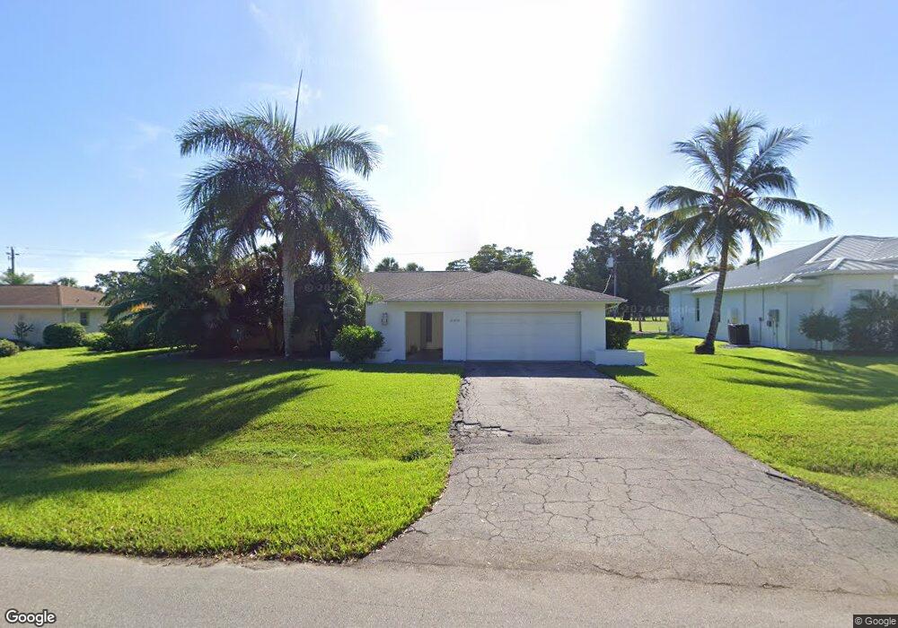
240 Burning Tree Dr Naples, FL 34105
Moorings Park-Hawks Ridge NeighborhoodEstimated Value: $883,475 - $1,448,000
Studio
--
Bath
1,669
Sq Ft
$675/Sq Ft
Est. Value
About This Home
This home is located at 240 Burning Tree Dr, Naples, FL 34105 and is currently estimated at $1,125,869, approximately $674 per square foot. 240 Burning Tree Dr is a home located in Collier County with nearby schools including Sea Gate Elementary School, Pine Ridge Middle School, and Barron Collier High School.
Ownership History
Date
Name
Owned For
Owner Type
Purchase Details
Closed on
Sep 6, 2003
Sold by
Lesyna Barbara J
Bought by
Cliff Cary Alan and Cliff Hope Lin
Current Estimated Value
Home Financials for this Owner
Home Financials are based on the most recent Mortgage that was taken out on this home.
Original Mortgage
$240,000
Outstanding Balance
$112,025
Interest Rate
6.33%
Estimated Equity
$1,013,844
Purchase Details
Closed on
Nov 20, 2002
Sold by
Schulte Mary Evelyn
Bought by
Schulte Mary Evelyn
Create a Home Valuation Report for This Property
The Home Valuation Report is an in-depth analysis detailing your home's value as well as a comparison with similar homes in the area
Home Values in the Area
Average Home Value in this Area
Purchase History
| Date | Buyer | Sale Price | Title Company |
|---|---|---|---|
| Cliff Cary Alan | $300,000 | -- | |
| Schulte Mary Evelyn | -- | -- |
Source: Public Records
Mortgage History
| Date | Status | Borrower | Loan Amount |
|---|---|---|---|
| Open | Cliff Cary Alan | $240,000 |
Source: Public Records
Tax History
| Year | Tax Paid | Tax Assessment Tax Assessment Total Assessment is a certain percentage of the fair market value that is determined by local assessors to be the total taxable value of land and additions on the property. | Land | Improvement |
|---|---|---|---|---|
| 2025 | $7,135 | $622,221 | -- | -- |
| 2024 | $7,245 | $565,655 | -- | -- |
| 2023 | $7,245 | $514,232 | $0 | $0 |
| 2022 | $5,984 | $467,484 | $0 | $0 |
| 2021 | $5,067 | $424,985 | $0 | $0 |
| 2020 | $4,398 | $386,350 | $268,726 | $117,624 |
| 2019 | $4,587 | $387,459 | $0 | $0 |
| 2018 | $4,520 | $352,235 | $0 | $0 |
| 2017 | $4,133 | $320,214 | $0 | $0 |
| 2016 | $4,080 | $291,104 | $0 | $0 |
| 2015 | $3,548 | $264,640 | $0 | $0 |
| 2014 | $3,092 | $240,582 | $0 | $0 |
Source: Public Records
Map
Nearby Homes
- 237 Burning Tree Dr
- 200 Burning Tree Dr
- 318 Burning Tree Dr
- 335 Burning Tree Dr
- 1037 Forest Lakes Dr Unit 8D
- 1041 Forest Lakes Dr Unit 7-D
- 1086 Forest Lakes Dr Unit 9207
- 1086 Forest Lakes Dr Unit 102
- 1086 Forest Lakes Dr Unit 9305
- 1084 Forest Lakes Dr Unit 7304
- 1083 Forest Lakes Dr Unit 6304/6305
- 1094 Forest Lakes Dr Unit 20C
- 1087 Forest Lakes Dr Unit 1-201
- 1087 Forest Lakes Dr Unit 309
- 1087 Forest Lakes Dr Unit 1-104
- 1087 Forest Lakes Dr Unit 1-309
- 267 Quail Forest Blvd Unit 209
- 1723 Camelia Ln
- 87 Burning Tree Dr
- 201 Quail Forest Blvd Unit 109
- 232 Burning Tree Dr
- 248 Burning Tree Dr
- 245 Burning Tree Dr
- 224 Burning Tree Dr
- 256 Burning Tree Dr
- 231 Burning Tree Dr
- 221 Burning Tree Dr
- 259 Burning Tree Dr
- 216 Burning Tree Dr
- 264 Burning Tree Dr
- 213 Burning Tree Dr
- 247 Burning Tree Dr
- 253 Burning Tree Dr
- 267 Burning Tree Dr
- 208 Burning Tree Dr
- 272 Burning Tree Dr
- 277 Burning Tree Dr
- 200 Burning Tree Dr Unit 20
- 280 Burning Tree Dr
- 281 Mel Jen Dr
Your Personal Tour Guide
Ask me questions while you tour the home.