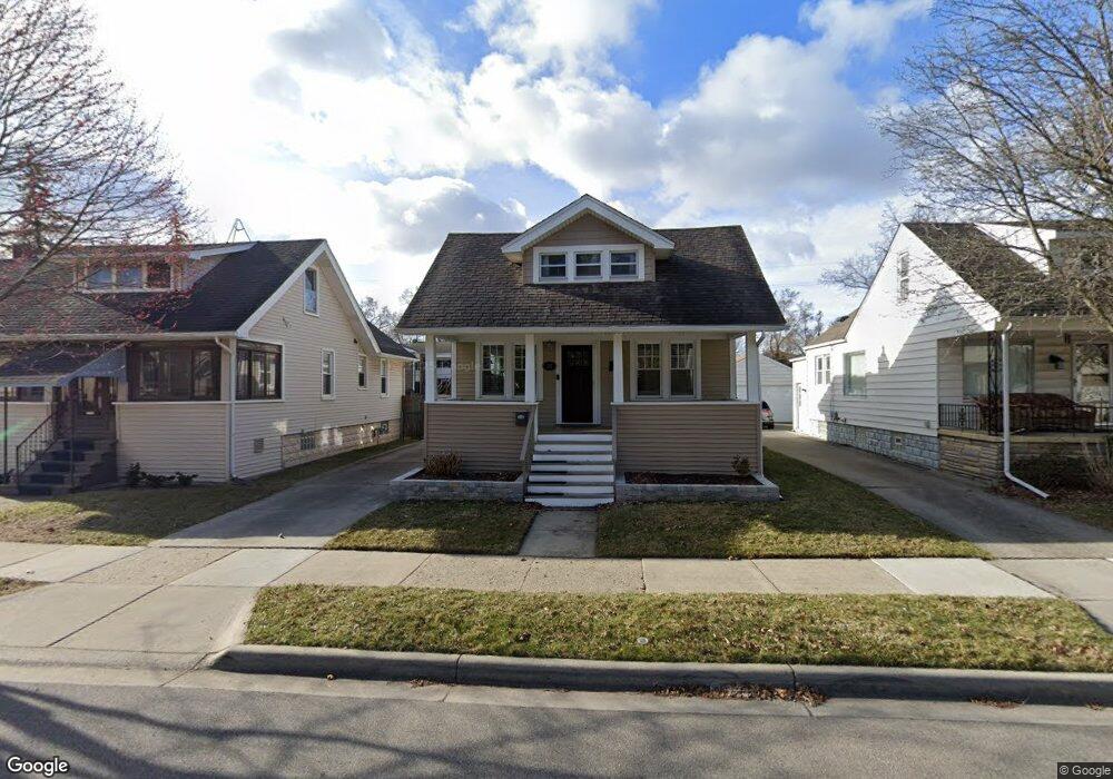
240 E Oakridge St Ferndale, MI 48220
Estimated Value: $276,000 - $311,000
3
Beds
2
Baths
1,042
Sq Ft
$279/Sq Ft
Est. Value
About This Home
This home is located at 240 E Oakridge St, Ferndale, MI 48220 and is currently estimated at $290,922, approximately $279 per square foot. 240 E Oakridge St is a home located in Oakland County with nearby schools including Ferndale Lower Elementary Campus, Ferndale Upper Elementary Campus, and Ferndale Middle School.
Ownership History
Date
Name
Owned For
Owner Type
Purchase Details
Closed on
Dec 30, 2015
Sold by
Lantry Timothy Joseph
Bought by
Lanstey Timothy Joseph and Scott James A
Current Estimated Value
Purchase Details
Closed on
Aug 21, 2002
Sold by
Holman Newell
Bought by
Lantzy Timothy J
Home Financials for this Owner
Home Financials are based on the most recent Mortgage that was taken out on this home.
Original Mortgage
$128,981
Outstanding Balance
$51,980
Interest Rate
6.56%
Estimated Equity
$238,942
Purchase Details
Closed on
Jun 17, 1986
Sold by
Holman Lela
Bought by
Holman Lela
Create a Home Valuation Report for This Property
The Home Valuation Report is an in-depth analysis detailing your home's value as well as a comparison with similar homes in the area
Home Values in the Area
Average Home Value in this Area
Purchase History
| Date | Buyer | Sale Price | Title Company |
|---|---|---|---|
| Lanstey Timothy Joseph | -- | Attorney | |
| Lantzy Timothy J | $130,000 | -- | |
| Holman Lela | -- | -- |
Source: Public Records
Mortgage History
| Date | Status | Borrower | Loan Amount |
|---|---|---|---|
| Open | Lantzy Timothy J | $128,981 |
Source: Public Records
Tax History
| Year | Tax Paid | Tax Assessment Tax Assessment Total Assessment is a certain percentage of the fair market value that is determined by local assessors to be the total taxable value of land and additions on the property. | Land | Improvement |
|---|---|---|---|---|
| 2025 | $4,715 | $145,020 | $0 | $0 |
| 2024 | $4,576 | $139,880 | $0 | $0 |
| 2023 | $4,422 | $131,620 | $0 | $0 |
| 2022 | $4,384 | $121,300 | $0 | $0 |
| 2021 | $4,031 | $92,910 | $0 | $0 |
| 2020 | $3,858 | $87,640 | $0 | $0 |
| 2019 | $3,887 | $78,450 | $0 | $0 |
| 2018 | $3,684 | $64,500 | $0 | $0 |
| 2017 | $3,630 | $63,310 | $0 | $0 |
| 2016 | $3,787 | $58,040 | $0 | $0 |
| 2015 | -- | $53,270 | $0 | $0 |
| 2014 | -- | $44,410 | $0 | $0 |
| 2011 | -- | $45,110 | $0 | $0 |
Source: Public Records
Map
Nearby Homes
- 449 E Oakridge St
- 340 W Maplehurst St
- 49 Amherst Rd
- 525 E Lewiston Ave
- 88 Wellesley Dr
- 502 E Lewiston Ave
- 535 E Lewiston Ave
- 2840 Horton St
- 187 Vester St
- 3116 Horton St
- 211 E 9 Mile Rd Unit 313
- 490 E Cambourne St
- 629 W Lewiston Ave
- 3291 Minerva St
- 350 Vester St
- 726 W Breckenridge St
- 705 W Breckenridge St
- 11 Poplar Park Blvd
- 571 W Saratoga St
- 2808 Goodrich St
- 250 E Oakridge St
- 232 E Oakridge St
- 226 E Oakridge St
- 258 E Oakridge St
- 218 E Oakridge St
- 266 E Oakridge St
- 227 E Drayton St
- 235 E Oakridge Ave
- 241 E Drayton St
- 241 E Drayton St
- 259 E Oakridge St
- 274 E Oakridge Ave
- 217 E Drayton St
- 265 E Drayton St
- 225 E Oakridge Ave
- 235 E Drayton St
- 235 E Drayton St
- 272 E Oakridge St
- 300 E Oakridge St
- 202 E Oakridge St
Your Personal Tour Guide
Ask me questions while you tour the home.