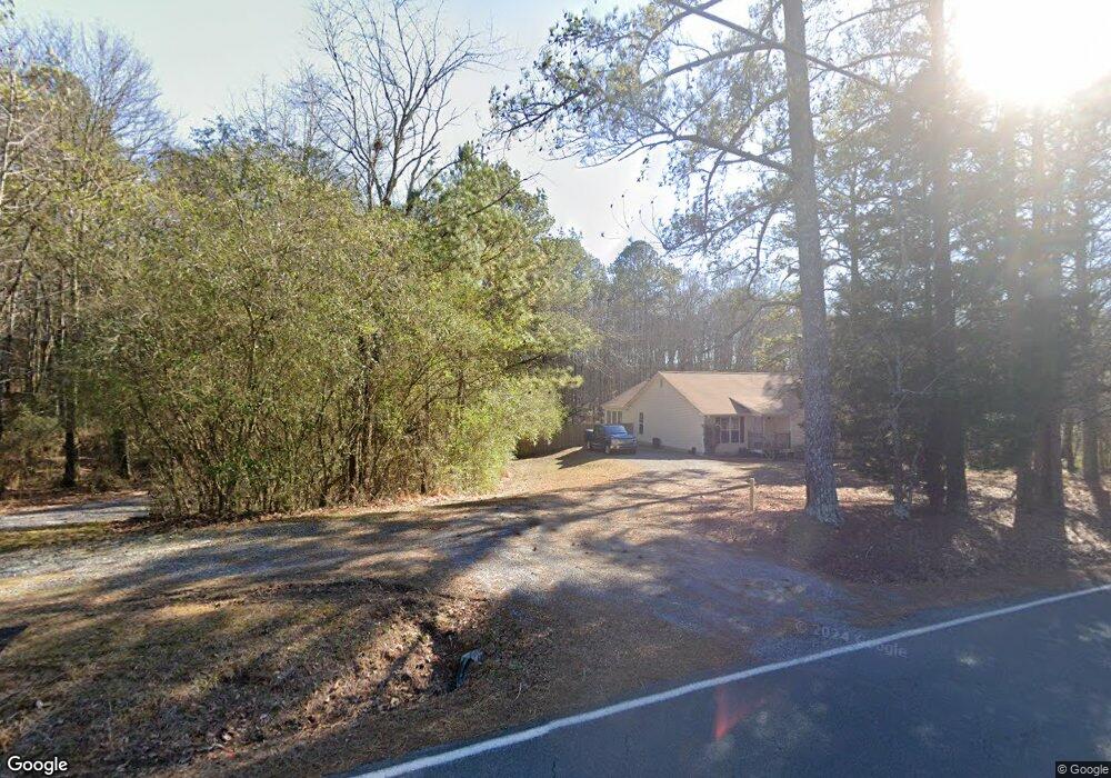
240 Kerce Rd Kingston, GA 30145
Estimated Value: $250,000 - $419,958
Studio
--
Bath
1,894
Sq Ft
$185/Sq Ft
Est. Value
About This Home
This home is located at 240 Kerce Rd, Kingston, GA 30145 and is currently estimated at $350,240, approximately $184 per square foot. 240 Kerce Rd is a home located in Floyd County with nearby schools including Model Middle School and Model High School.
Ownership History
Date
Name
Owned For
Owner Type
Purchase Details
Closed on
Feb 13, 2013
Sold by
P and R
Bought by
P and R
Current Estimated Value
Purchase Details
Closed on
Feb 5, 2013
Sold by
P and R
Bought by
P and R
Purchase Details
Closed on
Oct 30, 2006
Sold by
Not Provided
Bought by
Peace Donald R and Peace Tamera L
Home Financials for this Owner
Home Financials are based on the most recent Mortgage that was taken out on this home.
Original Mortgage
$168,500
Interest Rate
6.27%
Mortgage Type
New Conventional
Purchase Details
Closed on
Jun 1, 1994
Bought by
Peace Donald R and Peace Tamera L
Create a Home Valuation Report for This Property
The Home Valuation Report is an in-depth analysis detailing your home's value as well as a comparison with similar homes in the area
Home Values in the Area
Average Home Value in this Area
Purchase History
| Date | Buyer | Sale Price | Title Company |
|---|---|---|---|
| P | -- | -- | |
| P | -- | -- | |
| Peace Donald R | -- | -- | |
| Peace Donald R | -- | -- |
Source: Public Records
Mortgage History
| Date | Status | Borrower | Loan Amount |
|---|---|---|---|
| Previous Owner | Peace Donald R | $168,500 |
Source: Public Records
Tax History
| Year | Tax Paid | Tax Assessment Tax Assessment Total Assessment is a certain percentage of the fair market value that is determined by local assessors to be the total taxable value of land and additions on the property. | Land | Improvement |
|---|---|---|---|---|
| 2025 | $3,223 | $179,240 | $25,532 | $153,708 |
| 2024 | $3,223 | $166,203 | $22,694 | $143,509 |
| 2023 | $2,487 | $170,900 | $20,631 | $150,269 |
| 2022 | $2,827 | $141,927 | $17,008 | $124,919 |
| 2021 | $2,320 | $111,963 | $15,453 | $96,510 |
| 2020 | $2,050 | $96,293 | $13,438 | $82,855 |
| 2019 | $2,649 | $92,985 | $13,438 | $79,547 |
| 2018 | $2,558 | $88,202 | $12,798 | $75,404 |
| 2017 | $2,431 | $83,822 | $11,850 | $71,972 |
| 2016 | $2,438 | $83,072 | $11,840 | $71,232 |
| 2015 | $2,315 | $83,072 | $11,840 | $71,232 |
| 2014 | $2,315 | $83,072 | $11,840 | $71,232 |
Source: Public Records
Map
Nearby Homes
- 159 Ward Mountain Rd
- 145 Wiseman Rd
- 0 Mcclain Rd Unit 10537234
- 0 Brewer Rd Unit 10712421
- 493 Morrison Camp Ground Rd NE
- 438 Youngs Mill Rd
- 39 Fieldstone Dr NE
- 4 Cohutta Ct
- 7 Moss Creek Dr NE
- 567 Fred Kelley Rd NE
- 32 Fieldstone Dr NE
- 127 Branson Rd SE
- 1746 Wayside Rd
- 1799 Wayside Rd
- 20 Meadows Dr SE
- 406 Fred Kelley Rd NE
- 1644 Wayside Rd NE
- 919 Ward Mountain Rd
- 0 Fred Kelly Rd NE Unit 26384103
- 0 Fred Kelly Rd NE Unit 10695121
Your Personal Tour Guide
Ask me questions while you tour the home.