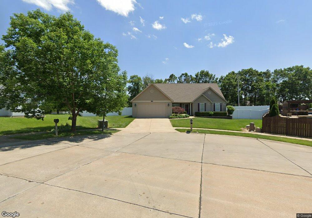
2404 Mountain Range Ct Pacific, MO 63069
Estimated Value: $338,000 - $360,000
About This Home
This home is located at 2404 Mountain Range Ct, Pacific, MO 63069 and is currently estimated at $344,329, approximately $205 per square foot. 2404 Mountain Range Ct is a home located in Franklin County with nearby schools including Pacific High School and St Bridget Elementary School.
Ownership History
We collect this data history from publicly available records. To have your information removed, we recommend requesting removal directly through your county’s website.
Purchase Details
Home Financials for this Owner
Home Financials are based on the most recent Mortgage that was taken out on this home.Purchase Details
Home Values in the Area
Average Home Value in this Area
Purchase History
We collect this data history from publicly available records. To have your information removed, we recommend requesting removal directly through your county’s website.
| Date | Buyer | Sale Price | Title Company |
|---|---|---|---|
| -- | None Available | ||
| -- | None Available |
Mortgage History
We collect this data history from publicly available records. To have your information removed, we recommend requesting removal directly through your county’s website.
| Date | Status | Borrower | Loan Amount |
|---|---|---|---|
| Closed | $170,000 |
Tax History
We collect this data history from publicly available records. To have your information removed, we recommend requesting removal directly through your county’s website.
| Year | Tax Paid | Tax Assessment Tax Assessment Total Assessment is a certain percentage of the fair market value that is determined by local assessors to be the total taxable value of land and additions on the property. | Land | Improvement |
|---|---|---|---|---|
| 2025 | $3,093 | $47,483 | $0 | $0 |
| 2024 | $3,093 | $40,084 | $0 | $0 |
| 2023 | $3,027 | $39,509 | $0 | $0 |
| 2022 | $2,947 | $42,476 | $0 | $0 |
| 2021 | $2,934 | $42,476 | $0 | $0 |
| 2020 | $2,656 | $38,424 | $0 | $0 |
| 2019 | $2,652 | $38,424 | $0 | $0 |
| 2018 | $2,488 | $35,304 | $0 | $0 |
| 2017 | $2,470 | $35,304 | $0 | $0 |
| 2016 | $2,299 | $32,524 | $0 | $0 |
| 2015 | $2,236 | $32,524 | $0 | $0 |
| 2014 | $2,216 | $32,792 | $0 | $0 |
Map
- 812 Silver Lake View Dr
- 652 Ct
- 668 #12 Highlands Ct Ct
- 667 #9 Highlands Rd
- 1780 Kristi Ln
- 122 Winter Wheat Trail
- 40 Brush Creek Dr
- 33 Cedar Dr
- 1877 Forest Ln
- 215 Candlewick Dr
- 1657 Westlake Ct
- 1192 Tahoe Place
- 1408 W Congress St
- 107 Vincent St
- 1323 W Congress St
- 156 Hogan Ave
- 109 Marcia Ln
- 6827 Eagles Landing Ct
- 2161 Young Rd
- 429 Orr St
- 2456 Silver Lake Estates Dr
- 2452 Silver Lake Estates Dr
- 2452 Silver Lake Estates Dr Unit ESTATES
- 2405 Mountain Range Ct
- 2409 Mountain Range Ct
- 2448 Silver Lake Estates Dr
- 2448 Silver Lake Estates Dr Unit ESTATES
- 2502 Silver Lake Estates Dr
- 2444 Silver Lake Estates Dr
- 901 Sierra Ridge Ave
- 905 Sierra Ridge Ave
- 815 Sierra Ridge Ave
- 2402 Smokey Mountain Ln
- 2406 Smokey Mountain Ln
- 2506 Silver Lake Estates Dr
- 909 Sierra Ridge Ave
- 2410 Smokey Mountain Ln
- 811 Sierra Ridge Ave
- 2440 Silver Lake Estates Dr
- 2455 Silver Lake Estates Dr
Ask me questions while you tour the home.