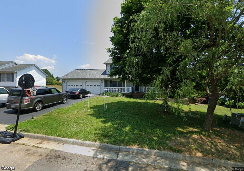
2417 Bloomfield Ave Roanoke, VA 24012
Estimated Value: $373,000 - $447,000
4
Beds
4
Baths
2,008
Sq Ft
$210/Sq Ft
Est. Value
About This Home
This home is located at 2417 Bloomfield Ave, Roanoke, VA 24012 and is currently estimated at $421,117, approximately $209 per square foot. 2417 Bloomfield Ave is a home located in Roanoke County with nearby schools including Bonsack Elementary School, William Byrd Middle School, and William Byrd High School.
Ownership History
Date
Name
Owned For
Owner Type
Purchase Details
Closed on
Jul 11, 2022
Sold by
Rothe Thomas and Rothe Leann R
Bought by
Thomas H Rothe And Leann R Rothe Living Trust
Current Estimated Value
Purchase Details
Closed on
Dec 10, 2018
Sold by
Rothe Thomas H
Bought by
Rothe Thomas H and Rothe Leann R
Home Financials for this Owner
Home Financials are based on the most recent Mortgage that was taken out on this home.
Original Mortgage
$214,400
Interest Rate
4.9%
Mortgage Type
New Conventional
Create a Home Valuation Report for This Property
The Home Valuation Report is an in-depth analysis detailing your home's value as well as a comparison with similar homes in the area
Purchase History
| Date | Buyer | Sale Price | Title Company |
|---|---|---|---|
| Thomas H Rothe And Leann R Rothe Living Trust | -- | None Listed On Document | |
| Thomas H Rothe And Leann R Rothe Living Trust | -- | None Listed On Document | |
| Rothe Thomas H | -- | First American Title Insuran |
Source: Public Records
Mortgage History
| Date | Status | Borrower | Loan Amount |
|---|---|---|---|
| Previous Owner | Rothe Thomas H | $214,400 |
Source: Public Records
Tax History
| Year | Tax Paid | Tax Assessment Tax Assessment Total Assessment is a certain percentage of the fair market value that is determined by local assessors to be the total taxable value of land and additions on the property. | Land | Improvement |
|---|---|---|---|---|
| 2025 | $4,092 | $397,300 | $59,000 | $338,300 |
| 2024 | $3,931 | $378,000 | $54,000 | $324,000 |
| 2023 | $3,870 | $365,100 | $54,000 | $311,100 |
| 2022 | $3,297 | $302,500 | $49,000 | $253,500 |
| 2021 | $3,017 | $276,800 | $45,000 | $231,800 |
| 2020 | $2,785 | $255,500 | $40,000 | $215,500 |
| 2019 | $2,696 | $247,300 | $39,000 | $208,300 |
| 2018 | $2,569 | $242,700 | $39,000 | $203,700 |
| 2017 | $2,569 | $235,700 | $39,000 | $196,700 |
| 2016 | $2,509 | $230,200 | $38,000 | $192,200 |
| 2015 | $2,468 | $226,400 | $38,000 | $188,400 |
| 2014 | $2,421 | $222,100 | $36,000 | $186,100 |
Source: Public Records
Map
Nearby Homes
- 4129 Blue View Dr
- 4043 Mockingbird Hill Rd
- 2792 E Ruritan Rd
- 3827 Alexandra Ct
- 5255 Dresden Cir
- 3009 Mystique Ct
- 5018 Carter Grove Ln
- 3040 Moyer Ct
- 2138 Ruritan Rd
- 3035 Moyer Ct
- 3523 Apricot Trail
- 2049 Surrey Ln NE
- 2130 Kings Walk Dr NE
- 5690 Sullivan Ln
- 3706 Derby Dr
- 5631 Huntridge Rd
- 5655 Huntridge Rd
- 5671 Huntridge Rd
- 5639 Huntridge Rd
- 5663 Huntridge Rd
- 2411 Bloomfield Ave
- 2423 Bloomfield Ave
- 2429 Bloomfield Ave
- 2405 Bloomfield Ave
- 2420 Bloomfield Ave
- 2428 Bloomfield Ave
- 2435 Bloomfield Ave
- 2317 Bloomfield Ave
- 2407 Carlsbad Cir
- 2434 Bloomfield Ave
- 0 W Ruritan Rd
- 2441 Bloomfield Ave
- 2402 Carlsbad Cir
- 2311 Bloomfield Ave
- 2413 Carlsbad Cir
- 1602 W Ruritan Rd
- 1602 W Ruritan Rd Unit 1602 & 1622
- 2510 Barnaget Dr
- 2408 Carlsbad Cir
- 1570 W Ruritan Rd
Your Personal Tour Guide
Ask me questions while you tour the home.