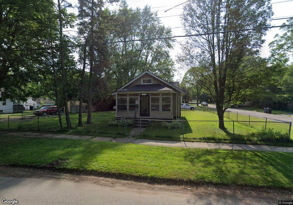
2429 Burns St Flint, MI 48506
Eastside NeighborhoodEstimated Value: $22,000 - $46,000
2
Beds
1
Bath
720
Sq Ft
$51/Sq Ft
Est. Value
About This Home
This home is located at 2429 Burns St, Flint, MI 48506 and is currently estimated at $36,854, approximately $51 per square foot. 2429 Burns St is a home located in Genesee County with nearby schools including Potter School, Flint Cultural Center Academy, and Richfield Public School Academy.
Ownership History
Date
Name
Owned For
Owner Type
Purchase Details
Closed on
May 10, 2022
Sold by
Genesee County Land Bank Authority
Bought by
Martin Thomas Glenn
Current Estimated Value
Purchase Details
Closed on
Sep 18, 2018
Sold by
The Genesee County Land Bank Authority
Bought by
Martin Thomas Glenn
Purchase Details
Closed on
Dec 20, 2016
Sold by
Cherry Deboarh L
Bought by
Genesse County Land Bank
Purchase Details
Closed on
Jun 14, 2001
Sold by
Bouchard Barbara
Bought by
Phillips Desiree L
Create a Home Valuation Report for This Property
The Home Valuation Report is an in-depth analysis detailing your home's value as well as a comparison with similar homes in the area
Home Values in the Area
Average Home Value in this Area
Purchase History
We collect this data history from publicly available records. To have your information removed, we recommend requesting removal directly through your county’s website.
| Date | Buyer | Sale Price | Title Company |
|---|---|---|---|
| Martin Thomas Glenn | $8,000 | None Listed On Document | |
| Martin Thomas Glenn | $8,000 | None Listed On Document | |
| Martin Thomas Glenn | $8,000 | Sun Title Agency Of Michigan | |
| Genesse County Land Bank | -- | None Available | |
| Phillips Desiree L | $37,000 | Guaranty Title Company |
Source: Public Records
Mortgage History
We collect this data history from publicly available records. To have your information removed, we recommend requesting removal directly through your county’s website.
| Date | Status | Borrower | Loan Amount |
|---|---|---|---|
| Closed | Martin Thomas Glenn | $0 |
Source: Public Records
Tax History
| Year | Tax Paid | Tax Assessment Tax Assessment Total Assessment is a certain percentage of the fair market value that is determined by local assessors to be the total taxable value of land and additions on the property. | Land | Improvement |
|---|---|---|---|---|
| 2025 | $851 | $12,800 | $0 | $0 |
| 2024 | $794 | $12,000 | $0 | $0 |
| 2023 | $782 | $10,500 | $0 | $0 |
| 2022 | $0 | $8,400 | $0 | $0 |
| 2021 | $789 | $8,000 | $0 | $0 |
| 2020 | $733 | $7,100 | $0 | $0 |
| 2019 | $730 | $7,100 | $0 | $0 |
| 2018 | $221 | $0 | $0 | $0 |
| 2017 | $438 | $0 | $0 | $0 |
| 2016 | $536 | $0 | $0 | $0 |
| 2015 | $0 | $0 | $0 | $0 |
| 2014 | -- | $0 | $0 | $0 |
| 2012 | -- | $8,400 | $0 | $0 |
Source: Public Records
Map
Nearby Homes
- 2506 Arlington Ave
- 2321 Levern St
- 2429 Delaware Ave
- 2217 Maryland Ave
- 2426 Hoff St
- 2613 Woodrow Ave
- 2212 Hoff St
- 2616 Maryland Ave
- 2601 Bennett Ave
- 1805 Bennett Ave
- 1826 Dakota Ave
- 1721 New York Ave
- 2415 N Dort Hwy
- 2601 Dakota Ave
- 2517 Leith St
- 1730 Oklahoma Ave
- 1917 Davison Rd
- 1733 Oklahoma Ave
- 1629 New York Ave
- 1714 Levern St
- 2501 Burns St
- 2436 N Vernon Ave
- 2430 N Vernon Ave
- 2417 Burns St
- 2421 Burns St
- 2426 N Vernon Ave
- 2500 N Vernon Ave
- 2505 Burns St
- 2413 Burns St
- 2422 N Vernon Ave
- 2436 Burns St
- 2506 N Vernon Ave
- 2509 Burns St
- 2424 Burns St
- 2411 Burns St
- 2510 N Vernon Ave
- 2416 Burns St
- 2410 N Vernon Ave
- 2513 Burns St
- 2412 Burns St
Your Personal Tour Guide
Ask me questions while you tour the home.