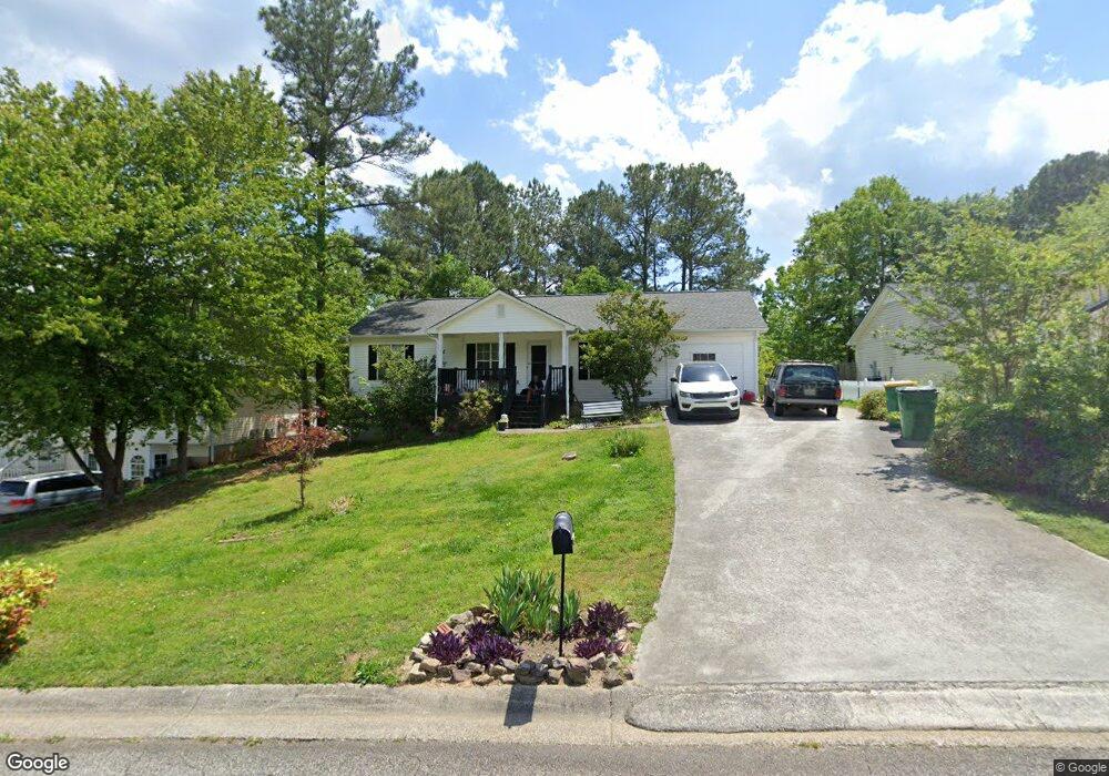
243 Jamie Ct Unit 2 Winder, GA 30680
Estimated Value: $251,000 - $283,000
3
Beds
3
Baths
1,144
Sq Ft
$236/Sq Ft
Est. Value
About This Home
This home is located at 243 Jamie Ct Unit 2, Winder, GA 30680 and is currently estimated at $269,741, approximately $235 per square foot. 243 Jamie Ct Unit 2 is a home located in Barrow County with nearby schools including Holsenbeck Elementary School, Bear Creek Middle School, and Winder-Barrow High School.
Ownership History
Date
Name
Owned For
Owner Type
Purchase Details
Closed on
Mar 26, 1999
Sold by
Pierce Danny
Bought by
Jessie Neal J and Jessie Cheryl
Current Estimated Value
Home Financials for this Owner
Home Financials are based on the most recent Mortgage that was taken out on this home.
Original Mortgage
$84,900
Outstanding Balance
$19,658
Interest Rate
6.74%
Mortgage Type
New Conventional
Estimated Equity
$250,083
Create a Home Valuation Report for This Property
The Home Valuation Report is an in-depth analysis detailing your home's value as well as a comparison with similar homes in the area
Home Values in the Area
Average Home Value in this Area
Purchase History
| Date | Buyer | Sale Price | Title Company |
|---|---|---|---|
| Jessie Neal J | $84,900 | -- |
Source: Public Records
Mortgage History
| Date | Status | Borrower | Loan Amount |
|---|---|---|---|
| Open | Jessie Neal J | $84,900 |
Source: Public Records
Tax History
| Year | Tax Paid | Tax Assessment Tax Assessment Total Assessment is a certain percentage of the fair market value that is determined by local assessors to be the total taxable value of land and additions on the property. | Land | Improvement |
|---|---|---|---|---|
| 2025 | $1,828 | $77,710 | $20,000 | $57,710 |
| 2024 | $1,828 | $76,032 | $20,000 | $56,032 |
| 2023 | $1,341 | $76,032 | $20,000 | $56,032 |
| 2022 | $1,786 | $59,766 | $16,400 | $43,366 |
| 2021 | $1,691 | $55,366 | $12,000 | $43,366 |
| 2020 | $1,543 | $51,208 | $12,000 | $39,208 |
| 2019 | $1,495 | $48,436 | $12,000 | $36,436 |
| 2018 | $1,326 | $41,794 | $10,000 | $31,794 |
| 2017 | $999 | $33,492 | $9,000 | $24,492 |
| 2016 | $884 | $29,854 | $8,000 | $21,854 |
| 2015 | $893 | $30,106 | $8,000 | $22,106 |
| 2014 | $793 | $27,847 | $5,488 | $22,359 |
| 2013 | -- | $26,544 | $5,488 | $21,056 |
Source: Public Records
Map
Nearby Homes
- 227 Martin Luther King jr Dr
- 208 Shields St
- 270 Griffith St
- 80 Shoal Ct
- 76 Shoal Ct
- 78 Shoal Ct
- 74 Shoal Ct
- 260 Westlyn Way
- 154 Blake Ln
- 324 E Broad St
- 163 Wood Cir
- 317 Georgia Ave
- 414 Grayson Dr
- 323 Lumpkin St
- 209 Georgia Ave
- 32 Saint Ives Cir Unit 2
- 252 Eastbrook Dr
- 40 Mimosa St
- 131 Pinehurst Dr
- 26 Hosch Cir
- 241 Jamie Ct Unit 2
- 245 Jamie Ct
- 247 Jamie Ct
- 247 Jamie Ct Unit 2
- 356 Mary Alice Dr Unit 3
- 356 Mary Alice Dr
- 239 Jamie Ct Unit 2
- 354 Mary Alice Dr Unit 3
- 352 Mary Alice Dr Unit 3
- 242 Jamie Ct
- 244 Jamie Ct
- 237 Jamie Ct
- 237 Jamie Ct Unit 2
- 240 Jamie Ct
- 358 Mary Alice Dr Unit 3
- 350 Mary Alice Dr
- 248 Jamie Ct
- 248 Jamie Ct Unit 2
- 238 Jamie Ct Unit II
- 246 Jamie Ct
Your Personal Tour Guide
Ask me questions while you tour the home.