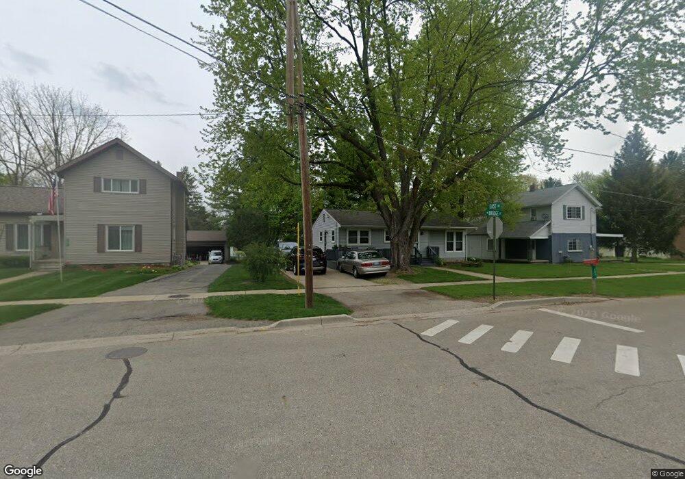
243 N Bridge St Dimondale, MI 48821
Estimated Value: $156,387 - $217,000
Studio
--
Bath
1,092
Sq Ft
$163/Sq Ft
Est. Value
About This Home
This home is located at 243 N Bridge St, Dimondale, MI 48821 and is currently estimated at $177,597, approximately $162 per square foot. 243 N Bridge St is a home located in Eaton County with nearby schools including Dimondale Elementary School, Washington Woods Middle School, and Holt Junior High School.
Ownership History
Date
Name
Owned For
Owner Type
Purchase Details
Closed on
Feb 17, 2023
Sold by
Burns Todd J and Burns Linda
Bought by
Burns Todd J and Burns Linda
Current Estimated Value
Purchase Details
Closed on
Jan 5, 2017
Sold by
Corwin Tamara J
Bought by
Burns Todd J and Burns Linda
Purchase Details
Closed on
May 6, 2013
Sold by
Corwin Tamara J
Bought by
Burns Todd J and Burns Linda
Create a Home Valuation Report for This Property
The Home Valuation Report is an in-depth analysis detailing your home's value as well as a comparison with similar homes in the area
Home Values in the Area
Average Home Value in this Area
Purchase History
We collect this data history from publicly available records. To have your information removed, we recommend requesting removal directly through your county’s website.
| Date | Buyer | Sale Price | Title Company |
|---|---|---|---|
| Burns Todd J | -- | Land Title | |
| Burns Todd J | -- | None Available | |
| Burns Todd J | -- | None Available |
Source: Public Records
Tax History
| Year | Tax Paid | Tax Assessment Tax Assessment Total Assessment is a certain percentage of the fair market value that is determined by local assessors to be the total taxable value of land and additions on the property. | Land | Improvement |
|---|---|---|---|---|
| 2025 | $1,682 | $73,100 | $0 | $0 |
| 2024 | $881 | $67,300 | $0 | $0 |
| 2023 | $890 | $60,000 | $0 | $0 |
| 2022 | $1,902 | $53,700 | $0 | $0 |
| 2021 | $1,822 | $49,600 | $0 | $0 |
| 2020 | $809 | $49,200 | $0 | $0 |
| 2019 | $2,496 | $46,820 | $0 | $0 |
| 2018 | $2,437 | $45,100 | $0 | $0 |
| 2017 | $2,388 | $43,500 | $0 | $0 |
| 2016 | -- | $42,100 | $0 | $0 |
| 2015 | -- | $35,800 | $0 | $0 |
| 2014 | -- | $34,800 | $0 | $0 |
| 2013 | -- | $35,500 | $0 | $0 |
Source: Public Records
Map
Nearby Homes
- 118 E Washington St
- 248 Birch Ln
- Vl Windsor Hwy
- 10114 Roblyn Cir Unit 38
- 0 E Jefferson St
- 6125 Brooks Landing
- 0 W Holt Hwy
- 5265 N Canal Rd
- 8825 Seney Dr
- 6470 Cheshire Dr
- 6520 W Galway Cir
- 4580 Dimond Way
- 10285 River Rock Rd
- 4416 N Smith Rd
- 8789 Justonian Way
- 8639 Jacaranda Dr
- 260 Cambridge Dr Unit 260
- 10289 Lafayette Ln
- Parcel C Bailey Rd
- Parcel A Bailey Rd
- 244 Pine St
- 232 Pine St
- 217 Van Buren St
- 236 Pine St
- 253 N Bridge St
- 253 Pine St Unit Bldg-Unit
- 253 Pine St
- 251 N Bridge St
- 270 Pine St
- 231 N Bridge St
- 269 N Bridge St
- 124 W Quincy St
- 140 W Quincy St
- 259 Pine St
- 132 W Quincy St
- 214 W Quincy St
- 116 W Quincy St
- 218 Van Buren St
- 276 Pine St
- 278 Pine St
Your Personal Tour Guide
Ask me questions while you tour the home.