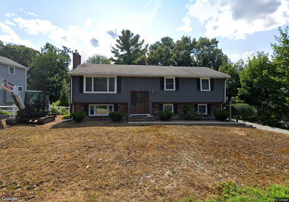
244 Grove St Reading, MA 01867
Estimated Value: $794,000 - $898,000
4
Beds
2
Baths
1,296
Sq Ft
$665/Sq Ft
Est. Value
About This Home
This home is located at 244 Grove St, Reading, MA 01867 and is currently estimated at $861,504, approximately $664 per square foot. 244 Grove St is a home located in Middlesex County with nearby schools including Wood End Elementary School, Arthur W. Coolidge Middle School, and Reading Memorial High School.
Ownership History
Date
Name
Owned For
Owner Type
Purchase Details
Closed on
Dec 18, 2018
Sold by
Holcomb John and Holcomb Amy
Bought by
Amy Holcomb 2018 Lt and Holcomb
Current Estimated Value
Purchase Details
Closed on
Nov 18, 2005
Sold by
Odonnell Ann B and Odonnell Paul R
Bought by
Centrella Alessandro and Centrella Danielle B
Home Financials for this Owner
Home Financials are based on the most recent Mortgage that was taken out on this home.
Original Mortgage
$316,000
Interest Rate
6.07%
Mortgage Type
Purchase Money Mortgage
Create a Home Valuation Report for This Property
The Home Valuation Report is an in-depth analysis detailing your home's value as well as a comparison with similar homes in the area
Home Values in the Area
Average Home Value in this Area
Purchase History
We collect this data history from publicly available records. To have your information removed, we recommend requesting removal directly through your county’s website.
| Date | Buyer | Sale Price | Title Company |
|---|---|---|---|
| Amy Holcomb 2018 Lt | -- | -- | |
| Centrella Alessandro | $395,000 | -- |
Source: Public Records
Mortgage History
We collect this data history from publicly available records. To have your information removed, we recommend requesting removal directly through your county’s website.
| Date | Status | Borrower | Loan Amount |
|---|---|---|---|
| Previous Owner | Centrella Alessandro | $316,000 |
Source: Public Records
Tax History
| Year | Tax Paid | Tax Assessment Tax Assessment Total Assessment is a certain percentage of the fair market value that is determined by local assessors to be the total taxable value of land and additions on the property. | Land | Improvement |
|---|---|---|---|---|
| 2025 | $8,800 | $772,600 | $473,300 | $299,300 |
| 2024 | $8,699 | $742,200 | $454,700 | $287,500 |
| 2023 | $8,424 | $669,100 | $409,900 | $259,200 |
| 2022 | $8,110 | $608,400 | $372,700 | $235,700 |
| 2021 | $7,280 | $584,900 | $357,100 | $227,800 |
| 2020 | $0 | $556,600 | $339,800 | $216,800 |
| 2019 | $7,545 | $530,200 | $323,700 | $206,500 |
| 2018 | $6,935 | $500,000 | $305,300 | $194,700 |
| 2017 | $6,618 | $471,700 | $288,000 | $183,700 |
| 2016 | $6,344 | $437,500 | $258,000 | $179,500 |
| 2015 | $5,943 | $404,300 | $238,400 | $165,900 |
| 2014 | $5,759 | $390,700 | $230,400 | $160,300 |
Source: Public Records
Map
Nearby Homes
- 106 Grove St
- 35 Blueberry Ln
- 32 Criterion Rd
- 55 Blueberry Ln
- 480 West St
- 15 Suncrest Ave
- 2 Inwood Dr Unit 3012
- 79 Hancock St
- 17 Courtyard Place Unit 17
- 10 West St
- 223 Franklin St
- 10 Brentwood Dr
- 127 Johnson Woods Dr
- 10 Deer Path Ln Unit 10
- 394 Pearl St
- 44 Grandview Rd
- 22 Irving St
- 85 Mineral St
- 187 Sanborn Ln
- 120 Summer Ave
Your Personal Tour Guide
Ask me questions while you tour the home.