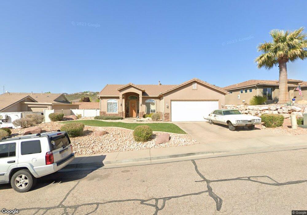
244 S 2040 Cir E St. George, UT 84790
Estimated Value: $444,298 - $483,000
4
Beds
2
Baths
1,633
Sq Ft
$288/Sq Ft
Est. Value
About This Home
This home is located at 244 S 2040 Cir E, St. George, UT 84790 and is currently estimated at $469,575, approximately $287 per square foot. 244 S 2040 Cir E is a home located in Washington County with nearby schools including Panorama School, Fossil Ridge Intermediate School, and Pine View Middle School.
Ownership History
Date
Name
Owned For
Owner Type
Purchase Details
Closed on
Jul 17, 2018
Sold by
Cain Darren
Bought by
Prickly Pear Holdings Llc
Current Estimated Value
Purchase Details
Closed on
May 13, 2016
Sold by
Russell L Harrington
Bought by
Cain Darren
Home Financials for this Owner
Home Financials are based on the most recent Mortgage that was taken out on this home.
Original Mortgage
$217,550
Interest Rate
3.57%
Purchase Details
Closed on
Mar 23, 2006
Sold by
Grantham Lindsay N and Grantham David
Bought by
Harrington Russell L and Harrington Serenity R
Home Financials for this Owner
Home Financials are based on the most recent Mortgage that was taken out on this home.
Original Mortgage
$228,640
Interest Rate
6.2%
Mortgage Type
Purchase Money Mortgage
Create a Home Valuation Report for This Property
The Home Valuation Report is an in-depth analysis detailing your home's value as well as a comparison with similar homes in the area
Purchase History
| Date | Buyer | Sale Price | Title Company |
|---|---|---|---|
| Prickly Pear Holdings Llc | -- | First American Title | |
| Cain Darren | -- | -- | |
| Harrington Russell L | -- | United Title Services |
Source: Public Records
Mortgage History
| Date | Status | Borrower | Loan Amount |
|---|---|---|---|
| Previous Owner | Cain Darren | $217,550 | |
| Previous Owner | Cain Darren | -- | |
| Previous Owner | Harrington Russell L | $228,640 |
Source: Public Records
Tax History
| Year | Tax Paid | Tax Assessment Tax Assessment Total Assessment is a certain percentage of the fair market value that is determined by local assessors to be the total taxable value of land and additions on the property. | Land | Improvement |
|---|---|---|---|---|
| 2025 | $1,648 | $241,780 | $61,875 | $179,905 |
| 2023 | $1,712 | $255,860 | $55,000 | $200,860 |
| 2022 | $1,824 | $256,245 | $54,890 | $201,355 |
| 2021 | $1,640 | $343,600 | $84,000 | $259,600 |
| 2020 | $1,496 | $295,200 | $63,000 | $232,200 |
| 2019 | $1,459 | $281,300 | $63,000 | $218,300 |
| 2018 | $1,374 | $136,785 | $0 | $0 |
| 2017 | $1,399 | $135,190 | $0 | $0 |
| 2016 | $1,450 | $129,580 | $0 | $0 |
| 2015 | $1,392 | $119,350 | $0 | $0 |
| 2014 | $1,314 | $113,410 | $0 | $0 |
Source: Public Records
Map
Nearby Homes
- 201 S 2020 East Cir
- 77 S 2000 E
- 232 S Acantilado Cir
- 0 S Mall Dr
- 4204 S Crimson Cir Unit 10
- 4186 S Crimson Cir Unit 13
- 86 S Acantilado Dr
- 145 N Mall Dr Unit 57
- 0 Null Unit 26-269072
- 5664 S Carnelian Pkwy
- 210 N Mall Dr Unit 115
- 210 N Mall Dr Unit 85
- 210 N Mall Dr Unit 27
- 316 S 2450 E Unit 41
- 24 S Arroyo Dr
- 0 Paisley Way Unit 26-269155
- 0 Paisley Way Unit 24-253758
- 1684 E 290 S
- 2721 E Riverside Dr
- 0 Tagans Way Unit 24-253754
- 244 S 2040 East Cir
- 232 S 2040 East Cir
- 232 S 2040 Cir E
- 256 S 2040 East Cir
- 247 S 2020 East Cir
- 233 S 2020 Cir E
- 233 S 2020 East Cir
- 259 S 2020 Cir E
- 259 S 2020 East Cir
- 239 S 2040 Cir E
- 218 S 2040 East Cir
- 218 S 2040 Cir E
- 239 S 2040 East Cir
- 253 S 2040 Cir E
- 253 S 2040 East Cir
- 217 S 2020 Cir E
- 217 S 2020 East Cir
- 227 S 2040 Cir E
- 227 S 2040 East Cir
- 210 S 2040 Cir E Unit 17
Your Personal Tour Guide
Ask me questions while you tour the home.