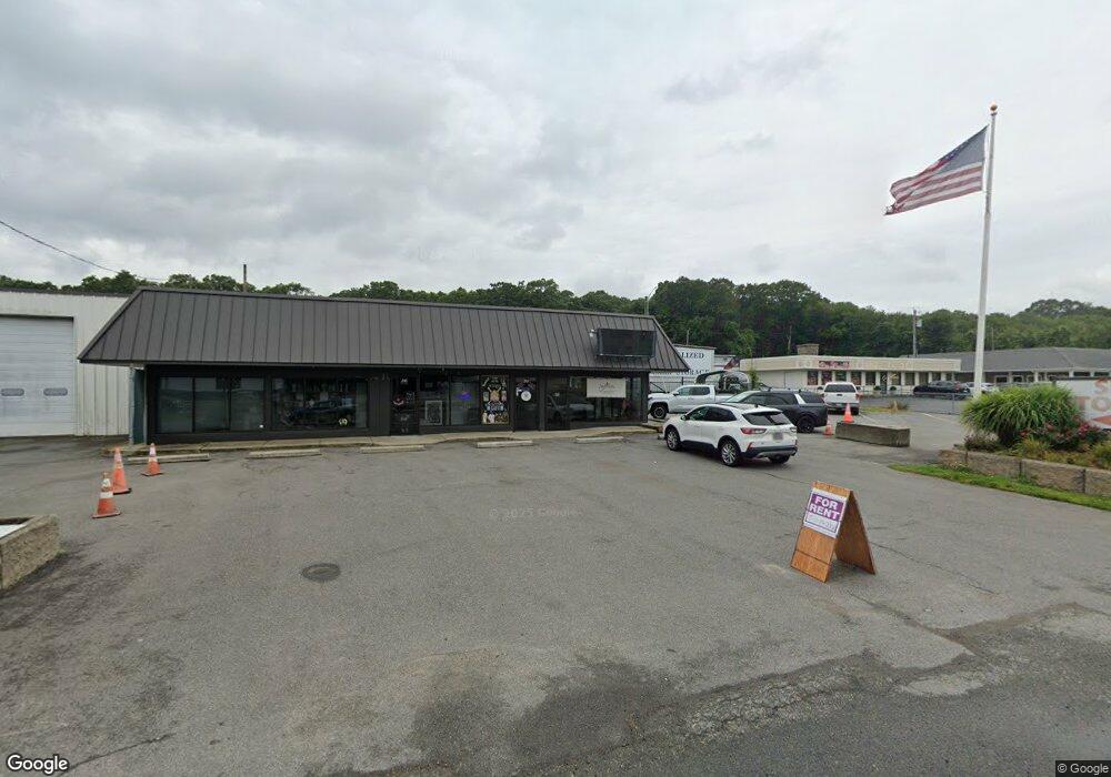
245 State Rd Unit C Westport, MA 02790
North Westport Neighborhood
Studio
--
Bath
800
Sq Ft
5.3
Acres Lot
About This Home
This home is located at 245 State Rd Unit C, Westport, MA 02790. 245 State Rd Unit C is a home located in Bristol County with nearby schools including Alice A. Macomber Primary School, Westport Elementary School, and Westport Middle-High School.
Ownership History
Date
Name
Owned For
Owner Type
Purchase Details
Closed on
Sep 26, 2013
Sold by
Jasan T T and Jasan Sandelman
Bought by
Fundamentals Co Llc
Purchase Details
Closed on
Jul 28, 1999
Sold by
N & G Realty Inc
Bought by
Davis Kevin
Create a Home Valuation Report for This Property
The Home Valuation Report is an in-depth analysis detailing your home's value as well as a comparison with similar homes in the area
Home Values in the Area
Average Home Value in this Area
Purchase History
| Date | Buyer | Sale Price | Title Company |
|---|---|---|---|
| Fundamentals Co Llc | -- | -- | |
| Fundamentals Co Llc | -- | -- | |
| Jasan Llc | -- | -- | |
| Davis Kevin | $350,000 | -- | |
| Davis Kevin | $350,000 | -- |
Source: Public Records
Mortgage History
| Date | Status | Borrower | Loan Amount |
|---|---|---|---|
| Previous Owner | Davis Kevin | $792,000 | |
| Previous Owner | Davis Kevin | $750,000 | |
| Previous Owner | Davis Kevin | $61,683 |
Source: Public Records
Tax History
| Year | Tax Paid | Tax Assessment Tax Assessment Total Assessment is a certain percentage of the fair market value that is determined by local assessors to be the total taxable value of land and additions on the property. | Land | Improvement |
|---|---|---|---|---|
| 2025 | $20,038 | $2,689,600 | $887,300 | $1,802,300 |
| 2024 | $20,153 | $2,607,100 | $804,800 | $1,802,300 |
| 2023 | $19,475 | $2,386,600 | $753,200 | $1,633,400 |
| 2022 | $19,236 | $2,307,300 | $753,200 | $1,554,100 |
| 2021 | $19,236 | $2,231,500 | $685,100 | $1,546,400 |
| 2020 | $18,812 | $2,231,500 | $685,100 | $1,546,400 |
| 2019 | $18,171 | $2,197,200 | $685,100 | $1,512,100 |
| 2018 | $17,920 | $2,193,400 | $657,800 | $1,535,600 |
| 2017 | $17,618 | $2,210,600 | $657,800 | $1,552,800 |
| 2016 | $17,486 | $2,210,600 | $657,800 | $1,552,800 |
| 2015 | $17,602 | $2,219,700 | $657,800 | $1,561,900 |
Source: Public Records
Map
Nearby Homes
- 6 Beaulieu St
- 11 Harrison Ct
- 343 Old Bedford Rd
- 320-322 Old Bedford Rd
- 3 Diane Way
- 50 Benoit St
- 32 Madison Ct
- 0 Hertitage Acres
- 100 D Dr
- 222 Blossom Rd
- 1951 Pleasant St
- 55 E Briggs Rd
- 38 Eaton St
- 1814 Pleasant St
- 219 Earle St Unit 3
- 217 Earle St Unit 2
- 1792 Pleasant St Unit 1808
- 99 Irving St
- 916 County St
- 1768 Pleasant St
- 245 State Rd
- 237 State Rd Unit B
- 237 State Rd Unit A
- 237 State Rd
- 237C State Rd Unit C
- 237 State Rd Unit A&B
- 237C State Rd
- 235-237-237 State Rd Unit 8
- 235-237-237 State Rd Unit B
- 231 State Rd Unit 235
- 231 State Rd
- 231 State Rd Unit A
- 231 State Rd Unit B
- 231 State Rd Unit 1
- 237C Sate Rd Unit C
- 275 State Rd
- 260 State Rd
- 248 State Rd
- 248 State Rd Unit 1
- 227 State Rd
Your Personal Tour Guide
Ask me questions while you tour the home.