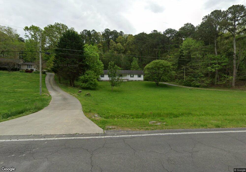
2467 Utility Rd Rocky Face, GA 30740
Estimated Value: $204,000 - $273,304
3
Beds
2
Baths
1,323
Sq Ft
$176/Sq Ft
Est. Value
About This Home
This home is located at 2467 Utility Rd, Rocky Face, GA 30740 and is currently estimated at $232,576, approximately $175 per square foot. 2467 Utility Rd is a home located in Whitfield County with nearby schools including Westside Elementary School, Westside Middle School, and Northwest Whitfield County High School.
Ownership History
Date
Name
Owned For
Owner Type
Purchase Details
Closed on
Jun 3, 2019
Sold by
Deutsche Bank National Trust Co Trustee
Bought by
Phillips Brian P
Current Estimated Value
Home Financials for this Owner
Home Financials are based on the most recent Mortgage that was taken out on this home.
Original Mortgage
$101,525
Outstanding Balance
$88,519
Interest Rate
4.1%
Mortgage Type
New Conventional
Estimated Equity
$144,057
Purchase Details
Closed on
Feb 5, 2019
Sold by
Stepp Kim
Bought by
Deutsche Bank National Trust Co Trustee and Morgan Stanley Abs Capital Inc Tr 2005 H
Purchase Details
Closed on
Apr 15, 2005
Sold by
Not Provided
Bought by
Stepp Kim
Home Financials for this Owner
Home Financials are based on the most recent Mortgage that was taken out on this home.
Original Mortgage
$96,720
Interest Rate
6.84%
Mortgage Type
New Conventional
Create a Home Valuation Report for This Property
The Home Valuation Report is an in-depth analysis detailing your home's value as well as a comparison with similar homes in the area
Purchase History
| Date | Buyer | Sale Price | Title Company |
|---|---|---|---|
| Phillips Brian P | $104,665 | -- | |
| Deutsche Bank National Trust Co Trustee | -- | -- | |
| Stepp Kim | $120,000 | -- |
Source: Public Records
Mortgage History
| Date | Status | Borrower | Loan Amount |
|---|---|---|---|
| Open | Phillips Brian P | $101,525 | |
| Previous Owner | Stepp Kim | $96,720 | |
| Previous Owner | Stepp Kim | $24,180 |
Source: Public Records
Tax History
| Year | Tax Paid | Tax Assessment Tax Assessment Total Assessment is a certain percentage of the fair market value that is determined by local assessors to be the total taxable value of land and additions on the property. | Land | Improvement |
|---|---|---|---|---|
| 2025 | $2,031 | $76,141 | $11,681 | $64,460 |
| 2024 | $2,031 | $76,141 | $11,681 | $64,460 |
| 2023 | $1,739 | $58,019 | $9,327 | $48,692 |
| 2022 | $1,309 | $44,372 | $7,862 | $36,510 |
| 2021 | $1,309 | $44,372 | $7,862 | $36,510 |
| 2020 | $1,278 | $44,372 | $7,862 | $36,510 |
| 2019 | $1,093 | $44,372 | $7,862 | $36,510 |
| 2018 | $1,059 | $42,910 | $6,400 | $36,510 |
| 2017 | $1,060 | $42,910 | $6,400 | $36,510 |
| 2016 | $932 | $39,606 | $6,400 | $33,206 |
| 2014 | $940 | $42,308 | $9,102 | $33,206 |
| 2013 | -- | $42,308 | $9,102 | $33,205 |
Source: Public Records
Map
Nearby Homes
- 2335 Coley Farm Rd
- 2386 Utility Rd
- 2617 Quarles Rd
- 0 Quarles Rd Unit 1523297
- 0 Quarles Rd Unit 132791
- 246 Old Babb Rd
- 110 Windy Hill Dr
- 2906 Davis Rd
- Lot 17 Old Babb Rd
- Lot 18 Old Babb Rd
- 0 Lafayette Unit 1532403
- 272 Old Utility Rd
- Lot 20 Plum St
- Lot 21 Plum St
- 0 Bluff View Trace
- 2950 Davis Rd
- Lot 28 Highland Cir
- Lot 21 Highland Cir
- Lot 15 Lamory Ln
- 3146 Highland Cir
- 2463 Utility Rd
- 2465 Utility Rd
- 2517 Utility Rd
- 2453 Utility Rd
- 2464 Utility Rd
- 2529 Utility Rd
- 2492 Quarles Rd
- 2445 Utility Rd
- 2536 Utility Rd
- 2504 Quarles Rd
- 2435 Utility Rd
- 2545 Utility Rd
- 2472 Quarles Rd
- 2500 Quarles Rd
- 2488 Quarles Rd
- 2484 Quarles Rd
- 2300 Coley Farm Rd
- 2480 Quarles Rd
- 272 Utility Rd
- 2476 Quarles Rd
Your Personal Tour Guide
Ask me questions while you tour the home.