Estimated Value: $310,000 - $415,000
2
Beds
3
Baths
1,912
Sq Ft
$186/Sq Ft
Est. Value
About This Home
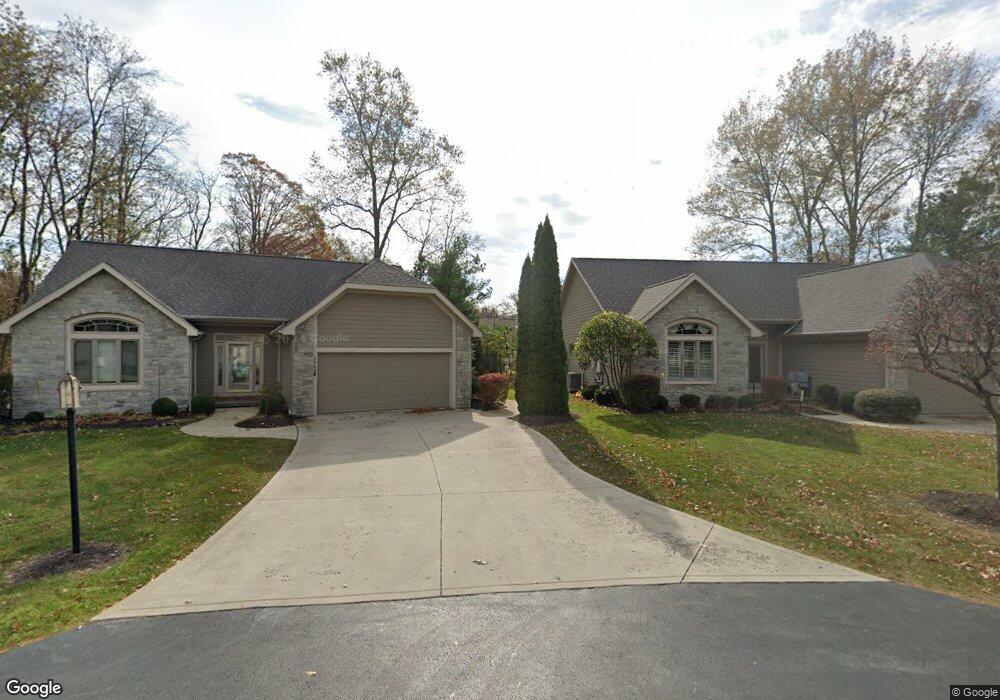
This home is located at 2469 Struthmore Dr, Lima, OH 45806 and is currently estimated at $355,088, approximately $185 per square foot. 2469 Struthmore Dr is a home located in Allen County with nearby schools including Maplewood Elementary School, Elmwood Elementary School, and Shawnee Middle School.
Ownership History
Date
Name
Owned For
Owner Type
Purchase Details
Closed on
Jul 12, 2022
Sold by
Lois M Rubens Revocable Living Trust
Bought by
Patrick A Eugene A and Patrick Bobbi Jo
Current Estimated Value
Purchase Details
Closed on
Oct 16, 2007
Sold by
Rubens Lois M
Bought by
Rubens Lois M and The Lois M Rubens Revocable Li
Create a Home Valuation Report for This Property
The Home Valuation Report is an in-depth analysis detailing your home's value as well as a comparison with similar homes in the area
Home Values in the Area
Average Home Value in this Area
Purchase History
We collect this data history from publicly available records. To have your information removed, we recommend requesting removal directly through your county’s website.
| Date | Buyer | Sale Price | Title Company |
|---|---|---|---|
| Patrick A Eugene A | $305,000 | Daley Douglas A | |
| Rubens Lois M | -- | Attorney |
Source: Public Records
Tax History
| Year | Tax Paid | Tax Assessment Tax Assessment Total Assessment is a certain percentage of the fair market value that is determined by local assessors to be the total taxable value of land and additions on the property. | Land | Improvement |
|---|---|---|---|---|
| 2024 | $5,273 | $107,380 | $12,110 | $95,270 |
| 2023 | $5,017 | $89,460 | $10,080 | $79,380 |
| 2022 | $4,545 | $89,460 | $10,080 | $79,380 |
| 2021 | $4,566 | $89,460 | $10,080 | $79,380 |
| 2020 | $3,548 | $81,870 | $10,080 | $71,790 |
| 2019 | $3,548 | $81,870 | $10,080 | $71,790 |
| 2018 | $3,596 | $81,870 | $10,080 | $71,790 |
| 2017 | $3,631 | $81,870 | $10,080 | $71,790 |
| 2016 | $3,599 | $81,870 | $10,080 | $71,790 |
| 2015 | $3,613 | $81,870 | $10,080 | $71,790 |
| 2014 | $3,613 | $81,310 | $9,380 | $71,930 |
| 2013 | $3,547 | $81,310 | $9,380 | $71,930 |
Source: Public Records
Map
Nearby Homes
- 2619 Gaithersburg Dr
- 2515 Alexandria Dr
- 115 Lanes End
- 4211 Fort Amanda Rd
- 2175 Wyandot Dr
- 4046 Cypress Ave
- 4054 Cypress Ave
- 4062 Cypress Ave
- 4039 Magnolia
- 1540 Adak Ave
- 3065 Lakeshore Dr
- 2975 Zurmehly Rd
- 2905 Oak Hill Ct
- 1515 Riverview Dr
- 2869 Riverwalk Blvd
- 3441 Winston Ln
- 2852 Riverwalk Blvd Unit 2852
- 4422 Indian Hill Dr
- 1452 W Shore Dr
- 3061 Inwood Dr
- 3545 Fort Amanda Rd
- 3583 Fort Amanda Rd
- 3515 Fort Amanda Rd
- 2465 Struthmore Dr
- 2463 Struthmore Dr Unit B
- 2467 Struthmore Dr Unit F
- 3512 Fort Amanda Rd
- 2471 Struthmore Dr
- 2461 Struthmore Dr
- 2473 Struthmore Dr Unit C
- 2475 Struthmore Dr
- 3485 Fort Amanda Rd
- 3570 Fort Amanda Rd
- 2519 Struthmore Dr
- 2521 Struthmore Dr
- 3647 Fort Amanda Rd
- 3647 Ft Amanda Rd
- 3590 Fort Amanda Rd
- 2515 Struthmore Dr
- 2669 Struthmore Dr
Your Personal Tour Guide
Ask me questions while you tour the home.