Estimated Value: $237,000 - $435,000
3
Beds
2
Baths
1,144
Sq Ft
$286/Sq Ft
Est. Value
About This Home
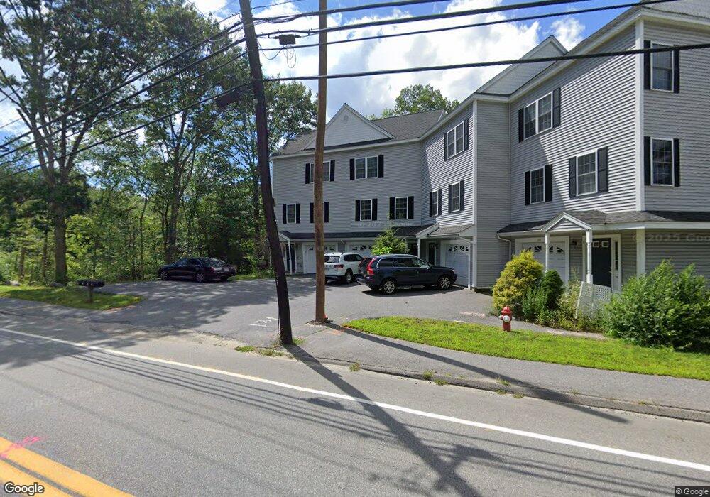
This home is located at 248 Main St Unit 2, Acton, MA 01720 and is currently estimated at $326,903, approximately $285 per square foot. 248 Main St Unit 2 is a home located in Middlesex County with nearby schools including Acton-Boxborough Regional High School, Maynard Knowledge Beginnings, and The Imago School.
Ownership History
Date
Name
Owned For
Owner Type
Purchase Details
Closed on
Apr 13, 2004
Sold by
Crossroads Dev Llc
Bought by
Burgess Lynda Quintana and Burgess Michael J
Current Estimated Value
Home Financials for this Owner
Home Financials are based on the most recent Mortgage that was taken out on this home.
Original Mortgage
$34,000
Outstanding Balance
$15,933
Interest Rate
5.6%
Mortgage Type
Purchase Money Mortgage
Estimated Equity
$310,970
Create a Home Valuation Report for This Property
The Home Valuation Report is an in-depth analysis detailing your home's value as well as a comparison with similar homes in the area
Home Values in the Area
Average Home Value in this Area
Purchase History
We collect this data history from publicly available records. To have your information removed, we recommend requesting removal directly through your county’s website.
| Date | Buyer | Sale Price | Title Company |
|---|---|---|---|
| Burgess Lynda Quintana | $170,000 | -- |
Source: Public Records
Mortgage History
We collect this data history from publicly available records. To have your information removed, we recommend requesting removal directly through your county’s website.
| Date | Status | Borrower | Loan Amount |
|---|---|---|---|
| Open | Burgess Lynda Quintana | $34,000 |
Source: Public Records
Tax History
| Year | Tax Paid | Tax Assessment Tax Assessment Total Assessment is a certain percentage of the fair market value that is determined by local assessors to be the total taxable value of land and additions on the property. | Land | Improvement |
|---|---|---|---|---|
| 2025 | $3,955 | $230,600 | $0 | $230,600 |
| 2024 | $3,431 | $205,800 | $0 | $205,800 |
| 2023 | $3,096 | $176,300 | $0 | $176,300 |
| 2022 | $3,773 | $194,000 | $0 | $194,000 |
| 2021 | $3,605 | $178,200 | $0 | $178,200 |
| 2020 | $2,976 | $154,700 | $0 | $154,700 |
| 2019 | $2,942 | $151,900 | $0 | $151,900 |
| 2018 | $2,890 | $149,100 | $0 | $149,100 |
| 2017 | $3,236 | $169,800 | $0 | $169,800 |
| 2016 | $3,269 | $170,000 | $0 | $170,000 |
| 2015 | $3,239 | $170,000 | $0 | $170,000 |
| 2014 | $3,307 | $170,000 | $0 | $170,000 |
Source: Public Records
Map
Nearby Homes
- 34 Flint Rd
- 203 Main St
- 31 Elm St
- 23 Spruce St Unit B
- 70 River St
- 92 Willow St Unit 1
- 94 Willow St Unit 2
- 68 Main St
- 14 Minot Ave
- 37 Concord Rd
- 40 Mohawk Dr
- 103 Newtown Rd
- 491 Main St
- 4 Meadowbrook Rd
- 5 Parmley Dr
- 114 Nagog Hill Rd
- 91 Drummer Rd Unit 91
- 128 Parker St Unit 3C
- 524 Main St
- 30 Duggan Rd
- 248 Main St Unit 4
- 248 Main St Unit 3
- 248 Main St Unit 1
- 1 Beverly Rd
- 1 Beverly Rd
- 247 Main St
- 249 Main St
- 245 Main St
- 253 Main St
- 251 Main St
- 255 Main St Unit A
- 246 Main St Unit 4
- 246 Main St Unit 3
- 246 Main St Unit 1
- 246 Main St Unit 8
- 246 Main St Unit 7
- 246 Main St Unit 6
- 246 Main St Unit 5
- 246 Main St Unit 8,246
- 243 Main St
Your Personal Tour Guide
Ask me questions while you tour the home.