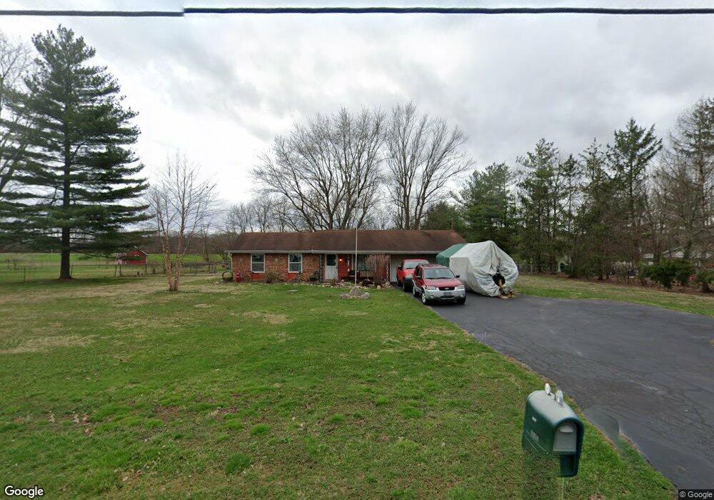
2485 S Tecumseh Rd Springfield, OH 45502
Estimated Value: $210,283 - $272,000
3
Beds
1
Bath
1,080
Sq Ft
$223/Sq Ft
Est. Value
About This Home
This home is located at 2485 S Tecumseh Rd, Springfield, OH 45502 and is currently estimated at $240,321, approximately $222 per square foot. 2485 S Tecumseh Rd is a home located in Clark County with nearby schools including Greenon Elementary School, Greenon Jr. High School, and Greenon High School.
Ownership History
Date
Name
Owned For
Owner Type
Purchase Details
Closed on
May 1, 2001
Sold by
Loper Edna L and Loper Edna L
Bought by
Cody William F and Cody Brenda J
Current Estimated Value
Home Financials for this Owner
Home Financials are based on the most recent Mortgage that was taken out on this home.
Original Mortgage
$108,199
Outstanding Balance
$38,703
Interest Rate
6.95%
Mortgage Type
FHA
Estimated Equity
$201,618
Purchase Details
Closed on
Jul 9, 1991
Create a Home Valuation Report for This Property
The Home Valuation Report is an in-depth analysis detailing your home's value as well as a comparison with similar homes in the area
Purchase History
| Date | Buyer | Sale Price | Title Company |
|---|---|---|---|
| Cody William F | $109,900 | -- | |
| -- | $75,000 | -- |
Source: Public Records
Mortgage History
| Date | Status | Borrower | Loan Amount |
|---|---|---|---|
| Open | Cody William F | $108,199 |
Source: Public Records
Tax History
| Year | Tax Paid | Tax Assessment Tax Assessment Total Assessment is a certain percentage of the fair market value that is determined by local assessors to be the total taxable value of land and additions on the property. | Land | Improvement |
|---|---|---|---|---|
| 2025 | $2,240 | $64,490 | $14,980 | $49,510 |
| 2024 | $2,700 | $51,630 | $13,510 | $38,120 |
| 2023 | $2,700 | $51,630 | $13,510 | $38,120 |
| 2022 | $2,697 | $51,630 | $13,510 | $38,120 |
| 2021 | $2,205 | $37,420 | $9,790 | $27,630 |
| 2020 | $2,210 | $37,420 | $9,790 | $27,630 |
| 2019 | $2,241 | $37,420 | $9,790 | $27,630 |
| 2018 | $2,225 | $36,330 | $8,970 | $27,360 |
| 2017 | $2,230 | $36,330 | $8,974 | $27,356 |
| 2016 | $1,943 | $36,330 | $8,974 | $27,356 |
| 2015 | $1,808 | $32,593 | $8,159 | $24,434 |
| 2014 | $1,812 | $32,593 | $8,159 | $24,434 |
| 2013 | $1,594 | $32,593 | $8,159 | $24,434 |
Source: Public Records
Map
Nearby Homes
- 3183 Lower Valley Pike
- 3190 Rebert Pike
- 100 Green Valley Dr
- 303 E Main St
- 3434 Killdeer Dr
- 141 N Xenia Dr
- 46-48 W Main St
- 206 S Tecumseh Rd
- 3924 Schenley St
- 5031 W National Rd
- 5654 W National Rd
- 3862 Marion Dr
- 3319 Wendover St
- 3079 Rocky Point Rd
- 4024 Raymond Dr
- 3267 Lower Valley Pike Unit Tract 2
- 5152 S Tecumseh Rd
- 4909 Shannon Ave
- 144 Matthews Ave
- 2821 Dayton Springfield Rd
- 2465 S Tecumseh Rd
- 2511 S Tecumseh Rd
- 2450 S Tecumseh Rd
- 2474 S Tecumseh Rd
- 2492 S Tecumseh Rd
- 2445 S Tecumseh Rd
- 2537 S Tecumseh Rd
- 2516 S Tecumseh Rd
- 2422 S Tecumseh Rd
- 2411 S Tecumseh Rd
- 2530 S Tecumseh Rd
- 2385 S Tecumseh Rd
- 2552 S Tecumseh Rd
- 2388 S Tecumseh Rd
- 2566 S Tecumseh Rd
- 2365 S Tecumseh Rd
- 2611 S Tecumseh Rd
- 2370 S Tecumseh Rd
- 2608 S Tecumseh Rd
- 2325 S Tecumseh Rd
Your Personal Tour Guide
Ask me questions while you tour the home.