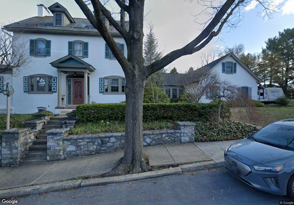
25 Broad St Ephrata, PA 17522
Estimated Value: $546,989 - $618,000
4
Beds
3
Baths
3,386
Sq Ft
$170/Sq Ft
Est. Value
About This Home
This home is located at 25 Broad St, Ephrata, PA 17522 and is currently estimated at $574,247, approximately $169 per square foot. 25 Broad St is a home located in Lancaster County with nearby schools including Highland Elementary School, Ephrata Intermediate School, and Ephrata Senior High School.
Ownership History
Date
Name
Owned For
Owner Type
Purchase Details
Closed on
May 17, 1999
Sold by
Parliment Joel W and Parliment Marguerite M
Bought by
Romig Gregory W and Romig Jennifer S
Current Estimated Value
Home Financials for this Owner
Home Financials are based on the most recent Mortgage that was taken out on this home.
Original Mortgage
$270,000
Outstanding Balance
$68,839
Interest Rate
6.88%
Mortgage Type
Purchase Money Mortgage
Estimated Equity
$505,408
Create a Home Valuation Report for This Property
The Home Valuation Report is an in-depth analysis detailing your home's value as well as a comparison with similar homes in the area
Home Values in the Area
Average Home Value in this Area
Purchase History
| Date | Buyer | Sale Price | Title Company |
|---|---|---|---|
| Romig Gregory W | $300,000 | -- |
Source: Public Records
Mortgage History
| Date | Status | Borrower | Loan Amount |
|---|---|---|---|
| Open | Romig Gregory W | $270,000 |
Source: Public Records
Tax History
| Year | Tax Paid | Tax Assessment Tax Assessment Total Assessment is a certain percentage of the fair market value that is determined by local assessors to be the total taxable value of land and additions on the property. | Land | Improvement |
|---|---|---|---|---|
| 2025 | $8,420 | $351,100 | $53,900 | $297,200 |
| 2024 | $8,420 | $351,100 | $53,900 | $297,200 |
| 2023 | $8,213 | $351,100 | $53,900 | $297,200 |
| 2022 | $7,862 | $351,100 | $53,900 | $297,200 |
| 2021 | $7,697 | $351,100 | $53,900 | $297,200 |
| 2020 | $7,697 | $351,100 | $53,900 | $297,200 |
| 2019 | $7,592 | $351,100 | $53,900 | $297,200 |
| 2018 | $5,824 | $351,100 | $53,900 | $297,200 |
| 2017 | $7,828 | $295,800 | $33,500 | $262,300 |
| 2016 | $7,766 | $295,800 | $33,500 | $262,300 |
| 2015 | $1,717 | $295,800 | $33,500 | $262,300 |
| 2014 | $5,670 | $295,800 | $33,500 | $262,300 |
Source: Public Records
Map
Nearby Homes
- 144 Church Ave
- 214 Duke St
- 247 Church Ave
- 239 Railroad Ave
- 87 E Franklin St
- 0 W Queen St
- 122 Boomerang Dr
- 45 E Walnut St
- 503 N State St
- 407 Lake St
- 0 S State St
- 413 E Main St
- 916 Dawn Ave
- 524 W Trout Run Rd
- 154 Julie Ann Ct
- 927 Emerald St
- 215 Akron Rd
- 485 N Maple St
- 129 Meadow Valley Rd Unit 11
- 66 Weaver Ave
Your Personal Tour Guide
Ask me questions while you tour the home.