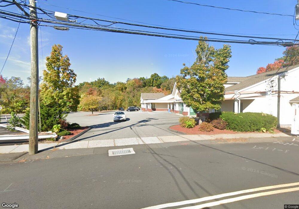
25 Collins Rd Bristol, CT 06010
North Bristol NeighborhoodEstimated Value: $1,427,473
Studio
--
Bath
14,036
Sq Ft
$102/Sq Ft
Est. Value
About This Home
This home is located at 25 Collins Rd, Bristol, CT 06010 and is currently estimated at $1,427,473, approximately $101 per square foot. 25 Collins Rd is a home located in Hartford County with nearby schools including Edgewood School, Northeast Middle School, and Bristol Eastern High School.
Ownership History
Date
Name
Owned For
Owner Type
Purchase Details
Closed on
Oct 10, 1997
Sold by
Rosen Jonathan H
Bought by
Brookside Medical
Current Estimated Value
Create a Home Valuation Report for This Property
The Home Valuation Report is an in-depth analysis detailing your home's value as well as a comparison with similar homes in the area
Home Values in the Area
Average Home Value in this Area
Purchase History
We collect this data history from publicly available records. To have your information removed, we recommend requesting removal directly through your county’s website.
| Date | Buyer | Sale Price | Title Company |
|---|---|---|---|
| Brookside Medical | $455,000 | -- |
Source: Public Records
Mortgage History
We collect this data history from publicly available records. To have your information removed, we recommend requesting removal directly through your county’s website.
| Date | Status | Borrower | Loan Amount |
|---|---|---|---|
| Closed | Brookside Medical | $50,000 | |
| Open | Brookside Medical | $1,044,440 | |
| Closed | Brookside Medical | $1,500,000 | |
| Closed | Brookside Medical | $1,680,000 |
Source: Public Records
Tax History
| Year | Tax Paid | Tax Assessment Tax Assessment Total Assessment is a certain percentage of the fair market value that is determined by local assessors to be the total taxable value of land and additions on the property. | Land | Improvement |
|---|---|---|---|---|
| 2025 | $59,110 | $1,751,400 | $200,970 | $1,550,430 |
| 2024 | $55,782 | $1,751,400 | $200,970 | $1,550,430 |
| 2023 | $53,155 | $1,751,400 | $200,970 | $1,550,430 |
| 2022 | $62,702 | $1,634,990 | $174,650 | $1,460,340 |
| 2021 | $62,702 | $1,634,990 | $174,650 | $1,460,340 |
| 2020 | $62,702 | $1,634,990 | $174,650 | $1,460,340 |
| 2019 | $62,211 | $1,634,990 | $174,650 | $1,460,340 |
| 2018 | $60,298 | $1,634,990 | $174,650 | $1,460,340 |
| 2017 | $58,568 | $1,625,540 | $184,730 | $1,440,810 |
| 2016 | $58,568 | $1,625,540 | $184,730 | $1,440,810 |
| 2015 | $56,260 | $1,625,540 | $184,730 | $1,440,810 |
| 2014 | $56,260 | $1,625,540 | $184,730 | $1,440,810 |
Source: Public Records
Map
Nearby Homes
- 42 Sandy Dr
- 102 Carol Dr
- 24 Fanway Ave
- 23 Morris Ave
- 3 Sandra St
- 70 Fanway Ave
- 35 Ruth St Unit 44
- 513 Stafford Ave
- 97 Louisiana Ave
- 24 Concetta Ln
- 196 Shagbark Dr
- 2 Burton St
- 12 Patricia Dr
- 77 Deerfield Rd
- 1325 Farmington Ave Unit 52
- 1325 Farmington Ave Unit 1
- 1325 Farmington Ave Unit 13
- 277 Mechanic St
- 66 Case St
- 137 Brook St
- 31 Collins Rd
- 37 Collins Rd
- 43 Collins Rd
- 34 Collins Rd
- 923 Farmington Ave
- 923 Farmington Ave Unit 8
- 38 Collins Rd
- 905 Farmington Ave
- 49 Collins Rd
- 931 Farmington Ave
- 893 Farmington Ave
- 46 Collins Rd
- 889 Farmington Ave
- 889 Farmington Ave Unit 2
- 889 Farmington Ave Unit 1
- 889 Farmington Ave Unit 4
- 899 Farmington Ave
- 891 Farmington Ave
- 52 Collins Rd
- 57 Collins Rd
Your Personal Tour Guide
Ask me questions while you tour the home.