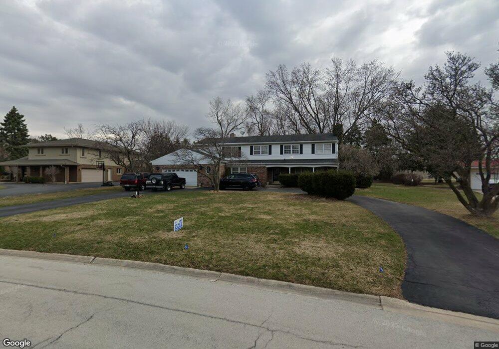
25 Croydon Ln Oak Brook, IL 60523
Estimated Value: $804,168 - $1,015,000
Studio
--
Bath
3,076
Sq Ft
$300/Sq Ft
Est. Value
About This Home
This home is located at 25 Croydon Ln, Oak Brook, IL 60523 and is currently estimated at $923,542, approximately $300 per square foot. 25 Croydon Ln is a home located in DuPage County with nearby schools including Brook Forest Elementary School, Butler Junior High School, and Hinsdale Central High School.
Ownership History
Date
Name
Owned For
Owner Type
Purchase Details
Closed on
Apr 7, 2005
Sold by
Knuth Alfred and Knuth Patricia
Bought by
Knuth Alfred and Knuth Patricia
Current Estimated Value
Purchase Details
Closed on
Jul 16, 1999
Sold by
Adler Donald N and Adler Arlene M
Bought by
Knuth Alfred and Knuth Patricia
Home Financials for this Owner
Home Financials are based on the most recent Mortgage that was taken out on this home.
Original Mortgage
$332,000
Interest Rate
7.5%
Create a Home Valuation Report for This Property
The Home Valuation Report is an in-depth analysis detailing your home's value as well as a comparison with similar homes in the area
Home Values in the Area
Average Home Value in this Area
Purchase History
| Date | Buyer | Sale Price | Title Company |
|---|---|---|---|
| Knuth Alfred | -- | -- | |
| Knuth Alfred | $415,000 | First American Title Ins |
Source: Public Records
Mortgage History
| Date | Status | Borrower | Loan Amount |
|---|---|---|---|
| Previous Owner | Knuth Alfred | $332,000 |
Source: Public Records
Tax History
| Year | Tax Paid | Tax Assessment Tax Assessment Total Assessment is a certain percentage of the fair market value that is determined by local assessors to be the total taxable value of land and additions on the property. | Land | Improvement |
|---|---|---|---|---|
| 2024 | $8,232 | $236,827 | $48,858 | $187,969 |
| 2023 | $7,837 | $219,000 | $45,180 | $173,820 |
| 2022 | $7,469 | $210,520 | $43,430 | $167,090 |
| 2021 | $7,492 | $215,190 | $45,110 | $170,080 |
| 2020 | $7,709 | $221,500 | $55,150 | $166,350 |
| 2019 | $7,719 | $221,500 | $52,430 | $169,070 |
| 2018 | $7,517 | $225,000 | $49,630 | $175,370 |
| 2017 | $7,609 | $231,190 | $47,290 | $183,900 |
| 2016 | $7,804 | $224,080 | $44,550 | $179,530 |
| 2015 | $7,693 | $208,750 | $41,500 | $167,250 |
| 2014 | $6,701 | $176,660 | $42,450 | $134,210 |
| 2013 | $6,647 | $179,150 | $43,050 | $136,100 |
Source: Public Records
Map
Nearby Homes
- 37 Sheffield Ln
- 734 Forest Glen Ln
- 11460 Prescott Ln
- 2556 Camberley Cir Unit 2-813
- 2612 Ashley Woods Dr
- 11466 Ashley Woods Dr
- 11438 Ashley Woods Dr
- 2601 Burton Dr
- 3103 York Rd
- 601-1 Harger Rd
- 3305 York Rd
- 3309 York Rd
- 11138 Shaw St
- 28 Queens Ct Unit Q28
- 3403 York Rd
- 10909 Martindale Dr
- 11053 Mandel Ave
- 10850 Claridge Ave Unit 2
- 10845 Claridge Ave
- 1409 Burr Oak Rd Unit 414A
Your Personal Tour Guide
Ask me questions while you tour the home.