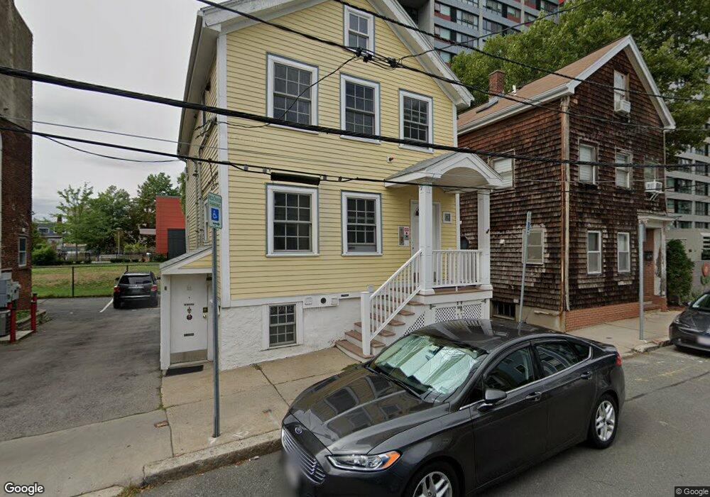
25 Lambert St Cambridge, MA 02141
East Cambridge NeighborhoodEstimated Value: $1,074,000 - $1,673,000
3
Beds
4
Baths
1,433
Sq Ft
$930/Sq Ft
Est. Value
About This Home
This home is located at 25 Lambert St, Cambridge, MA 02141 and is currently estimated at $1,333,000, approximately $930 per square foot. 25 Lambert St is a home located in Middlesex County with nearby schools including Community Charter School of Cambridge.
Ownership History
Date
Name
Owned For
Owner Type
Purchase Details
Closed on
Jan 6, 2021
Sold by
Delaney Properties Inc
Bought by
Rcg Lambert Llc
Current Estimated Value
Home Financials for this Owner
Home Financials are based on the most recent Mortgage that was taken out on this home.
Original Mortgage
$2,139,000
Outstanding Balance
$1,908,729
Interest Rate
2.7%
Mortgage Type
Purchase Money Mortgage
Estimated Equity
-$575,729
Create a Home Valuation Report for This Property
The Home Valuation Report is an in-depth analysis detailing your home's value as well as a comparison with similar homes in the area
Home Values in the Area
Average Home Value in this Area
Purchase History
| Date | Buyer | Sale Price | Title Company |
|---|---|---|---|
| Rcg Lambert Llc | $3,565,000 | None Available | |
| Rcg Lambert Llc | $3,565,000 | None Available |
Source: Public Records
Mortgage History
| Date | Status | Borrower | Loan Amount |
|---|---|---|---|
| Open | Rcg Lambert Llc | $2,139,000 |
Source: Public Records
Tax History
| Year | Tax Paid | Tax Assessment Tax Assessment Total Assessment is a certain percentage of the fair market value that is determined by local assessors to be the total taxable value of land and additions on the property. | Land | Improvement |
|---|---|---|---|---|
| 2025 | $7,409 | $1,166,700 | $661,100 | $505,600 |
| 2024 | $7,052 | $1,191,300 | $704,100 | $487,200 |
| 2023 | $6,544 | $1,116,800 | $672,300 | $444,500 |
| 2022 | $6,310 | $1,065,900 | $663,900 | $402,000 |
| 2021 | $6,104 | $1,043,500 | $651,500 | $392,000 |
| 2020 | $5,798 | $1,008,300 | $657,600 | $350,700 |
| 2019 | $5,771 | $971,500 | $645,000 | $326,500 |
| 2018 | $5,273 | $838,300 | $534,900 | $303,400 |
| 2017 | $4,969 | $765,700 | $478,300 | $287,400 |
| 2016 | $4,474 | $640,100 | $374,400 | $265,700 |
| 2015 | $4,327 | $553,300 | $321,000 | $232,300 |
| 2014 | $3,873 | $462,200 | $248,600 | $213,600 |
Source: Public Records
Map
Nearby Homes
- 47-53R 8th St
- 59 7th St
- 59 7th St Unit 2
- 59 7th St Unit 1
- 59 7th St Unit 3
- 218 Thorndike St Unit 203
- 747 Cambridge St Unit 7
- 747 Cambridge St Unit 2
- 747 Cambridge St Unit 4
- 747 Cambridge St Unit 6
- 71 Fulkerson St Unit 210
- 377-379 Cardinal Medeiros Ave
- 1 Marney St
- 66 6th St Unit 3
- 66 6th St Unit 2
- 9 Medford St Unit 405
- 9 Medford St Unit 410
- 42 Jefferson St Unit 3
- 20 Harding St
- 303 Hurley St
- 25 Lambert St
- 25 Lambert St Unit 1
- 25 Lambert St Unit 2
- 25 Lambert St Unit B
- 21 Lambert St
- 23 Lambert St Unit 3R
- 21 Lambert St Unit 1L
- 23 Lambert St Unit 27-1L
- 23 Lambert St Unit 27-2A
- 23 Lambert St Unit 27-2L
- 21 Lambert St Unit 3L
- 23 Lambert St Unit 3T
- 23 Lambert St Unit 3A
- 23 Lambert St Unit 3l
- 23 Lambert St
- 23 Lambert St Unit 2
- 23 Lambert St
- 23 Lambert St Unit 1
- 27A Lambert St Unit 3R
- 27A Lambert St Unit 2L
Your Personal Tour Guide
Ask me questions while you tour the home.