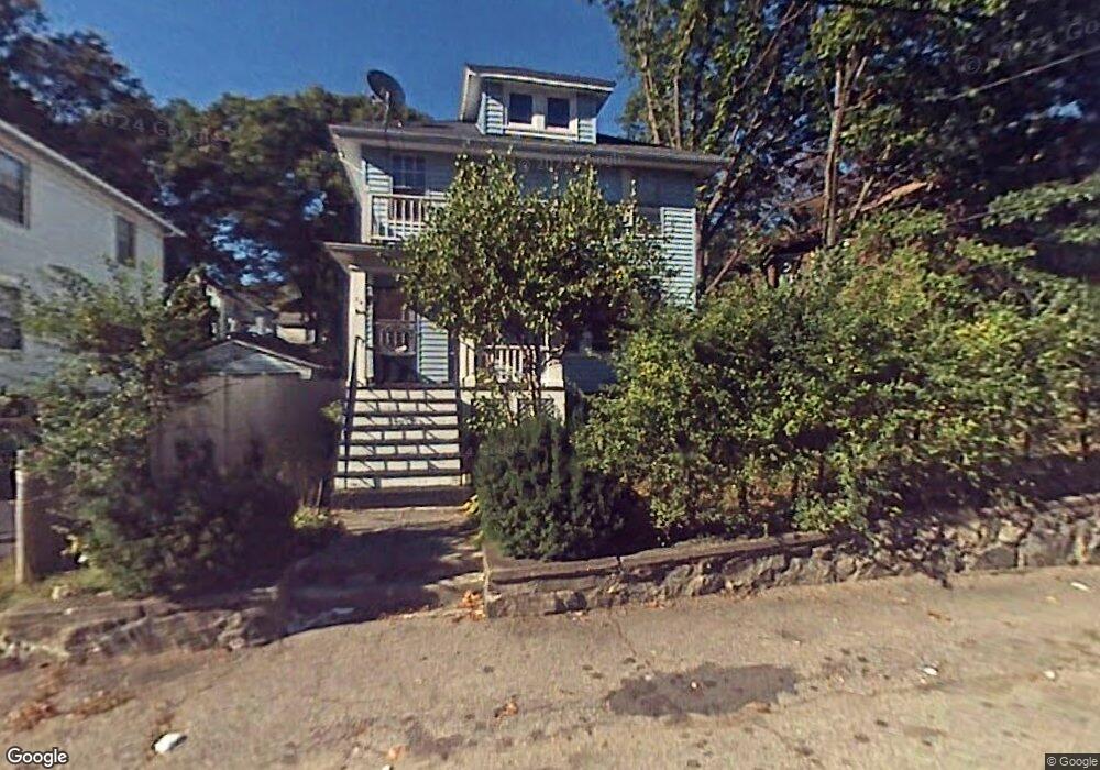
25 Lothrop Ave Unit 2 Milton, MA 02186
Brush Hill NeighborhoodEstimated Value: $837,000 - $929,000
3
Beds
1
Bath
1,080
Sq Ft
$816/Sq Ft
Est. Value
About This Home
This home is located at 25 Lothrop Ave Unit 2, Milton, MA 02186 and is currently estimated at $881,579, approximately $816 per square foot. 25 Lothrop Ave Unit 2 is a home located in Norfolk County with nearby schools including Milton High School, KIPP Academy Boston Charter School, and St. Mary of the Hills School.
Ownership History
Date
Name
Owned For
Owner Type
Purchase Details
Closed on
Jun 30, 1999
Sold by
Quish Mary G
Bought by
Leite Jose R and Leite Maria D
Current Estimated Value
Home Financials for this Owner
Home Financials are based on the most recent Mortgage that was taken out on this home.
Original Mortgage
$211,500
Outstanding Balance
$57,513
Interest Rate
7.19%
Mortgage Type
Purchase Money Mortgage
Estimated Equity
$824,066
Create a Home Valuation Report for This Property
The Home Valuation Report is an in-depth analysis detailing your home's value as well as a comparison with similar homes in the area
Home Values in the Area
Average Home Value in this Area
Purchase History
We collect this data history from publicly available records. To have your information removed, we recommend requesting removal directly through your county’s website.
| Date | Buyer | Sale Price | Title Company |
|---|---|---|---|
| Leite Jose R | $235,000 | -- |
Source: Public Records
Mortgage History
We collect this data history from publicly available records. To have your information removed, we recommend requesting removal directly through your county’s website.
| Date | Status | Borrower | Loan Amount |
|---|---|---|---|
| Open | Leite Jose R | $30,000 | |
| Open | Leite Jose R | $211,500 | |
| Previous Owner | Leite Jose R | $76,000 |
Source: Public Records
Tax History
| Year | Tax Paid | Tax Assessment Tax Assessment Total Assessment is a certain percentage of the fair market value that is determined by local assessors to be the total taxable value of land and additions on the property. | Land | Improvement |
|---|---|---|---|---|
| 2025 | $8,350 | $752,900 | $332,400 | $420,500 |
| 2024 | $8,313 | $761,300 | $332,400 | $428,900 |
| 2023 | $8,046 | $705,800 | $309,100 | $396,700 |
| 2022 | $8,102 | $649,700 | $309,100 | $340,600 |
| 2021 | $8,198 | $624,400 | $300,100 | $324,300 |
| 2020 | $7,440 | $567,100 | $277,500 | $289,600 |
| 2019 | $6,902 | $523,700 | $269,400 | $254,300 |
| 2018 | $6,510 | $471,400 | $218,900 | $252,500 |
| 2017 | $5,939 | $438,000 | $208,500 | $229,500 |
| 2016 | $5,493 | $406,900 | $195,400 | $211,500 |
| 2015 | $5,304 | $380,500 | $179,800 | $200,700 |
Source: Public Records
Map
Nearby Homes
- 15 Crown St
- 9 Crown St
- 112 Brush Hill Rd
- 59 Amor Rd
- 70 Brush Hill Rd Unit 72
- 7 Parkway Crescent
- 168 Brook Rd
- 15 Norman St
- 38 Monponset St
- 640 River St
- 645 River St
- 485 Blue Hills Pkwy Unit 39
- 485 Blue Hills Pkwy Unit 12
- 485 Blue Hills Pkwy Unit 13
- 485 Blue Hills Pkwy Unit 2
- 485 Blue Hills Pkwy Unit 21
- 5 Adanac Rd
- 39-41 Suncrest Rd
- 45 Adanac Rd
- 60 Marilyn Rd
- 25 Lothrop Ave Unit 25A
- 23 Lothrop Ave
- 23 Lothrop Ave Unit 1
- 27 Lothrop Ave
- 24 Lothrop Ave
- 14 Verndale Rd
- 12 Verndale Rd Unit 1
- 12 Verndale Rd
- 14 Verndale Rd Unit R
- 14 Verndale Rd Unit L
- 21 Lothrop Ave Unit 21A
- 21 Lothrop Ave Unit 2nd fl
- 29 Lothrop Ave
- 10 Verndale Rd
- 47 Decker St
- 30 Lothrop Ave Unit 32
- 32 Lothrop Ave Unit 2
- 32 Lothrop Ave Unit 32
- 30 Lothrop Ave Unit 2
- 30 Lothrop Ave Unit 1
Your Personal Tour Guide
Ask me questions while you tour the home.