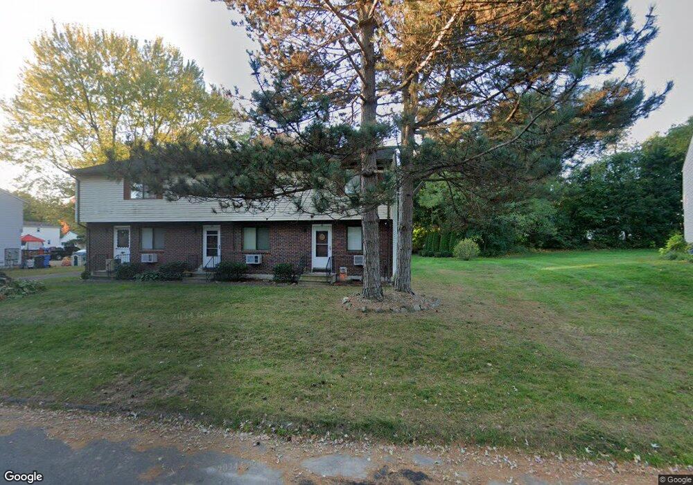
25 Robertson St Bristol, CT 06010
Forestville NeighborhoodEstimated Value: $188,000 - $226,000
2
Beds
2
Baths
900
Sq Ft
$235/Sq Ft
Est. Value
About This Home
This home is located at 25 Robertson St, Bristol, CT 06010 and is currently estimated at $211,069, approximately $234 per square foot. 25 Robertson St is a home located in Hartford County with nearby schools including Northeast Middle School, Bristol Eastern High School, and St Matthew School.
Ownership History
Date
Name
Owned For
Owner Type
Purchase Details
Closed on
Jan 29, 1999
Sold by
Hassan David W and Hassan Lorraine M
Bought by
Malone Kenneth J and Malone Candyce C
Current Estimated Value
Home Financials for this Owner
Home Financials are based on the most recent Mortgage that was taken out on this home.
Original Mortgage
$60,100
Interest Rate
6.67%
Purchase Details
Closed on
Jul 17, 1987
Sold by
Ford Paul W
Bought by
Hamilton Clifford M
Create a Home Valuation Report for This Property
The Home Valuation Report is an in-depth analysis detailing your home's value as well as a comparison with similar homes in the area
Home Values in the Area
Average Home Value in this Area
Purchase History
| Date | Buyer | Sale Price | Title Company |
|---|---|---|---|
| Malone Kenneth J | $62,000 | -- | |
| Hamilton Clifford M | $100,000 | -- |
Source: Public Records
Mortgage History
| Date | Status | Borrower | Loan Amount |
|---|---|---|---|
| Open | Hamilton Clifford M | $95,000 | |
| Closed | Hamilton Clifford M | $75,000 | |
| Closed | Hamilton Clifford M | $13,300 | |
| Closed | Hamilton Clifford M | $60,100 |
Source: Public Records
Tax History
| Year | Tax Paid | Tax Assessment Tax Assessment Total Assessment is a certain percentage of the fair market value that is determined by local assessors to be the total taxable value of land and additions on the property. | Land | Improvement |
|---|---|---|---|---|
| 2025 | $3,005 | $89,040 | $0 | $89,040 |
| 2024 | $2,836 | $89,040 | $0 | $89,040 |
| 2023 | $2,702 | $89,040 | $0 | $89,040 |
| 2022 | $2,475 | $64,540 | $0 | $64,540 |
| 2021 | $2,475 | $64,540 | $0 | $64,540 |
| 2020 | $2,475 | $64,540 | $0 | $64,540 |
| 2019 | $2,456 | $64,540 | $0 | $64,540 |
| 2018 | $2,380 | $64,540 | $0 | $64,540 |
| 2017 | $2,252 | $62,510 | $0 | $62,510 |
| 2016 | $2,252 | $62,510 | $0 | $62,510 |
| 2015 | $2,163 | $62,510 | $0 | $62,510 |
| 2014 | $2,163 | $62,510 | $0 | $62,510 |
Source: Public Records
Map
Nearby Homes
- 160 Fair St
- 89 Nicholas Dr Unit 89
- 159 Robertson St
- 262 Westwoods Terrace
- 2 Bushel Rd
- 201 Westwoods Terrace
- 135 E Main St
- 133 Central St
- 29 Bingham St
- 158 E Main St
- 44 Curtiss Ave
- 33 Kenney St
- 137 Brook St
- 0 Oakwood Cir
- 0 Overlook Dr Unit Lots 3 and 4
- 206 Burton St
- 50 Forestville Ave
- 169 Morningside Dr E
- 92 Garfield Rd
- 109 Glenwood Dr
- 23 Robertson St
- 21 Robertson St
- 21 Robertson St Unit D
- 21 Robertson St Unit 21
- 22 Robertson St
- 20 Robertson St
- 33 Robertson St
- 33 Robertson St Unit 33B
- 15 Robertson St
- 15 Robertson St Unit 15
- 13 Robertson St
- 31 Robertson St
- 35 Robertson St
- 35 Robertson St Unit 35
- 11 Robertson St
- 37 Robertson St
- 37 Robertson St Unit A
- 37 Robertson St Unit 37A
- 39 Robertson St
- 39 Robertson St Unit 39
Your Personal Tour Guide
Ask me questions while you tour the home.