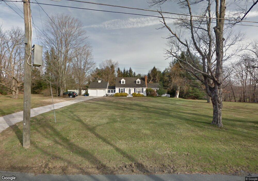
250 Maple St Litchfield, CT 06759
Estimated Value: $516,944 - $826,000
About This Home
This home is located at 250 Maple St, Litchfield, CT 06759 and is currently estimated at $602,236, approximately $410 per square foot. 250 Maple St is a home located in Litchfield County with nearby schools including Center School, Litchfield Intermediate School, and Litchfield High School.
Ownership History
We collect this data history from publicly available records. To have your information removed, we recommend requesting removal directly through your county’s website.
Purchase Details
Purchase Details
Purchase Details
Home Values in the Area
Average Home Value in this Area
Purchase History
We collect this data history from publicly available records. To have your information removed, we recommend requesting removal directly through your county’s website.
| Date | Buyer | Sale Price | Title Company |
|---|---|---|---|
| -- | None Available | ||
| $129,000 | -- | ||
| $230,000 | -- |
Mortgage History
We collect this data history from publicly available records. To have your information removed, we recommend requesting removal directly through your county’s website.
| Date | Status | Borrower | Loan Amount |
|---|---|---|---|
| Previous Owner | $287,500 | ||
| Previous Owner | $204,854 | ||
| Previous Owner | $102,439 |
Tax History
We collect this data history from publicly available records. To have your information removed, we recommend requesting removal directly through your county’s website.
| Year | Tax Paid | Tax Assessment Tax Assessment Total Assessment is a certain percentage of the fair market value that is determined by local assessors to be the total taxable value of land and additions on the property. | Land | Improvement |
|---|---|---|---|---|
| 2025 | $5,540 | $277,010 | $97,950 | $179,060 |
| 2024 | $5,125 | $277,010 | $97,950 | $179,060 |
| 2023 | $5,700 | $213,470 | $86,640 | $126,830 |
| 2022 | $5,721 | $213,470 | $86,640 | $126,830 |
| 2021 | $5,892 | $213,470 | $86,640 | $126,830 |
| 2020 | $5,913 | $213,470 | $86,640 | $126,830 |
| 2019 | $6,020 | $213,470 | $86,640 | $126,830 |
| 2018 | $6,054 | $218,560 | $116,300 | $102,260 |
| 2017 | $6,032 | $218,560 | $116,300 | $102,260 |
| 2016 | $5,836 | $218,560 | $116,300 | $102,260 |
| 2015 | -- | $219,440 | $116,300 | $103,140 |
| 2014 | $5,530 | $219,440 | $116,300 | $103,140 |
Map
- 88 Knox Rd
- 28 Trumbull St
- 22 Highland Ave
- 26 Seminole Cir
- 1134 Bantam Rd
- 24 Tapping Reeve Village
- 38 Old Turnpike Rd
- 11 Sheldon Ln
- 424 Bantam Lake Rd
- 19 Seherr Thoss Dr
- 28 Headquarters Rd
- 47 North St
- 148 North St
- 18 Willow Ln
- 0 Torrington Rd Unit 24168723
- 212 Old South Rd
- 350 South St
- 415 South St
- 0 Newcomb Rd
- 44 Bantam Lake Heights
Ask me questions while you tour the home.