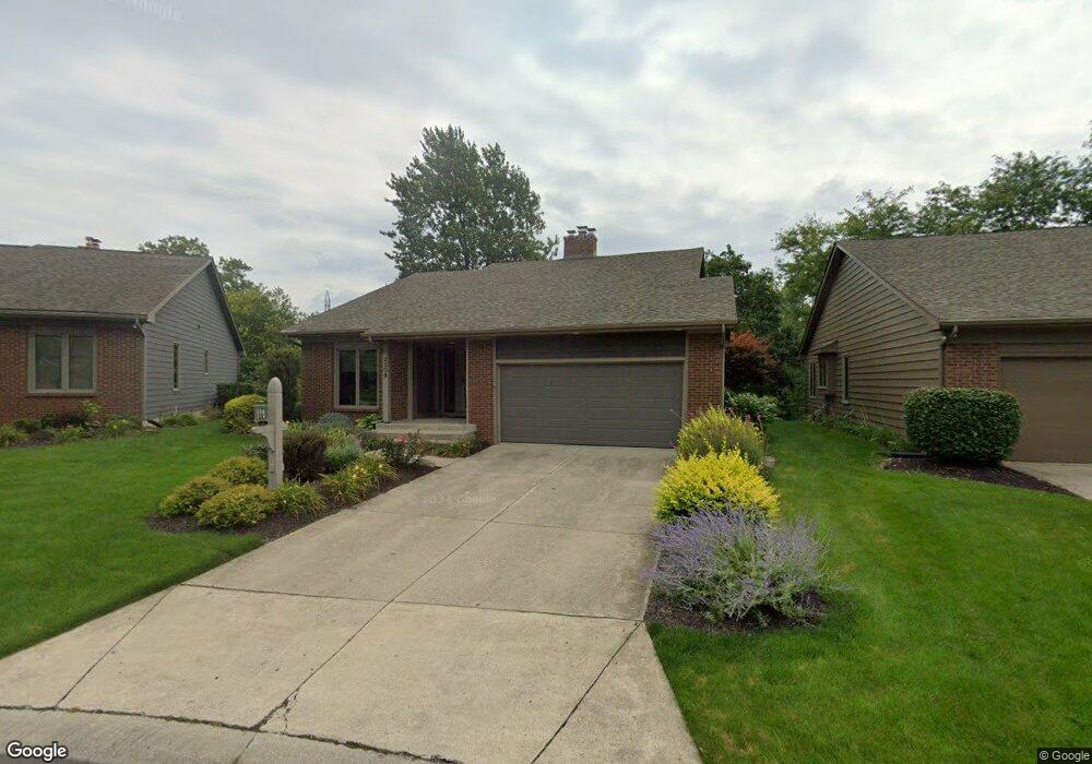
2506 E Saint Thomas Point Fort Wayne, IN 46815
Buckingham NeighborhoodEstimated Value: $293,000 - $329,000
3
Beds
3
Baths
3,672
Sq Ft
$83/Sq Ft
Est. Value
About This Home
This home is located at 2506 E Saint Thomas Point, Fort Wayne, IN 46815 and is currently estimated at $306,556, approximately $83 per square foot. 2506 E Saint Thomas Point is a home located in Allen County with nearby schools including J Wilbur Haley Elementary School, Blackhawk Middle School, and R Nelson Snider High School.
Ownership History
Date
Name
Owned For
Owner Type
Purchase Details
Closed on
Aug 6, 2003
Sold by
Shipsky Don C and Shipsky Judith V
Bought by
Steinhauser Thomas P and Steinhauser Mary Jane
Current Estimated Value
Home Financials for this Owner
Home Financials are based on the most recent Mortgage that was taken out on this home.
Original Mortgage
$155,000
Outstanding Balance
$65,006
Interest Rate
5.31%
Mortgage Type
Purchase Money Mortgage
Estimated Equity
$241,550
Create a Home Valuation Report for This Property
The Home Valuation Report is an in-depth analysis detailing your home's value as well as a comparison with similar homes in the area
Home Values in the Area
Average Home Value in this Area
Purchase History
| Date | Buyer | Sale Price | Title Company |
|---|---|---|---|
| Steinhauser Thomas P | -- | Three Rivers Title Co Inc |
Source: Public Records
Mortgage History
| Date | Status | Borrower | Loan Amount |
|---|---|---|---|
| Open | Steinhauser Thomas P | $155,000 | |
| Closed | Steinhauser Thomas P | $60,000 |
Source: Public Records
Tax History
| Year | Tax Paid | Tax Assessment Tax Assessment Total Assessment is a certain percentage of the fair market value that is determined by local assessors to be the total taxable value of land and additions on the property. | Land | Improvement |
|---|---|---|---|---|
| 2025 | $3,761 | $351,400 | $48,000 | $303,400 |
| 2024 | $3,304 | $326,300 | $48,000 | $278,300 |
| 2022 | $3,182 | $281,000 | $48,000 | $233,000 |
| 2021 | $2,749 | $244,500 | $31,000 | $213,500 |
| 2020 | $2,379 | $217,400 | $31,000 | $186,400 |
| 2019 | $2,100 | $193,400 | $31,000 | $162,400 |
| 2018 | $2,215 | $202,400 | $31,000 | $171,400 |
| 2017 | $2,320 | $209,900 | $31,000 | $178,900 |
| 2016 | $2,130 | $196,000 | $31,000 | $165,000 |
| 2014 | $1,872 | $181,000 | $31,000 | $150,000 |
| 2013 | $1,836 | $177,800 | $31,000 | $146,800 |
Source: Public Records
Map
Nearby Homes
- 2611 Neptunes Crossing
- 5722 Port Royal
- 2636 Kingston Point
- 5723 Port Royal
- 5720 Bayside Dr
- 5717 Bayside Dr
- 6113 Millhollow Ln
- 6334 Bennington Dr
- 6124 Vance Ave
- 6601 Bennington Dr
- 6320 Wakopa Ct
- 2818 1/2 Reed Rd
- 5826 Thoreau Ave
- 6136 Landmark Dr
- 1605 Benham Dr
- 5109 Woodmark Ct
- 5117 Woodmark Ct
- 6322 Baychester Dr
- 1416 Lofton Way
- 3210 Arrowwood Dr
- 2502 E Saint Thomas Point
- 2510 E Saint Thomas Point
- 2516 E Saint Thomas Point
- 2409 Kingston Point
- 2509 E Saint Thomas Point
- 2421 Kingston Point
- 2522 E Saint Thomas Point
- 2515 E Saint Thomas Point
- 2435 Kingston Point
- 2510 Kingston Point
- 2516 Kingston Point
- 2527 E Saint Thomas Point
- 2727 Old Pond Cove
- 2534 E Saint Thomas Point
- 2501 Kingston Point
- 2733 Old Pond Cove
- 2515 Kingston Point
- 2515 Kingston Point Unit 9 south
- 2805 Old Pond Cove
- 2721 Old Pond Cove
Your Personal Tour Guide
Ask me questions while you tour the home.