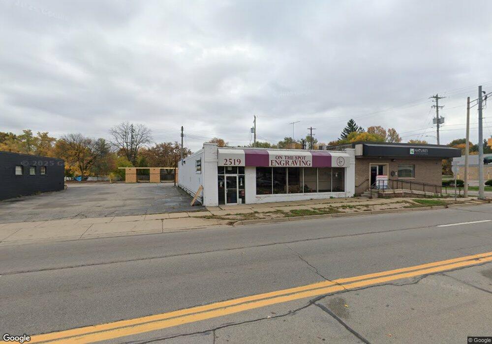
2519 S Cedar St Lansing, MI 48910
Clifford Park NeighborhoodEstimated Value: $129,056
Studio
--
Bath
3,570
Sq Ft
$36/Sq Ft
Est. Value
About This Home
This home is located at 2519 S Cedar St, Lansing, MI 48910 and is currently estimated at $129,056, approximately $36 per square foot. 2519 S Cedar St is a home located in Ingham County with nearby schools including Lyons Elementary School, Attwood School, and Eastern High School.
Ownership History
Date
Name
Owned For
Owner Type
Purchase Details
Closed on
Dec 24, 2020
Sold by
Williams John E and Williams Betty I
Bought by
Djs Auto Sales Llc
Current Estimated Value
Purchase Details
Closed on
Jun 23, 2000
Sold by
Clinton Memorial Hospital Assn
Bought by
Williams John E and Williams Betty L
Home Financials for this Owner
Home Financials are based on the most recent Mortgage that was taken out on this home.
Original Mortgage
$170,000
Interest Rate
8.66%
Mortgage Type
Commercial
Create a Home Valuation Report for This Property
The Home Valuation Report is an in-depth analysis detailing your home's value as well as a comparison with similar homes in the area
Home Values in the Area
Average Home Value in this Area
Purchase History
| Date | Buyer | Sale Price | Title Company |
|---|---|---|---|
| Djs Auto Sales Llc | $99,000 | Ata National Title Group Llc | |
| Williams John E | $225,000 | Metropolitan Title Company |
Source: Public Records
Mortgage History
| Date | Status | Borrower | Loan Amount |
|---|---|---|---|
| Previous Owner | Williams John E | $170,000 |
Source: Public Records
Tax History
| Year | Tax Paid | Tax Assessment Tax Assessment Total Assessment is a certain percentage of the fair market value that is determined by local assessors to be the total taxable value of land and additions on the property. | Land | Improvement |
|---|---|---|---|---|
| 2025 | $7,010 | $107,800 | $17,600 | $90,200 |
| 2024 | $61 | $86,700 | $17,600 | $69,100 |
| 2023 | $6,860 | $86,000 | $20,100 | $65,900 |
| 2022 | $8,987 | $117,900 | $20,100 | $97,800 |
| 2021 | $8,302 | $113,900 | $20,100 | $93,800 |
| 2020 | $8,248 | $112,300 | $20,100 | $92,200 |
| 2019 | $14,751 | $104,500 | $20,100 | $84,400 |
| 2018 | $7,575 | $115,900 | $21,900 | $94,000 |
| 2017 | $7,300 | $115,900 | $21,900 | $94,000 |
| 2016 | $12,300 | $113,400 | $21,900 | $91,500 |
| 2015 | $12,300 | $107,200 | $43,731 | $63,469 |
| 2014 | $12,300 | $99,600 | $43,731 | $55,869 |
Source: Public Records
Map
Nearby Homes
- 318 E Greenlawn Ave
- 2600 Maplewood Ave
- 609 S Park Blvd
- 613 Tisdale Ave
- 630 E Greenlawn Ave
- 321 Paris Ave
- 528 Riley St
- 2229 Forest Ave
- 413 E Hodge Ave
- 2316 Forest Ave
- 320 E Hodge Ave
- 108 Dunlap St
- 210 Dunlap St
- 215 Dunlap St
- 226 Dunlap St
- 3209 Stabler St
- 315 E Mount Hope Ave
- 311 E Mount Hope Ave
- 307 E Mount Hope Ave
- 3115 Tenny St
- 2513 S Cedar St
- 2521 S Cedar St
- 521 E Greenlawn Ave
- 516 E Greenlawn Ave
- 524 Lincoln Ave
- 529 E Greenlawn Ave
- 520 E Greenlawn Ave
- 528 Lincoln Ave
- 524 E Greenlawn Ave
- 533 E Greenlawn Ave
- 532 Lincoln Ave
- 528 E Greenlawn Ave
- 532 E Greenlawn Ave
- 404 E Greenlawn Ave
- 541 E Greenlawn Ave
- 529 Lincoln Ave
- 540 E Greenlawn Ave
- 400 E Greenlawn Ave
- E Greenlawn Ave
- 545 E Greenlawn Ave
Your Personal Tour Guide
Ask me questions while you tour the home.