254 Pond Rd Wanchese, NC 27981
Wanchese NeighborhoodEstimated Value: $245,000 - $383,138
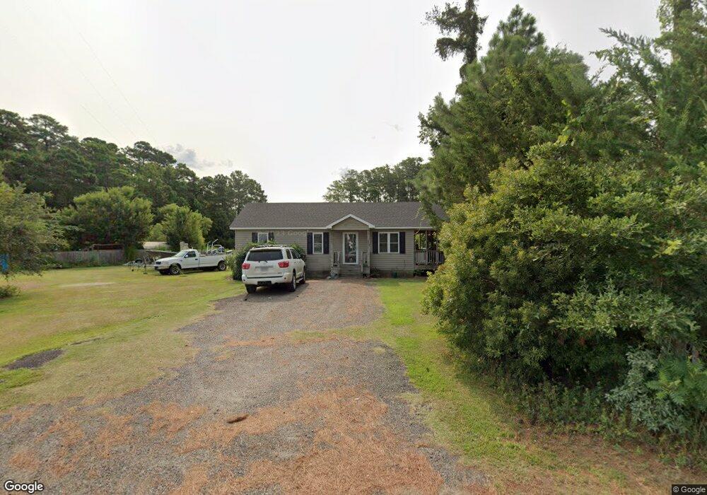
About This Home
This home is located at 254 Pond Rd, Wanchese, NC 27981 and is currently estimated at $316,046, approximately $182 per square foot. 254 Pond Rd is a home located in Dare County with nearby schools including Manteo Elementary School, Manteo Middle School, and Manteo High School.
Ownership History
We collect this data history from publicly available records. To have your information removed, we recommend requesting removal directly through your county’s website.
Purchase Details
Purchase Details
Home Financials for this Owner
Home Financials are based on the most recent Mortgage that was taken out on this home.Purchase Details
Home Financials for this Owner
Home Financials are based on the most recent Mortgage that was taken out on this home.Home Values in the Area
Average Home Value in this Area
Purchase History
We collect this data history from publicly available records. To have your information removed, we recommend requesting removal directly through your county’s website.
| Date | Buyer | Sale Price | Title Company |
|---|---|---|---|
| $135,000 | None Listed On Document | ||
| $135,000 | None Listed On Document | ||
| $135,000 | None Listed On Document | ||
| $70,000 | None Available | ||
| $145,000 | None Available |
Mortgage History
We collect this data history from publicly available records. To have your information removed, we recommend requesting removal directly through your county’s website.
| Date | Status | Borrower | Loan Amount |
|---|---|---|---|
| Previous Owner | $59,900 | ||
| Previous Owner | $141,324 |
Tax History
We collect this data history from publicly available records. To have your information removed, we recommend requesting removal directly through your county’s website.
| Year | Tax Paid | Tax Assessment Tax Assessment Total Assessment is a certain percentage of the fair market value that is determined by local assessors to be the total taxable value of land and additions on the property. | Land | Improvement |
|---|---|---|---|---|
| 2025 | $570 | $123,700 | $122,700 | $1,000 |
| 2024 | $611 | $86,200 | $85,300 | $900 |
| 2023 | $1,036 | $181,927 | $85,300 | $96,627 |
| 2022 | $1,007 | $179,987 | $85,300 | $94,687 |
| 2021 | $989 | $179,987 | $85,300 | $94,687 |
| 2020 | $989 | $180,494 | $85,300 | $95,194 |
| 2019 | $980 | $135,000 | $54,400 | $80,600 |
| 2018 | $868 | $135,000 | $54,400 | $80,600 |
| 2017 | $868 | $135,000 | $54,400 | $80,600 |
| 2016 | $814 | $135,000 | $54,400 | $80,600 |
| 2014 | $814 | $135,000 | $54,400 | $80,600 |
Map
- 918 Old Wharf Rd Unit Lot 4
- 1146 E R Daniels Rd
- 92 Mosley Ln
- 168 Burrus Rd
- 4013 Mill Landing Rd
- 4683 Mill Landing Rd
- 3 Little Tim Island Unit Lot 3
- 213 Pirates Way Unit 213
- 125 Pirates Way Unit 125D
- 202 Sailfish Dr Unit 202
- 40 Sailfish Dr Unit Lot 40
- 424 Pirates Way Unit 424A
- 432 Pirates Way Unit 432A
- 413 Pirates Way Unit 413A
- 315 Pirates Way Unit 315B
- 15 Yacht Club Ct Unit Slip 15
- 97 Yacht Club Ct Unit Slip 97
- 525 Pirates Way Unit 525
- 632 Pirates Way Unit 632B
- 513 Pirates Way Unit 513b
Ask me questions while you tour the home.