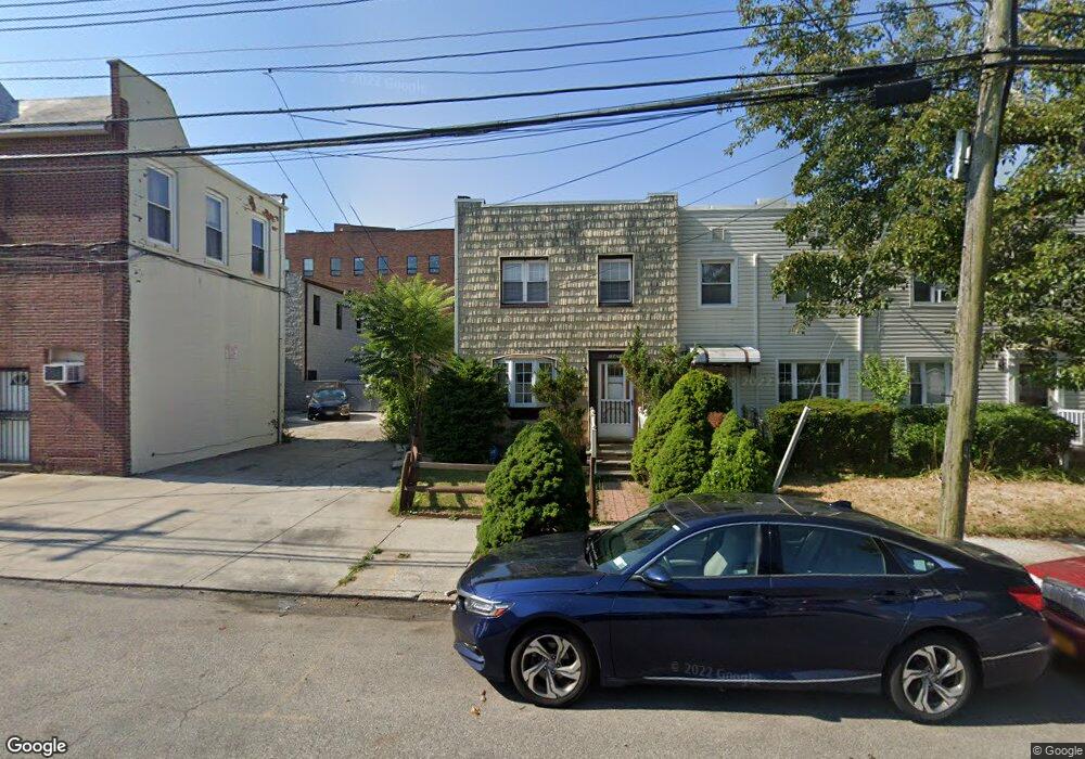
25410 87th Dr Bellerose, NY 11426
Bellerose NeighborhoodEstimated Value: $722,000 - $743,573
Studio
--
Bath
1,224
Sq Ft
$599/Sq Ft
Est. Value
About This Home
This home is located at 25410 87th Dr, Bellerose, NY 11426 and is currently estimated at $733,393, approximately $599 per square foot. 25410 87th Dr is a home located in Queens County with nearby schools including P.S.133Q, Irwin Altman Middle School 172, and Martin Van Buren High School.
Ownership History
Date
Name
Owned For
Owner Type
Purchase Details
Closed on
Mar 3, 2025
Sold by
Diane Bubelis As Executor and Estate Of William A Guarino
Bought by
Flemming Isabel and Roslonowski Gregory
Current Estimated Value
Home Financials for this Owner
Home Financials are based on the most recent Mortgage that was taken out on this home.
Original Mortgage
$691,600
Outstanding Balance
$683,292
Interest Rate
6.96%
Mortgage Type
Purchase Money Mortgage
Estimated Equity
$50,101
Create a Home Valuation Report for This Property
The Home Valuation Report is an in-depth analysis detailing your home's value as well as a comparison with similar homes in the area
Home Values in the Area
Average Home Value in this Area
Purchase History
| Date | Buyer | Sale Price | Title Company |
|---|---|---|---|
| Flemming Isabel | $728,000 | -- |
Source: Public Records
Mortgage History
| Date | Status | Borrower | Loan Amount |
|---|---|---|---|
| Open | Flemming Isabel | $691,600 |
Source: Public Records
Tax History
| Year | Tax Paid | Tax Assessment Tax Assessment Total Assessment is a certain percentage of the fair market value that is determined by local assessors to be the total taxable value of land and additions on the property. | Land | Improvement |
|---|---|---|---|---|
| 2026 | $6,956 | $34,634 | $13,038 | $21,596 |
| 2025 | $6,622 | $34,634 | $14,519 | $20,115 |
| 2024 | $6,634 | $34,370 | $14,005 | $20,365 |
| 2023 | $6,301 | $32,426 | $12,242 | $20,184 |
| 2022 | $5,820 | $37,680 | $15,720 | $21,960 |
| 2021 | $5,778 | $36,060 | $15,720 | $20,340 |
| 2020 | $5,813 | $31,020 | $15,720 | $15,300 |
| 2019 | $5,699 | $34,200 | $15,720 | $18,480 |
| 2018 | $5,211 | $27,022 | $13,563 | $13,459 |
| 2017 | $4,897 | $25,495 | $13,413 | $12,082 |
| 2016 | $4,498 | $25,495 | $13,413 | $12,082 |
| 2015 | $2,681 | $24,052 | $15,084 | $8,968 |
| 2014 | $2,681 | $23,869 | $16,229 | $7,640 |
Source: Public Records
Map
Nearby Homes
- 8783 254th St
- 25 Adelaide St
- 250-23 88th Rd
- 6 Brokaw Ave
- 22 Brokaw Ave
- 25719 87th Rd
- 78 Ontario Rd
- 68 Hudson Rd
- 87-15 258th St
- 91 Tulip Ave Unit G C2
- 91 Tulip Ave Unit Hb-1
- 9 Belmont Ave
- 248-55 88th Rd
- 8726 249th St
- 35 Floral Blvd Unit 1A
- 248-24 88th Dr
- 248-21 87th Ave
- 182 Lowell Ave
- 248-29 88th Rd
- 8610 250th St
- 25408 87th Dr
- 254-10 87th Dr
- 25406 87th Dr
- 25404 87th Dr
- 8812 Little Neck Pkwy
- 8806 Little Neck Pkwy
- 8804 Little Neck Pkwy
- 8808 Little Neck Pkwy
- 88-08 Little Neck Pkwy
- 25402 87th Dr
- 254-02 87th Dr
- 88-10 Little Neck Pwy
- 88-10 Little Neck Pkwy
- 8818 Little Neck Pkwy
- 88-04 Little Neck Pkwy Unit A
- 88-04 Little Neck Pkwy
- 25348 87th Dr
- 8802 Little Neck Pkwy
- 8806 Little Neck Pkwy
- 8810 Little Neck Pkwy
Your Personal Tour Guide
Ask me questions while you tour the home.