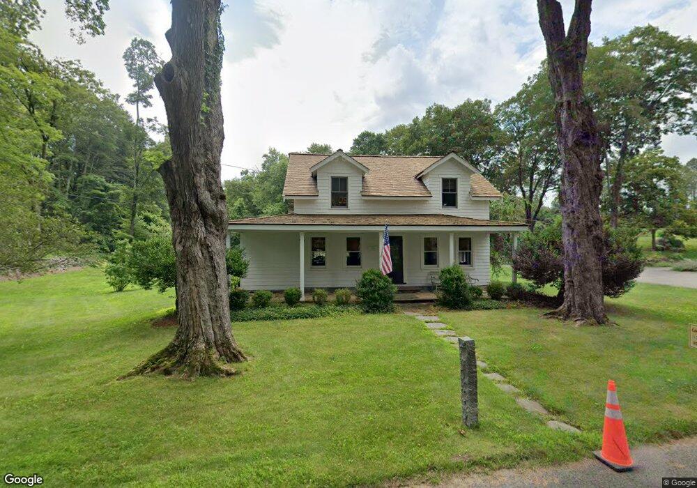
255 Maple Rd Easton, CT 06612
Estimated Value: $632,000 - $951,000
3
Beds
2
Baths
1,653
Sq Ft
$453/Sq Ft
Est. Value
About This Home
This home is located at 255 Maple Rd, Easton, CT 06612 and is currently estimated at $749,406, approximately $453 per square foot. 255 Maple Rd is a home located in Fairfield County with nearby schools including Samuel Staples Elementary School, Helen Keller Middle School, and Joel Barlow High School.
Ownership History
Date
Name
Owned For
Owner Type
Purchase Details
Closed on
Dec 1, 1999
Sold by
Nicholls Ian S and Nicholls Karen E
Bought by
Solway David I and Solway Killeen F
Current Estimated Value
Home Financials for this Owner
Home Financials are based on the most recent Mortgage that was taken out on this home.
Original Mortgage
$261,000
Interest Rate
7.86%
Create a Home Valuation Report for This Property
The Home Valuation Report is an in-depth analysis detailing your home's value as well as a comparison with similar homes in the area
Home Values in the Area
Average Home Value in this Area
Purchase History
We collect this data history from publicly available records. To have your information removed, we recommend requesting removal directly through your county’s website.
| Date | Buyer | Sale Price | Title Company |
|---|---|---|---|
| Solway David I | $327,000 | -- | |
| Solway David I | $327,000 | -- |
Source: Public Records
Mortgage History
We collect this data history from publicly available records. To have your information removed, we recommend requesting removal directly through your county’s website.
| Date | Status | Borrower | Loan Amount |
|---|---|---|---|
| Open | Solway David I | $560,250 | |
| Closed | Solway David I | $330,000 | |
| Closed | Solway David I | $31,914 | |
| Closed | Solway David I | $261,000 |
Source: Public Records
Tax History
| Year | Tax Paid | Tax Assessment Tax Assessment Total Assessment is a certain percentage of the fair market value that is determined by local assessors to be the total taxable value of land and additions on the property. | Land | Improvement |
|---|---|---|---|---|
| 2025 | $11,447 | $369,250 | $199,360 | $169,890 |
| 2024 | $10,908 | $369,250 | $199,360 | $169,890 |
| 2023 | $10,693 | $369,250 | $199,360 | $169,890 |
| 2022 | $10,501 | $369,250 | $199,360 | $169,890 |
| 2021 | $11,961 | $369,730 | $213,350 | $156,380 |
| 2020 | $11,462 | $369,730 | $213,350 | $156,380 |
| 2019 | $11,584 | $369,730 | $213,350 | $156,380 |
| 2018 | $11,602 | $369,730 | $213,350 | $156,380 |
| 2017 | $12,342 | $369,730 | $213,350 | $156,380 |
| 2016 | $11,774 | $382,160 | $265,850 | $116,310 |
| 2015 | $11,610 | $382,160 | $265,850 | $116,310 |
| 2014 | $11,427 | $382,160 | $265,850 | $116,310 |
Source: Public Records
Map
Nearby Homes
- 41 Ridge Line Rd
- 294 Maple Rd
- 766 N Park Ave
- 80 Maple Rd
- 429 Rock House Rd
- 235 Rock House Rd
- 35 Grace View Dr
- 16 Robin Hood Ln
- 54 Rock House Rd
- 46 Sherwood Rd
- 101 Sport Hill Rd
- 70 Crossbow Ln
- 145 Sherwood Rd
- 28 Goodridge Rd
- 63 Turney Rd
- 45 Martin Ln
- 22 Bridle Path Trail
- 332 Hattertown Rd
- 30 Birchwood Rd
- 32 Blanket Meadow Rd
Your Personal Tour Guide
Ask me questions while you tour the home.