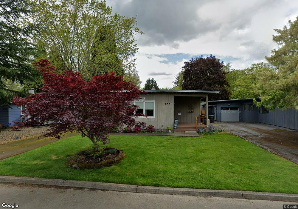
255 SW 131st Ave Beaverton, OR 97005
Estimated Value: $437,000 - $587,000
3
Beds
6
Baths
1,388
Sq Ft
$347/Sq Ft
Est. Value
About This Home
This home is located at 255 SW 131st Ave, Beaverton, OR 97005 and is currently estimated at $481,408, approximately $346 per square foot. 255 SW 131st Ave is a home located in Washington County with nearby schools including Barnes Elementary School, Meadow Park Middle School, and Sunset High School.
Ownership History
Date
Name
Owned For
Owner Type
Purchase Details
Closed on
May 18, 1999
Sold by
Jones Marie A
Bought by
Dahlman Karen A
Current Estimated Value
Home Financials for this Owner
Home Financials are based on the most recent Mortgage that was taken out on this home.
Original Mortgage
$108,000
Outstanding Balance
$26,518
Interest Rate
6.92%
Estimated Equity
$454,890
Purchase Details
Closed on
Sep 9, 1997
Sold by
Jones William David
Bought by
Jones Maria Alica
Purchase Details
Closed on
Apr 15, 1996
Sold by
Babcock Nancy M
Bought by
Jones William D and Jones Marie
Home Financials for this Owner
Home Financials are based on the most recent Mortgage that was taken out on this home.
Original Mortgage
$95,600
Interest Rate
7.41%
Create a Home Valuation Report for This Property
The Home Valuation Report is an in-depth analysis detailing your home's value as well as a comparison with similar homes in the area
Home Values in the Area
Average Home Value in this Area
Purchase History
We collect this data history from publicly available records. To have your information removed, we recommend requesting removal directly through your county’s website.
| Date | Buyer | Sale Price | Title Company |
|---|---|---|---|
| Dahlman Karen A | $135,000 | Oregon Title Insurance Co | |
| Jones Maria Alica | -- | -- | |
| Jones William D | $119,500 | -- |
Source: Public Records
Mortgage History
We collect this data history from publicly available records. To have your information removed, we recommend requesting removal directly through your county’s website.
| Date | Status | Borrower | Loan Amount |
|---|---|---|---|
| Open | Dahlman Karen A | $108,000 | |
| Previous Owner | Jones William D | $95,600 |
Source: Public Records
Tax History
| Year | Tax Paid | Tax Assessment Tax Assessment Total Assessment is a certain percentage of the fair market value that is determined by local assessors to be the total taxable value of land and additions on the property. | Land | Improvement |
|---|---|---|---|---|
| 2026 | $3,858 | $217,460 | -- | -- |
| 2025 | $3,858 | $211,130 | -- | -- |
| 2024 | $3,623 | $204,990 | -- | -- |
| 2023 | $3,623 | $199,020 | $0 | $0 |
| 2022 | $3,496 | $199,020 | $0 | $0 |
| 2021 | $3,370 | $187,610 | $0 | $0 |
| 2020 | $3,268 | $182,150 | $0 | $0 |
| 2019 | $3,165 | $176,850 | $0 | $0 |
| 2018 | $3,062 | $171,700 | $0 | $0 |
| 2017 | $2,952 | $166,700 | $0 | $0 |
| 2016 | $2,847 | $161,850 | $0 | $0 |
| 2015 | $2,746 | $157,140 | $0 | $0 |
| 2014 | $2,701 | $152,570 | $0 | $0 |
Source: Public Records
Map
Nearby Homes
- 12955 SW Evergreen St
- 13100 SW Butner Ct
- 12616 NW Barnes Rd Unit 7
- 12612 NW Barnes Rd Unit 6
- 13115 NW Glenridge Dr
- 12608 NW Barnes Rd Unit 4
- 12622 NW Barnes Rd Unit 6
- 12626 NW Barnes Rd Unit 3
- 13860 SW Butner Rd
- 12642 NW Barnes Rd Unit 3
- 12642 NW Barnes Rd Unit 8
- 12225 SW Spring Ct
- 11990 SW Corby Dr Unit 16
- 11990 SW Corby Dr Unit 2
- 855 SW Spring Ln
- 12935 SW Park Way
- 13405 SW Park Way
- 14155 NW Pioneer Rd
- 216 NW 117th Loop
- 13520 SW Devonshire Dr
- 275 SW 131st Ave
- 235 SW 131st Ave
- 315 SW 131st Ave
- 260 SW 132nd Ave
- 215 SW 131st Ave
- 280 SW 132nd Ave
- 240 SW 132nd Ave
- 320 SW 132nd Ave
- 220 SW 132nd Ave
- 260 SW 131st Ave
- 335 SW 131st Ave
- 175 SW 131st Ave
- 280 SW 131st Ave
- 240 SW 131st Ave
- 220 SW 131st Ave
- 320 SW 131st Ave
- 340 SW 132nd Ave
- 180 SW 132nd Ave
- 355 SW 131st Ave
- 155 SW 131st Ave
Your Personal Tour Guide
Ask me questions while you tour the home.