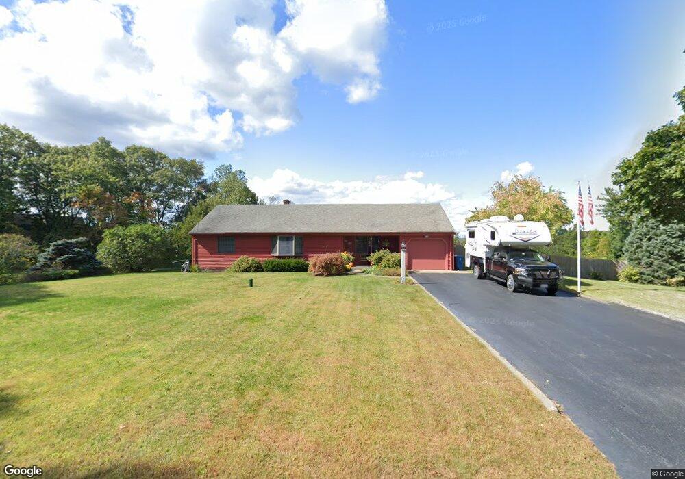
256 Williams St Uxbridge, MA 01569
Estimated Value: $425,000 - $528,000
3
Beds
2
Baths
1,521
Sq Ft
$311/Sq Ft
Est. Value
About This Home
This home is located at 256 Williams St, Uxbridge, MA 01569 and is currently estimated at $473,787, approximately $311 per square foot. 256 Williams St is a home located in Worcester County with nearby schools including Uxbridge High School and Whitinsville Christian School.
Ownership History
Date
Name
Owned For
Owner Type
Purchase Details
Closed on
Dec 29, 2017
Sold by
Buteyn Joyce and Buteyn Mary J
Bought by
Lozeau Joseph and Lozeau Alison M
Current Estimated Value
Home Financials for this Owner
Home Financials are based on the most recent Mortgage that was taken out on this home.
Original Mortgage
$244,000
Outstanding Balance
$165,853
Interest Rate
3.95%
Mortgage Type
New Conventional
Estimated Equity
$307,934
Purchase Details
Closed on
Jun 28, 1961
Bought by
Buteyn Adrian D and Buteyn Joyce H
Create a Home Valuation Report for This Property
The Home Valuation Report is an in-depth analysis detailing your home's value as well as a comparison with similar homes in the area
Home Values in the Area
Average Home Value in this Area
Purchase History
We collect this data history from publicly available records. To have your information removed, we recommend requesting removal directly through your county’s website.
| Date | Buyer | Sale Price | Title Company |
|---|---|---|---|
| Lozeau Joseph | $305,000 | -- | |
| Buteyn Adrian D | -- | -- |
Source: Public Records
Mortgage History
We collect this data history from publicly available records. To have your information removed, we recommend requesting removal directly through your county’s website.
| Date | Status | Borrower | Loan Amount |
|---|---|---|---|
| Open | Lozeau Joseph | $244,000 |
Source: Public Records
Tax History
| Year | Tax Paid | Tax Assessment Tax Assessment Total Assessment is a certain percentage of the fair market value that is determined by local assessors to be the total taxable value of land and additions on the property. | Land | Improvement |
|---|---|---|---|---|
| 2025 | $57 | $433,700 | $147,600 | $286,100 |
| 2024 | $5,047 | $390,600 | $140,000 | $250,600 |
| 2023 | $4,630 | $331,900 | $121,100 | $210,800 |
| 2022 | $4,404 | $290,500 | $106,000 | $184,500 |
| 2021 | $4,559 | $288,200 | $103,700 | $184,500 |
| 2020 | $4,393 | $262,400 | $102,200 | $160,200 |
| 2019 | $4,499 | $259,300 | $102,200 | $157,100 |
| 2018 | $3,990 | $232,400 | $102,200 | $130,200 |
| 2017 | $4,025 | $237,300 | $100,800 | $136,500 |
| 2016 | $4,199 | $239,000 | $87,400 | $151,600 |
| 2015 | $4,115 | $236,500 | $87,400 | $149,100 |
Source: Public Records
Map
Nearby Homes
- 37 Bayliss Way
- 26 Bayliss Way
- 15 Bayliss Way
- 583 Fletcher St
- 7 Whitin Ave
- 150 Hazel St
- 117 Saint Andre Dr
- 138 Elm St
- 66 High St
- 167 Theresa Cir
- 42 Brookside Dr
- 17 Arcade St Unit B
- 223 Heritage Dr
- 28 Cross Rd
- 923 Main St
- 35 Highland Park Unit 35
- 28-30 Brook St
- 23 Yale St Unit 23
- 93 Mantell Rd
- 11 Boston St
- 264 Williams St
- 259 Williams St
- 240 Williams St
- 249 Williams St
- 272 Williams St
- 269 Williams St
- 280 Williams St
- 235 Williams St
- 285 Williams St
- 23 Rawson St
- 7 Rawson St
- 299 Williams St
- 306 Williams St
- 213 Williams St
- 300 Williams St
- 24 Rawson St
- 2 Rawson St
- 225 Williams St
- Lot 7 Waterman Way (Hammond Estates)
- L15R Kasey Ct
Your Personal Tour Guide
Ask me questions while you tour the home.