Estimated Value: $309,127 - $350,000
4
Beds
2
Baths
2,047
Sq Ft
$161/Sq Ft
Est. Value
About This Home
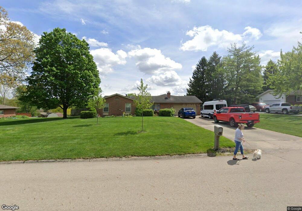
This home is located at 2581 Brookview Rd, Troy, OH 45373 and is currently estimated at $328,782, approximately $160 per square foot. 2581 Brookview Rd is a home located in Miami County with nearby schools including Kyle Elementary School, Van Cleve Elementary School, and Troy Junior High School.
Ownership History
Date
Name
Owned For
Owner Type
Purchase Details
Closed on
Dec 3, 2008
Sold by
Besecker David W
Bought by
Young Pamela J
Current Estimated Value
Purchase Details
Closed on
Jan 30, 2006
Sold by
Riffell J Michael
Bought by
Besecker David W
Purchase Details
Closed on
Sep 8, 2003
Sold by
Klatte Joseph C and Klatte Pamela K
Bought by
Besecker David W and Besecker Michael Riffell
Home Financials for this Owner
Home Financials are based on the most recent Mortgage that was taken out on this home.
Original Mortgage
$159,200
Interest Rate
5.97%
Mortgage Type
New Conventional
Purchase Details
Closed on
Feb 1, 1979
Bought by
Klatte Joseph C
Create a Home Valuation Report for This Property
The Home Valuation Report is an in-depth analysis detailing your home's value as well as a comparison with similar homes in the area
Home Values in the Area
Average Home Value in this Area
Purchase History
| Date | Buyer | Sale Price | Title Company |
|---|---|---|---|
| Young Pamela J | $204,000 | -- | |
| Besecker David W | -- | -- | |
| Besecker David W | $199,000 | -- | |
| Klatte Joseph C | $65,000 | -- |
Source: Public Records
Mortgage History
| Date | Status | Borrower | Loan Amount |
|---|---|---|---|
| Previous Owner | Besecker David W | $159,200 |
Source: Public Records
Tax History
| Year | Tax Paid | Tax Assessment Tax Assessment Total Assessment is a certain percentage of the fair market value that is determined by local assessors to be the total taxable value of land and additions on the property. | Land | Improvement |
|---|---|---|---|---|
| 2025 | $3,460 | $84,850 | $15,860 | $68,990 |
| 2024 | $3,460 | $74,730 | $15,750 | $58,980 |
| 2023 | $3,341 | $74,730 | $15,750 | $58,980 |
| 2022 | $2,869 | $74,730 | $15,750 | $58,980 |
| 2021 | $2,596 | $62,270 | $13,130 | $49,140 |
| 2020 | $2,598 | $62,270 | $13,130 | $49,140 |
| 2019 | $2,618 | $62,270 | $13,130 | $49,140 |
| 2018 | $2,354 | $52,120 | $10,120 | $42,000 |
| 2017 | $2,372 | $52,120 | $10,120 | $42,000 |
| 2016 | $2,345 | $52,120 | $10,120 | $42,000 |
| 2015 | $2,309 | $49,180 | $9,560 | $39,620 |
| 2014 | $2,309 | $49,180 | $9,560 | $39,620 |
| 2013 | $2,321 | $49,180 | $9,560 | $39,620 |
Source: Public Records
Map
Nearby Homes
- 20 Boone Dr
- 120 Windmere Dr
- 173 Countryside Dr N
- 2882 Red Oak Cir
- 591 Countryside Dr S
- 2065 S Co Road 25a
- 0 Lincolnshire Unit 939331
- 2550 Broken Woods Dr
- 2685 Merrimont Dr
- 999 Brookwood Dr
- 3480 Redbud Dr
- 85 Swailes Rd
- 974 Stony Brook Ln
- 2672 Pleasant View Dr
- 2650 Pleasant View Dr
- 1704 Chevington Chase
- 1704 Chevington Chase
- 1245 Wind Rock Dr
- 1702 Chevington Chase
- 1610 Creekwood Dr
- 2603 Brookview Rd
- 2577 Brookview Rd
- 2580 Vista Ridge Dr
- 2625 Brookview Rd
- 2570 Vista Ridge Dr
- 2600 Brookview Rd
- 2545 Brookview Rd
- 2586 Brookview Rd
- 2610 Brookview Rd
- 2590 Vista Ridge Dr
- 2693 Brookview Rd
- 2566 Brookview Rd
- 2620 Vista Ridge Dr
- 2575 Vista Ridge Dr
- 2546 Brookview Rd
- 2690 Vista Ridge Dr
- 2583 S County Road 25a
- 2360 Vista Ridge Dr
- 2526 Brookview Rd
- 2640 Brookview Rd
Your Personal Tour Guide
Ask me questions while you tour the home.