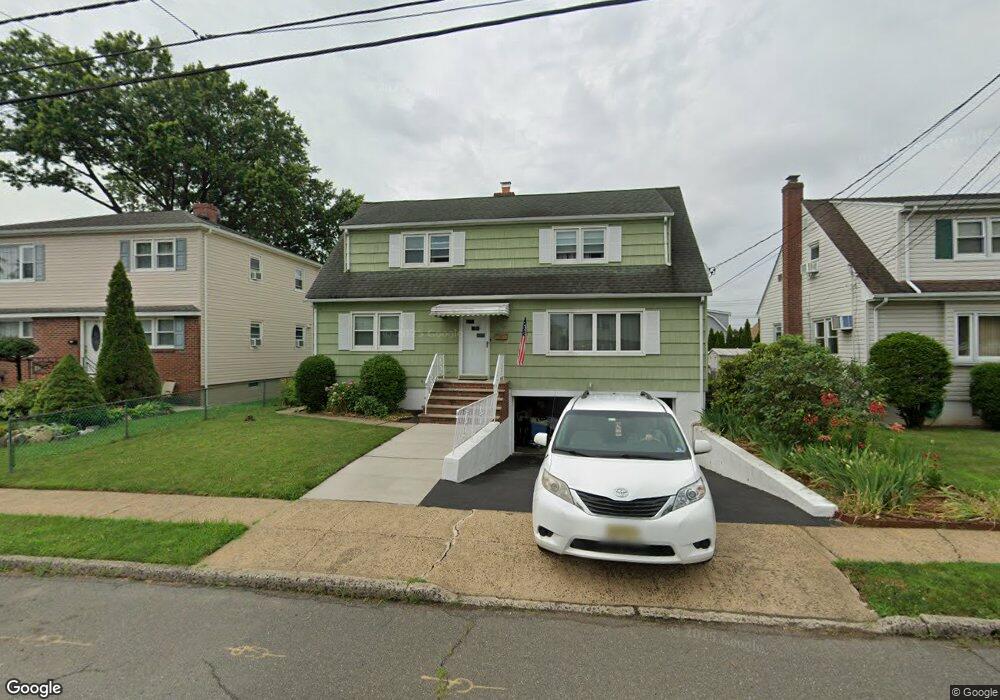
26 Barbara St Bloomfield, NJ 07003
Estimated Value: $570,614 - $783,000
Studio
--
Bath
1,680
Sq Ft
$431/Sq Ft
Est. Value
About This Home
This home is located at 26 Barbara St, Bloomfield, NJ 07003 and is currently estimated at $723,904, approximately $430 per square foot. 26 Barbara St is a home located in Essex County with nearby schools including Demarest School, Bloomfield Middle School, and Bloomfield High School.
Ownership History
Date
Name
Owned For
Owner Type
Purchase Details
Closed on
Oct 27, 2006
Sold by
Kilkeary Daria
Bought by
Mehring James and Goldsworthy Lyn
Current Estimated Value
Home Financials for this Owner
Home Financials are based on the most recent Mortgage that was taken out on this home.
Original Mortgage
$393,600
Outstanding Balance
$234,776
Interest Rate
6.36%
Mortgage Type
New Conventional
Estimated Equity
$489,128
Purchase Details
Closed on
Dec 20, 1996
Sold by
Torre Paula
Bought by
Kilkeary Michael and Kilkeary Daria
Home Financials for this Owner
Home Financials are based on the most recent Mortgage that was taken out on this home.
Original Mortgage
$140,000
Interest Rate
7.46%
Create a Home Valuation Report for This Property
The Home Valuation Report is an in-depth analysis detailing your home's value as well as a comparison with similar homes in the area
Home Values in the Area
Average Home Value in this Area
Purchase History
We collect this data history from publicly available records. To have your information removed, we recommend requesting removal directly through your county’s website.
| Date | Buyer | Sale Price | Title Company |
|---|---|---|---|
| Mehring James | $492,000 | -- | |
| Kilkeary Michael | $165,000 | -- |
Source: Public Records
Mortgage History
We collect this data history from publicly available records. To have your information removed, we recommend requesting removal directly through your county’s website.
| Date | Status | Borrower | Loan Amount |
|---|---|---|---|
| Open | Mehring James | $393,600 | |
| Previous Owner | Kilkeary Michael | $140,000 |
Source: Public Records
Tax History
| Year | Tax Paid | Tax Assessment Tax Assessment Total Assessment is a certain percentage of the fair market value that is determined by local assessors to be the total taxable value of land and additions on the property. | Land | Improvement |
|---|---|---|---|---|
| 2025 | $12,187 | $369,500 | $173,800 | $195,700 |
| 2024 | $11,742 | $359,300 | $173,800 | $195,700 |
| 2022 | $11,505 | $359,300 | $0 | $0 |
| 2021 | $11,293 | $359,300 | $0 | $0 |
| 2020 | $11,120 | $359,300 | $0 | $0 |
| 2019 | $12,417 | $311,900 | $157,000 | $154,900 |
| 2018 | $12,364 | $311,900 | $157,000 | $154,900 |
| 2017 | $12,177 | $311,900 | $157,000 | $154,900 |
| 2016 | $12,039 | $311,900 | $157,000 | $154,900 |
| 2015 | $11,930 | $311,900 | $157,000 | $154,900 |
| 2014 | $11,712 | $311,900 | $157,000 | $154,900 |
Source: Public Records
Map
Nearby Homes
- 106 Broughton Ave
- 43 Fritz St
- 26 Briar Ln
- 263 Hoover Ave
- 154 Milton Ave
- 129 Pake St
- 55 Greenbrook Dr Unit 7C
- 52 Greenbrook Dr
- 330 Hoover Ave
- 138 Spatz Ave
- 126 Ridge Ave
- 367 Hoover Ave
- 322 Broughton Ave
- 380 Hoover Ave Unit 156
- 398 Hoover Ave Unit 185
- 734 Broad St
- 106 Summit Ave
- 935 Broad St Unit 35B
- 81 Hastings Ave
- 78 Hastings Ave
Your Personal Tour Guide
Ask me questions while you tour the home.