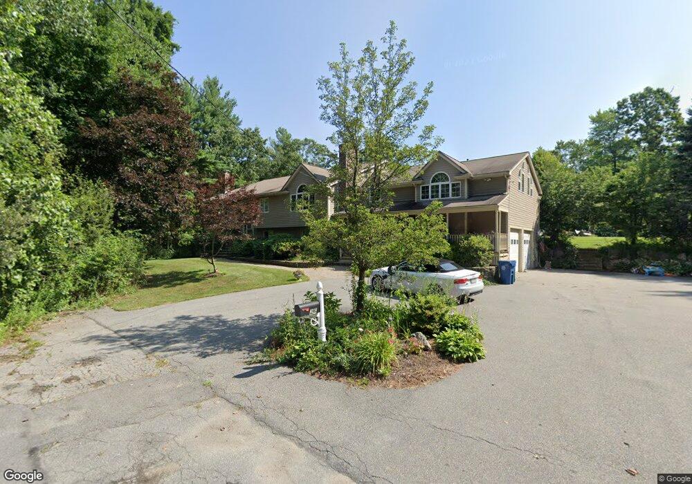
26 Bruning Rd Billerica, MA 01821
Estimated Value: $1,064,000 - $1,340,000
4
Beds
4
Baths
5,414
Sq Ft
$226/Sq Ft
Est. Value
About This Home
This home is located at 26 Bruning Rd, Billerica, MA 01821 and is currently estimated at $1,221,376, approximately $225 per square foot. 26 Bruning Rd is a home located in Middlesex County with nearby schools including Billerica Memorial High School.
Ownership History
Date
Name
Owned For
Owner Type
Purchase Details
Closed on
Mar 4, 1991
Sold by
Sixth Rt
Bought by
Tenaglia Frank J and Tenaglia Gina F
Current Estimated Value
Home Financials for this Owner
Home Financials are based on the most recent Mortgage that was taken out on this home.
Original Mortgage
$159,850
Interest Rate
9.69%
Mortgage Type
Purchase Money Mortgage
Create a Home Valuation Report for This Property
The Home Valuation Report is an in-depth analysis detailing your home's value as well as a comparison with similar homes in the area
Purchase History
| Date | Buyer | Sale Price | Title Company |
|---|---|---|---|
| Tenaglia Frank J | $174,000 | -- |
Source: Public Records
Mortgage History
| Date | Status | Borrower | Loan Amount |
|---|---|---|---|
| Open | Tenaglia Frank J | $330,000 | |
| Closed | Tenaglia Frank J | $180,000 | |
| Closed | Tenaglia Frank J | $155,500 | |
| Closed | Tenaglia Frank J | $159,850 |
Source: Public Records
Tax History
| Year | Tax Paid | Tax Assessment Tax Assessment Total Assessment is a certain percentage of the fair market value that is determined by local assessors to be the total taxable value of land and additions on the property. | Land | Improvement |
|---|---|---|---|---|
| 2025 | $12,609 | $1,109,000 | $341,600 | $767,400 |
| 2024 | $11,182 | $990,400 | $334,800 | $655,600 |
| 2023 | $10,938 | $921,500 | $292,200 | $629,300 |
| 2022 | $10,111 | $799,900 | $254,000 | $545,900 |
| 2021 | $11,620 | $752,700 | $224,300 | $528,400 |
| 2020 | $9,657 | $743,400 | $215,000 | $528,400 |
| 2019 | $9,181 | $681,100 | $215,000 | $466,100 |
| 2018 | $8,894 | $626,800 | $190,900 | $435,900 |
| 2017 | $8,205 | $582,300 | $184,900 | $397,400 |
| 2016 | $8,177 | $578,300 | $180,900 | $397,400 |
| 2015 | $8,119 | $578,300 | $180,900 | $397,400 |
| 2014 | $8,192 | $573,300 | $173,200 | $400,100 |
Source: Public Records
Map
Nearby Homes
- 0 Bruning Rd
- 0 Sullivan Rd L:3
- 20 3rd Ave
- 25 Bruning Rd
- 16 Dorchester St
- 16 Edgeworth St
- 18 Dorchester St
- 34 4th Ave
- 14 Dorchester St
- 15 Bruning Rd
- 20 Dorchester St
- 12 Dorchester St
- 14 Vincent St
- 17 Dorchester St
- 15 Dorchester St
- 10 Vincent St
- 11 Dorchester St
- 22 Dorchester St
- 10R Dorchester St
- 19 Dorchester St
Your Personal Tour Guide
Ask me questions while you tour the home.