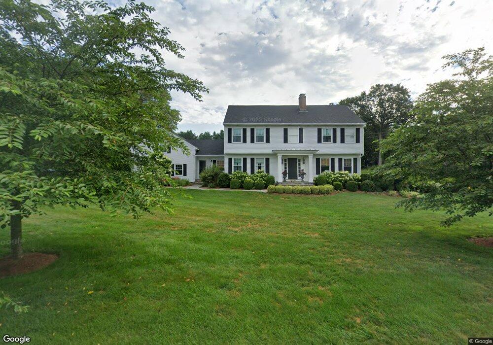
26 Cornfield Rd Trumbull, CT 06611
Trumbull Center NeighborhoodEstimated Value: $968,000 - $1,201,000
About This Home
This home is located at 26 Cornfield Rd, Trumbull, CT 06611 and is currently estimated at $1,054,794, approximately $293 per square foot. 26 Cornfield Rd is a home located in Fairfield County with nearby schools including Booth Hill School, Hillcrest Middle School, and Trumbull High School.
Ownership History
We collect this data history from publicly available records. To have your information removed, we recommend requesting removal directly through your county’s website.
Purchase Details
Purchase Details
Home Financials for this Owner
Home Financials are based on the most recent Mortgage that was taken out on this home.Purchase Details
Purchase Details
Home Values in the Area
Average Home Value in this Area
Purchase History
We collect this data history from publicly available records. To have your information removed, we recommend requesting removal directly through your county’s website.
| Date | Buyer | Sale Price | Title Company |
|---|---|---|---|
| $20,000 | None Available | ||
| $20,000 | None Available | ||
| $680,000 | -- | ||
| $451,000 | -- | ||
| $680,000 | -- | ||
| $451,000 | -- | ||
| $412,500 | -- |
Mortgage History
We collect this data history from publicly available records. To have your information removed, we recommend requesting removal directly through your county’s website.
| Date | Status | Borrower | Loan Amount |
|---|---|---|---|
| Previous Owner | $544,000 |
Tax History
We collect this data history from publicly available records. To have your information removed, we recommend requesting removal directly through your county’s website.
| Year | Tax Paid | Tax Assessment Tax Assessment Total Assessment is a certain percentage of the fair market value that is determined by local assessors to be the total taxable value of land and additions on the property. | Land | Improvement |
|---|---|---|---|---|
| 2025 | $17,032 | $460,810 | $170,380 | $290,430 |
| 2024 | $16,542 | $460,810 | $170,380 | $290,430 |
| 2023 | $16,290 | $460,810 | $170,380 | $290,430 |
| 2022 | $15,910 | $457,100 | $170,870 | $286,230 |
| 2021 | $15,338 | $426,580 | $174,720 | $251,860 |
| 2020 | $15,338 | $426,580 | $174,720 | $251,860 |
| 2018 | $15,003 | $426,580 | $174,720 | $251,860 |
| 2017 | $14,717 | $426,580 | $174,720 | $251,860 |
| 2016 | $14,441 | $426,580 | $174,720 | $251,860 |
| 2015 | $14,326 | $425,100 | $174,700 | $250,400 |
| 2014 | $14,020 | $425,100 | $174,700 | $250,400 |
Map
- 34 Robinwood Rd
- 315 Booth Hill Rd
- 52 Mischa Hill Rd
- 153 North St
- 5 W Mischa Rd
- Lot #4 W Mischa Rd
- 33 Jerusalem Hill
- 36 North St
- 91 Jerusalem Hill
- 421 Shelton Rd
- 50 Turkey Meadow Rd
- 12 Unity Dr
- 68 Old Dike Rd
- 22 Round Ridge Trail
- 22 Larkspur Dr
- 0 Pinewood Trail
- 35 Cherry Gate Ln
- 16 Hawley Glen
- 9 Round Hill Rd
- 20 Oakridge Rd
- 24 Cornfield Rd
- 50 Old Dairy Rd
- 38 Old Dairy Rd
- 47 Old Dairy Rd
- 51 Old Dairy Rd
- 20 Cornfield Rd
- 43 Old Dairy Rd
- 56 Old Dairy Rd
- 37 Old Dairy Rd
- 17 Cornfield Rd
- 1925 Huntington Turnpike
- 30 Old Dairy Rd
- 1923 Huntington Turnpike
- 1943 Huntington Turnpike
- 10 Cornfield Rd
- 1919 Huntington Turnpike
- 11 Cornfield Rd
- 32 Cornfield Rd
- 1961 Huntington Turnpike
- 31 Old Dairy Rd
Ask me questions while you tour the home.