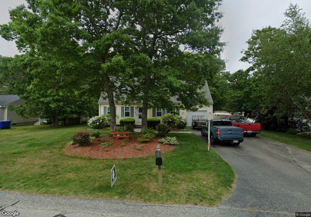
26 High Ridge Dr Bourne, MA 2532
Estimated Value: $598,000 - $650,000
3
Beds
2
Baths
1,422
Sq Ft
$436/Sq Ft
Est. Value
About This Home
This home is located at 26 High Ridge Dr, Bourne, MA 2532 and is currently estimated at $620,601, approximately $436 per square foot. 26 High Ridge Dr is a home located in Barnstable County with nearby schools including Bourne High School and St Margaret Regional School.
Ownership History
Date
Name
Owned For
Owner Type
Purchase Details
Closed on
Sep 7, 1999
Sold by
Nightingale Ltd Div
Bought by
Boyle James K
Current Estimated Value
Create a Home Valuation Report for This Property
The Home Valuation Report is an in-depth analysis detailing your home's value as well as a comparison with similar homes in the area
Purchase History
We collect this data history from publicly available records. To have your information removed, we recommend requesting removal directly through your county’s website.
| Date | Buyer | Sale Price | Title Company |
|---|---|---|---|
| Boyle James K | $175,700 | -- | |
| Nightingale Ltd Div | $40,000 | -- | |
| Nightingale Ltd Div | $40,000 | -- |
Source: Public Records
Mortgage History
We collect this data history from publicly available records. To have your information removed, we recommend requesting removal directly through your county’s website.
| Date | Status | Borrower | Loan Amount |
|---|---|---|---|
| Open | Nightingale Ltd Div | $60,000 | |
| Open | Nightingale Ltd Div | $170,000 | |
| Closed | Nightingale Ltd Div | $18,500 |
Source: Public Records
Tax History
| Year | Tax Paid | Tax Assessment Tax Assessment Total Assessment is a certain percentage of the fair market value that is determined by local assessors to be the total taxable value of land and additions on the property. | Land | Improvement |
|---|---|---|---|---|
| 2025 | $4,397 | $563,000 | $214,200 | $348,800 |
| 2024 | $4,300 | $536,200 | $204,000 | $332,200 |
| 2023 | $4,359 | $494,800 | $197,000 | $297,800 |
| 2022 | $4,025 | $398,900 | $174,300 | $224,600 |
| 2021 | $3,938 | $365,600 | $158,600 | $207,000 |
| 2020 | $3,703 | $344,800 | $157,100 | $187,700 |
| 2019 | $3,535 | $336,300 | $157,100 | $179,200 |
| 2018 | $3,399 | $322,500 | $149,700 | $172,800 |
| 2017 | $3,225 | $313,100 | $142,100 | $171,000 |
| 2016 | $3,011 | $296,400 | $129,700 | $166,700 |
| 2015 | $2,922 | $290,200 | $123,500 | $166,700 |
Source: Public Records
Map
Nearby Homes
- 20 Settlers Way
- 40 Mirasol Dr
- 33 Head of The Bay Rd
- 51 Ships View Terrace
- 24 Ships View Terrace
- 29 Weather Deck Rd
- 9 Fabyan Way
- 6 Honora Ln
- 5 Honora Ln Unit 5
- 5 Honora Ln
- 3 Honora Ln Unit 3
- 38 Old Bridge Rd
- 32 Everett Rd
- 100 Bournedale Rd
- 9 Blueberry Rd
- 92 Sandwich Rd Unit 4-D
- 65 Lewis Point Rd
- 84 Cotuit Rd
- 10 Harrison Ave Unit 2
- 10 Harrison Ave Unit 3
- 28 High Ridge Dr
- 26 High Ridge Dr
- 24 High Ridge Dr
- 9 Cuttersound Dr
- 24 High Ridge Dr
- 2 Cutters Sound Dr
- 3 Cutters Sound Dr
- 3 Cutters Sound Dr
- 2 Cutters Sound Dr
- 22 High Ridge Dr
- 30 High Ridge Dr
- 5 Cutters Sound Dr
- 29 High Ridge Dr
- 5 Cutters Sound Dr
- 29 High Ridge Dr
- 32 High Ridge Dr
- 20 High Ridge Dr
- 7 Cutters Sound Dr
- 7 Cutters Sound Dr
- 31 High Ridge Dr
Your Personal Tour Guide
Ask me questions while you tour the home.