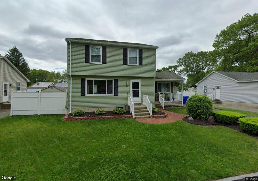
26 Pascal Dr Springfield, MA 01119
Pine Point NeighborhoodEstimated Value: $329,664 - $366,000
3
Beds
2
Baths
1,372
Sq Ft
$251/Sq Ft
Est. Value
About This Home
This home is located at 26 Pascal Dr, Springfield, MA 01119 and is currently estimated at $344,416, approximately $251 per square foot. 26 Pascal Dr is a home located in Hampden County with nearby schools including Thomas M Balliet Elementary School, John J Duggan Middle, and Springfield Central High School.
Ownership History
Date
Name
Owned For
Owner Type
Purchase Details
Closed on
Jun 5, 2002
Sold by
Brodeur John Bryan
Bought by
Hicks Roland M and Hicks Meraritalia R
Current Estimated Value
Home Financials for this Owner
Home Financials are based on the most recent Mortgage that was taken out on this home.
Original Mortgage
$115,000
Outstanding Balance
$48,934
Interest Rate
6.9%
Mortgage Type
Purchase Money Mortgage
Estimated Equity
$295,482
Create a Home Valuation Report for This Property
The Home Valuation Report is an in-depth analysis detailing your home's value as well as a comparison with similar homes in the area
Home Values in the Area
Average Home Value in this Area
Purchase History
| Date | Buyer | Sale Price | Title Company |
|---|---|---|---|
| Hicks Roland M | $115,000 | -- |
Source: Public Records
Mortgage History
| Date | Status | Borrower | Loan Amount |
|---|---|---|---|
| Open | Hicks Roland M | $115,000 | |
| Previous Owner | Hicks Roland M | $14,743 |
Source: Public Records
Tax History
| Year | Tax Paid | Tax Assessment Tax Assessment Total Assessment is a certain percentage of the fair market value that is determined by local assessors to be the total taxable value of land and additions on the property. | Land | Improvement |
|---|---|---|---|---|
| 2025 | $4,916 | $313,500 | $38,600 | $274,900 |
| 2024 | $4,702 | $292,800 | $38,600 | $254,200 |
| 2023 | $4,943 | $289,900 | $34,200 | $255,700 |
| 2022 | $5,019 | $266,700 | $32,000 | $234,700 |
| 2021 | $4,171 | $220,700 | $29,100 | $191,600 |
| 2020 | $3,984 | $204,000 | $29,100 | $174,900 |
| 2019 | $3,899 | $198,100 | $30,100 | $168,000 |
| 2018 | $3,948 | $200,600 | $30,100 | $170,500 |
| 2017 | $3,743 | $190,400 | $33,100 | $157,300 |
| 2016 | $3,374 | $171,600 | $33,100 | $138,500 |
| 2015 | $3,407 | $173,200 | $33,100 | $140,100 |
Source: Public Records
Map
Nearby Homes
Your Personal Tour Guide
Ask me questions while you tour the home.