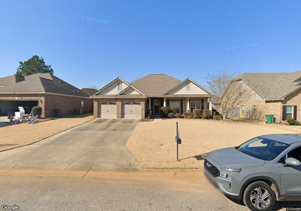
26 William Cir Elmore, AL 36025
Estimated Value: $259,000 - $318,000
4
Beds
2
Baths
1,780
Sq Ft
$156/Sq Ft
Est. Value
About This Home
This home is located at 26 William Cir, Elmore, AL 36025 and is currently estimated at $277,000, approximately $155 per square foot. 26 William Cir is a home located in Elmore County with nearby schools including Coosada Elementary School, Airport Road Intermediate School, and Millbrook Middle Junior High School.
Ownership History
Date
Name
Owned For
Owner Type
Purchase Details
Closed on
Jun 14, 2024
Sold by
Crowley James Patrick and Delora Moore
Bought by
Watts Christina C and Splunge Jermichael L
Current Estimated Value
Home Financials for this Owner
Home Financials are based on the most recent Mortgage that was taken out on this home.
Original Mortgage
$9,100
Interest Rate
7.22%
Mortgage Type
New Conventional
Purchase Details
Closed on
Mar 8, 2011
Sold by
River Rock Properties Of Alabama Llc
Bought by
Crowley James Patrick
Create a Home Valuation Report for This Property
The Home Valuation Report is an in-depth analysis detailing your home's value as well as a comparison with similar homes in the area
Home Values in the Area
Average Home Value in this Area
Purchase History
| Date | Buyer | Sale Price | Title Company |
|---|---|---|---|
| Watts Christina C | $260,000 | None Listed On Document | |
| Crowley James Patrick | -- | -- |
Source: Public Records
Mortgage History
| Date | Status | Borrower | Loan Amount |
|---|---|---|---|
| Closed | Watts Christina C | $9,100 | |
| Open | Watts Christina C | $255,290 |
Source: Public Records
Tax History
| Year | Tax Paid | Tax Assessment Tax Assessment Total Assessment is a certain percentage of the fair market value that is determined by local assessors to be the total taxable value of land and additions on the property. | Land | Improvement |
|---|---|---|---|---|
| 2025 | $774 | $25,580 | $0 | $0 |
| 2024 | $774 | $24,140 | $0 | $0 |
| 2023 | $731 | $244,000 | $20,000 | $224,000 |
| 2022 | $617 | $22,000 | $2,000 | $20,000 |
| 2021 | $544 | $19,550 | $2,000 | $17,550 |
| 2020 | $524 | $18,900 | $2,000 | $16,900 |
| 2019 | $530 | $20,290 | $3,200 | $17,090 |
| 2018 | $508 | $18,350 | $3,200 | $15,150 |
| 2017 | $517 | $18,660 | $3,202 | $15,458 |
| 2016 | $558 | $18,350 | $3,200 | $15,150 |
| 2014 | $563 | $185,300 | $32,000 | $153,300 |
Source: Public Records
Map
Nearby Homes
- 115 Pine Meadows Cir
- 86 Sterling Dr
- 173 Brittany Dr S
- 4820 Alabama 14
- 6735 Pineleaf Dr
- 186 Lake Bend Cove
- 143 Lake Bend Dr
- 124 Sevarg Ln
- 4980 Longview Rd
- 125 Brownstone Loop
- 145 Brownstone Loop
- 225 Brownstone Loop
- 239 Brownstone Loop
- 245 Brownstone Loop
- 246 Brownstone Loop
- 6835 Sanders Dr
- 274 Brownstone Loop
- 280 Brownstone Loop
- 310 Brownstone Loop
- 430 Catalpa Rd
- 14 William Cir
- 40 William Cir
- 230 Silver Pointe Dr
- 0-Lot 47 William Cir
- 213 Pine Meadow Cir
- 56 William Cir
- 21 William Cir
- 37 William Cir
- 215 Pine Meadows Cir
- 47 William Cir
- 225 Pine Meadows Cir
- 57 William Cir
- 212 Silver Pointe Dr
- 229 Pine Meadows Cir
- 203 Pine Meadows Cir
- 199/203 Pine Meadow
- 70 William Cir
- 265 Silver Pointe Dr
- 241 Silver Pointe Dr
- 65 William Cir
Your Personal Tour Guide
Ask me questions while you tour the home.