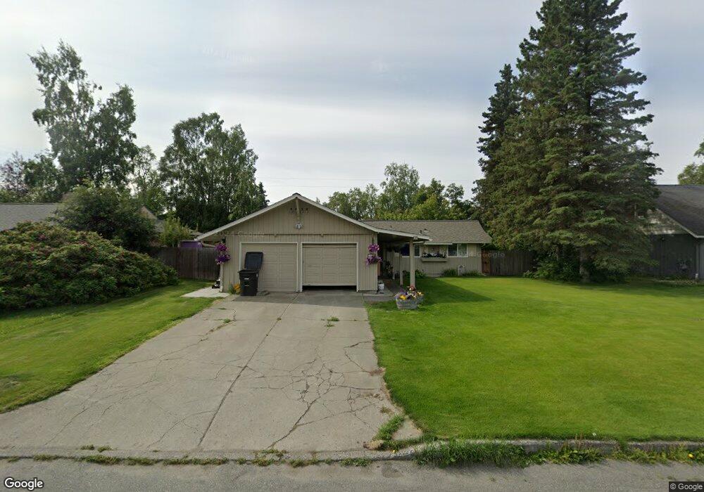
2600 Captain Cook Dr Anchorage, AK 99517
Turnagain NeighborhoodEstimated Value: $291,000 - $652,000
5
Beds
2
Baths
2,640
Sq Ft
$195/Sq Ft
Est. Value
About This Home
This home is located at 2600 Captain Cook Dr, Anchorage, AK 99517 and is currently estimated at $515,845, approximately $195 per square foot. 2600 Captain Cook Dr is a home located in Anchorage Municipality with nearby schools including Turnagain Elementary School, Romig Middle School, and West High School.
Ownership History
Date
Name
Owned For
Owner Type
Purchase Details
Closed on
Jul 19, 2001
Sold by
Ruatto Martin D and Henderson Pamela J
Bought by
Kocurek Eric M and Kocurek Jennifer L
Current Estimated Value
Home Financials for this Owner
Home Financials are based on the most recent Mortgage that was taken out on this home.
Original Mortgage
$261,250
Interest Rate
7.05%
Purchase Details
Closed on
Apr 28, 1989
Sold by
Empire/America Fsb
Bought by
Ruatto Martin D and Henderson Pamela J
Home Financials for this Owner
Home Financials are based on the most recent Mortgage that was taken out on this home.
Original Mortgage
$115,289
Interest Rate
11.11%
Mortgage Type
FHA
Create a Home Valuation Report for This Property
The Home Valuation Report is an in-depth analysis detailing your home's value as well as a comparison with similar homes in the area
Home Values in the Area
Average Home Value in this Area
Purchase History
| Date | Buyer | Sale Price | Title Company |
|---|---|---|---|
| Kocurek Eric M | -- | -- | |
| Ruatto Martin D | -- | -- |
Source: Public Records
Mortgage History
| Date | Status | Borrower | Loan Amount |
|---|---|---|---|
| Previous Owner | Kocurek Eric M | $261,250 | |
| Previous Owner | Ruatto Martin D | $115,289 |
Source: Public Records
Tax History
| Year | Tax Paid | Tax Assessment Tax Assessment Total Assessment is a certain percentage of the fair market value that is determined by local assessors to be the total taxable value of land and additions on the property. | Land | Improvement |
|---|---|---|---|---|
| 2025 | $6,503 | $503,700 | $203,400 | $300,300 |
| 2024 | $6,503 | $477,800 | $190,400 | $287,400 |
| 2023 | $7,599 | $446,200 | $190,400 | $255,800 |
| 2022 | $6,669 | $446,000 | $190,400 | $255,600 |
| 2021 | $7,192 | $399,100 | $190,400 | $208,700 |
| 2020 | $6,008 | $403,700 | $190,400 | $213,300 |
| 2019 | $5,633 | $394,300 | $190,400 | $203,900 |
| 2018 | $5,620 | $392,700 | $190,400 | $202,300 |
| 2017 | $6,117 | $410,600 | $190,400 | $220,200 |
| 2016 | $5,639 | $417,900 | $180,000 | $237,900 |
| 2015 | $5,639 | $417,900 | $180,000 | $237,900 |
| 2014 | $5,639 | $383,900 | $180,000 | $203,900 |
Source: Public Records
Map
Nearby Homes
- 2540 Lord Baranof Dr
- 2350 Captain Cook Dr
- 2335 Lord Baranof Dr
- 2921 W 29th Ave Unit 5B
- 2500 Foraker Dr
- 2543 La Honda Dr Unit 7
- 2606 W 30th Ave
- 2610 W 30th Ave
- 2607 W 31st Ave
- 2934 Marston Dr
- Tr A W Northern Lights Blvd
- 2204 W Northern Lights Blvd
- 2101 W 29th Ave Unit 22
- 3504 Vintage Cir
- 3640 Challenger Cir
- 3517 Vintage Cir
- 3105 Willow St
- 2431 Wellington Ct
- 3035 Telequana Dr
- 2996 Lois Dr Unit 7
- 2528 Captain Cook Dr
- 2614 Captain Cook Dr
- 2601 Brooke Dr
- 2543 Brooke Dr
- 2615 Brooke Dr
- 2514 Captain Cook Dr
- 2601 Captain Cook Dr
- 2533 Brooke Dr
- 2845 Knik Ave
- 2527 Captain Cook Dr
- 2613 Captain Cook Dr
- 2859 Knik Ave
- 2871 Knik Ave
- 2523 Brooke Dr
- 2515 Captain Cook Dr
- 2829 Knik Ave
- 2502 Captain Cook Dr
- 13511 Discovery View Dr Unit 204A
- 2600 Lord Baranof Dr
- 2600 Brooke Dr
Your Personal Tour Guide
Ask me questions while you tour the home.