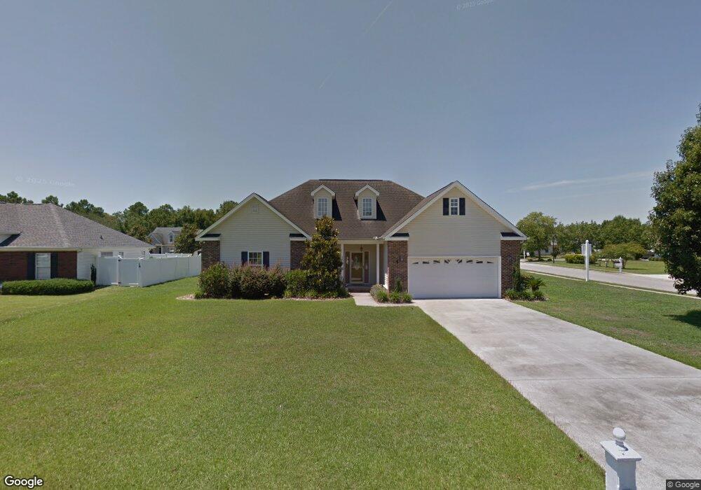
2600 Corn Pile Rd Myrtle Beach, SC 29588
Forestbrook AreaEstimated Value: $326,000 - $373,000
About This Home
This home is located at 2600 Corn Pile Rd, Myrtle Beach, SC 29588 and is currently estimated at $349,974, approximately $169 per square foot. 2600 Corn Pile Rd is a home located in Horry County with nearby schools including Forestbrook Elementary School, Forestbrook Middle School, and Socastee High School.
Ownership History
We collect this data history from publicly available records. To have your information removed, we recommend requesting removal directly through your county’s website.
Purchase Details
Home Financials for this Owner
Home Financials are based on the most recent Mortgage that was taken out on this home.Home Values in the Area
Average Home Value in this Area
Purchase History
We collect this data history from publicly available records. To have your information removed, we recommend requesting removal directly through your county’s website.
| Date | Buyer | Sale Price | Title Company |
|---|---|---|---|
| $28,900 | -- |
Mortgage History
We collect this data history from publicly available records. To have your information removed, we recommend requesting removal directly through your county’s website.
| Date | Status | Borrower | Loan Amount |
|---|---|---|---|
| Open | $161,000 | ||
| Closed | $159,075 | ||
| Closed | $26,912 |
Tax History
We collect this data history from publicly available records. To have your information removed, we recommend requesting removal directly through your county’s website.
| Year | Tax Paid | Tax Assessment Tax Assessment Total Assessment is a certain percentage of the fair market value that is determined by local assessors to be the total taxable value of land and additions on the property. | Land | Improvement |
|---|---|---|---|---|
| 2025 | $931 | $0 | $0 | $0 |
| 2024 | $931 | $13,319 | $4,055 | $9,264 |
| 2023 | $931 | $7,967 | $1,146 | $6,821 |
| 2021 | $843 | $8,116 | $1,292 | $6,824 |
| 2020 | $738 | $8,116 | $1,292 | $6,824 |
| 2019 | $738 | $8,116 | $1,292 | $6,824 |
| 2018 | $665 | $6,928 | $976 | $5,952 |
| 2017 | $650 | $6,928 | $976 | $5,952 |
| 2016 | -- | $6,928 | $976 | $5,952 |
| 2015 | $650 | $6,928 | $976 | $5,952 |
| 2014 | $600 | $6,928 | $976 | $5,952 |
Map
- 2601 Corn Pile Rd
- 2645 Corn Pile Rd
- Lot 133 Squealer Lake Covey
- 2560 Wild Game Trail Unit Hunters Ridge
- 2611 Ringneck Trail
- 2618 Ringneck Trail
- 281 La Patos Dr
- 264 La Patos Dr
- 425 Dog Pen Ct
- 3955 Camden Dr
- 4154 Steeple Chase Dr
- 2423 Hunters Trail
- 117 Black Bear Rd
- 629 Cottontail Trail Unit Hunters Ridge Crossi
- 776 Harrison Mill St
- 780 Harrison Mill St
- 317 Forestbrook Cove Cir
- 787 Laconic Dr Unit Starling- Lot 416
- 6232 Zoe Way
- 6144 Zoe Way Unit 831
- 2605 Corn Pile Rd
- 2607 Corn Pile Rd
- 2601 Corn Pile Rd
- 2609 Corn Pile Rd
- 2731 Canvasback Trail
- 2602 Corn Pile Rd
- 2604 Corn Pile Rd
- 2611 Corn Pile Rd
- 2610 Corn Pile Rd
- 2727 Canvasback Trail
- 2612 Corn Pile Rd
- 2612 Corn Pile Rd
- 2613 Corn Pile Rd
- 2734 Canvasback Trail
- 2732 Canvasback Trail
- 2730 Canvasback Trail
- 2736 Canvasback Trail
- 2725 Canvasback Trail
- 2614 Corn Pile Rd
- 2728 Canvasback Trail
Ask me questions while you tour the home.