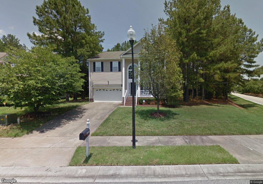
2600 Gross Ave Wake Forest, NC 27587
Estimated Value: $512,000 - $526,000
4
Beds
3
Baths
3,358
Sq Ft
$155/Sq Ft
Est. Value
About This Home
This home is located at 2600 Gross Ave, Wake Forest, NC 27587 and is currently estimated at $521,281, approximately $155 per square foot. 2600 Gross Ave is a home located in Wake County with nearby schools including Sanford Creek Elementary School, Wake Forest-Rolesville Middle School, and Wake Forest High School.
Ownership History
Date
Name
Owned For
Owner Type
Purchase Details
Closed on
Aug 6, 2008
Sold by
Primacy Closing Corp
Bought by
Mckinney Delois
Current Estimated Value
Home Financials for this Owner
Home Financials are based on the most recent Mortgage that was taken out on this home.
Original Mortgage
$220,000
Outstanding Balance
$144,250
Interest Rate
6.31%
Mortgage Type
VA
Estimated Equity
$377,031
Purchase Details
Closed on
Mar 26, 2008
Sold by
Smith Michael R and Smith Renee
Bought by
Primacy Closing Corp
Purchase Details
Closed on
Aug 15, 2003
Sold by
The New Fortis Corp
Bought by
Smith Michael R and Smith Renee
Home Financials for this Owner
Home Financials are based on the most recent Mortgage that was taken out on this home.
Original Mortgage
$213,900
Interest Rate
5.42%
Mortgage Type
Purchase Money Mortgage
Purchase Details
Closed on
Sep 17, 2002
Sold by
1St American Realty Llc
Bought by
Westminster Homes Inc
Create a Home Valuation Report for This Property
The Home Valuation Report is an in-depth analysis detailing your home's value as well as a comparison with similar homes in the area
Home Values in the Area
Average Home Value in this Area
Purchase History
| Date | Buyer | Sale Price | Title Company |
|---|---|---|---|
| Mckinney Delois | $220,000 | None Available | |
| Primacy Closing Corp | $220,000 | None Available | |
| Smith Michael R | $225,500 | -- | |
| Westminster Homes Inc | $250,000 | -- |
Source: Public Records
Mortgage History
| Date | Status | Borrower | Loan Amount |
|---|---|---|---|
| Open | Mckinney Delois | $220,000 | |
| Previous Owner | Smith Michael R | $213,900 |
Source: Public Records
Tax History
| Year | Tax Paid | Tax Assessment Tax Assessment Total Assessment is a certain percentage of the fair market value that is determined by local assessors to be the total taxable value of land and additions on the property. | Land | Improvement |
|---|---|---|---|---|
| 2025 | $4,594 | $475,205 | $80,000 | $395,205 |
| 2024 | $4,577 | $475,205 | $80,000 | $395,205 |
Source: Public Records
Map
Nearby Homes
- 3100 Lariat Ridge Dr
- 8330 Bratt Ave
- 2908 Thurman Dairy Loop
- 2928 Thurman Dairy Loop
- 8516 Hampton Chase Ct
- 3065 Thurman Dairy Loop
- 3101 Greenville Loop Rd
- 3425 Coach Lantern Ave
- 3309 Donner Trail
- 3320 Buck Run Trail
- 9232 Kitchin Farms Way
- 4509 Middletown Dr
- 4444 Iyar Way
- 4438 Hillsgrove Rd
- 8401 Chelridge Dr
- 9830 Precious Stone Dr
- 9249 Kitchin Farms Way Unit 432
- 5105 Bambi Ct
- 4447 Middletown Dr
- 3229 Douglas Fir Rd
- 2604 Gross Ave
- 8508 Bratt Ave
- 8512 Bratt Ave
- 8504 Bratt Ave
- 2608 Gross Ave
- 3101 Lariat Ridge Dr
- 8500 Bratt Ave
- 8514 Bratt Ave
- 2612 Gross Ave
- 2601 Gross Ave
- 8420 Bratt Ave
- 3105 Lariat Ridge Dr
- 2605 Gross Ave
- 8800 Cochran Ct
- 8505 Bratt Ave
- 2616 Gross Ave
- 8416 Bratt Ave
- 8509 Bratt Ave
- 3104 Lariat Ridge Dr
- 3109 Lariat Ridge Dr
Your Personal Tour Guide
Ask me questions while you tour the home.