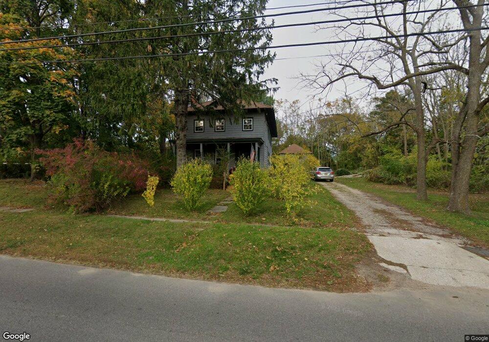
2600 Peconic Ln Peconic, NY 11958
Estimated Value: $653,000 - $778,000
4
Beds
2
Baths
2,000
Sq Ft
$365/Sq Ft
Est. Value
About This Home
This home is located at 2600 Peconic Ln, Peconic, NY 11958 and is currently estimated at $730,010, approximately $365 per square foot. 2600 Peconic Ln is a home located in Suffolk County with nearby schools including Southold Elementary School, Southold Junior/Senior High School, and Peconic Community School.
Ownership History
Date
Name
Owned For
Owner Type
Purchase Details
Closed on
Jul 15, 2016
Sold by
Beltz Phillip B
Bought by
Dubois Scott Harold
Current Estimated Value
Home Financials for this Owner
Home Financials are based on the most recent Mortgage that was taken out on this home.
Original Mortgage
$282,000
Outstanding Balance
$219,530
Interest Rate
3.41%
Mortgage Type
New Conventional
Estimated Equity
$510,480
Purchase Details
Closed on
Dec 6, 2002
Sold by
Tristate Capital Corp
Bought by
Beltz B Phillip
Home Financials for this Owner
Home Financials are based on the most recent Mortgage that was taken out on this home.
Original Mortgage
$75,000
Interest Rate
6.17%
Create a Home Valuation Report for This Property
The Home Valuation Report is an in-depth analysis detailing your home's value as well as a comparison with similar homes in the area
Home Values in the Area
Average Home Value in this Area
Purchase History
We collect this data history from publicly available records. To have your information removed, we recommend requesting removal directly through your county’s website.
| Date | Buyer | Sale Price | Title Company |
|---|---|---|---|
| Dubois Scott Harold | $305,000 | Stewart Title | |
| Beltz B Phillip | $270,000 | -- |
Source: Public Records
Mortgage History
We collect this data history from publicly available records. To have your information removed, we recommend requesting removal directly through your county’s website.
| Date | Status | Borrower | Loan Amount |
|---|---|---|---|
| Open | Dubois Scott Harold | $282,000 | |
| Previous Owner | Beltz B Phillip | $75,000 |
Source: Public Records
Tax History
| Year | Tax Paid | Tax Assessment Tax Assessment Total Assessment is a certain percentage of the fair market value that is determined by local assessors to be the total taxable value of land and additions on the property. | Land | Improvement |
|---|---|---|---|---|
| 2024 | $5,655 | $3,900 | $400 | $3,500 |
| 2023 | $5,655 | $3,900 | $400 | $3,500 |
| 2022 | $5,528 | $3,900 | $400 | $3,500 |
| 2021 | $5,348 | $3,900 | $400 | $3,500 |
| 2020 | $5,290 | $3,900 | $400 | $3,500 |
| 2019 | $5,290 | $0 | $0 | $0 |
| 2018 | $4,926 | $3,900 | $400 | $3,500 |
| 2017 | $5,094 | $3,900 | $400 | $3,500 |
| 2016 | $4,564 | $3,900 | $400 | $3,500 |
| 2015 | -- | $3,900 | $400 | $3,500 |
| 2014 | -- | $3,900 | $400 | $3,500 |
Source: Public Records
Map
Nearby Homes
- 44075 Route 25
- 36595 County Road 48
- 4760 Blue Horizon Bluffs
- 155 2nd Ave
- 210 Spring Ln
- 1545 Indian Neck Ln
- 150 Baywater Ave
- 480 Ackerly Pond Ln
- 1270 Skunk Ln
- 600 Glenn Rd
- 4170 Indian Neck Ln
- 35950 Main Rd
- 1985 Skunk Ln
- 19620 Soundview Ave
- 1480 Old Wood Path
- 1665 Glenn Rd
- 5045 Main Bayview Rd
- 800 Corey Creek Ln
- 2015 Kenneys Rd
- 5845 Bridge Ln
- 2500 Peconic Ln
- 2595 Peconic Ln
- 2745 Peconic Ln
- 2850 Peconic Ln
- 2495 Peconic Ln
- 2543 Peconic Ln
- 2980 Peconic Ln
- 1527 Carroll Ave
- 3000 Peconic Ln Unit 3000
- 3000 Peconic Ln
- 3025 Peconic Ln Unit 3025
- 3025 Peconic Ln
- 2935 Peconic Ln
- 3070 Peconic Ln
- 4760 Blue Horz Bluff Rd
- 4730 Blue Horizon Bluffs
- 1425 Carroll Ave
- 3105 Peconic Ln
- 3200 Peconic Ln
- 1825 Carroll Ave
Your Personal Tour Guide
Ask me questions while you tour the home.