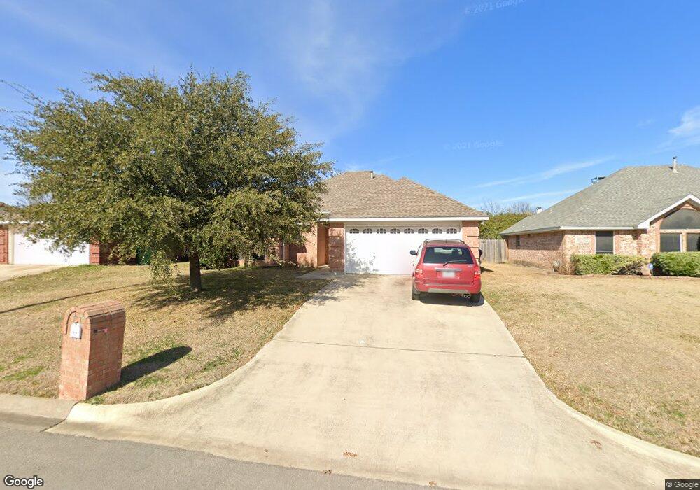
2604 John Dr Denton, TX 76207
McKamy Evers NeighborhoodEstimated Value: $284,047 - $310,000
3
Beds
2
Baths
1,259
Sq Ft
$239/Sq Ft
Est. Value
About This Home
This home is located at 2604 John Dr, Denton, TX 76207 and is currently estimated at $301,512, approximately $239 per square foot. 2604 John Dr is a home located in Denton County with nearby schools including Evers Park Elementary School, Calhoun Middle School, and Denton High School.
Ownership History
Date
Name
Owned For
Owner Type
Purchase Details
Closed on
Dec 29, 2022
Sold by
Jones David and Jones Shirley
Bought by
Green Alex
Current Estimated Value
Purchase Details
Closed on
Jul 14, 2015
Sold by
Anderson Myra A and Anderson Gregory Thomas
Bought by
Denton Rental Llc
Purchase Details
Closed on
Sep 15, 2010
Sold by
Anderson Myra Hall
Bought by
Anderson Gregory Thomas and Anderson Myra Hall
Purchase Details
Closed on
Mar 24, 1999
Sold by
Norman Mike
Bought by
Stardust Enterprises Inc
Home Financials for this Owner
Home Financials are based on the most recent Mortgage that was taken out on this home.
Original Mortgage
$94,951
Interest Rate
6.69%
Mortgage Type
FHA
Create a Home Valuation Report for This Property
The Home Valuation Report is an in-depth analysis detailing your home's value as well as a comparison with similar homes in the area
Home Values in the Area
Average Home Value in this Area
Purchase History
| Date | Buyer | Sale Price | Title Company |
|---|---|---|---|
| Green Alex | -- | -- | |
| Denton Rental Llc | -- | Title Resources | |
| Anderson Gregory Thomas | -- | None Available | |
| Stardust Enterprises Inc | -- | -- | |
| Anderson Myra A | -- | -- | |
| Stardust Enterprises Inc | -- | -- |
Source: Public Records
Mortgage History
| Date | Status | Borrower | Loan Amount |
|---|---|---|---|
| Previous Owner | Anderson Myra A | $94,951 |
Source: Public Records
Tax History
| Year | Tax Paid | Tax Assessment Tax Assessment Total Assessment is a certain percentage of the fair market value that is determined by local assessors to be the total taxable value of land and additions on the property. | Land | Improvement |
|---|---|---|---|---|
| 2025 | $4,528 | $281,889 | $72,000 | $209,889 |
| 2024 | $5,724 | $296,545 | $72,000 | $224,545 |
| 2023 | $4,340 | $290,000 | $68,258 | $221,742 |
| 2022 | $5,290 | $249,215 | $72,000 | $177,215 |
| 2021 | $4,299 | $193,366 | $43,200 | $150,166 |
| 2020 | $4,143 | $181,256 | $43,200 | $138,056 |
| 2019 | $4,247 | $178,000 | $43,200 | $134,800 |
| 2018 | $4,036 | $167,091 | $43,200 | $123,891 |
| 2017 | $3,708 | $150,000 | $43,200 | $106,800 |
| 2016 | $3,624 | $135,000 | $25,920 | $109,080 |
| 2015 | $1,980 | $118,137 | $25,920 | $92,217 |
| 2014 | $1,980 | $118,993 | $25,920 | $93,073 |
| 2013 | -- | $116,647 | $25,920 | $90,727 |
Source: Public Records
Map
Nearby Homes
- 2620 John Dr
- 2317 Overlook Ln
- 2316 Overlook Ln
- 2324 Southway
- 2225 Southway
- 2712 Claydon Dr
- 2909 Savill Garden
- 2201 Windsor Farms Dr
- 2113 Carriage Hill
- 2904 Lakewood Dr
- 2112 Windsor Farms Dr
- 2905 Lakewood Dr
- TBD N Bonnie Brae St
- 3317 Paruament Dr
- 3400 Kingsview Dr
- 3308 Kingsdown Dr
- 3060 Solana Cir
- 3217 Kingsgarden Rd
- 3321 Cricket Dr
- 3329 Cricket Dr
Your Personal Tour Guide
Ask me questions while you tour the home.