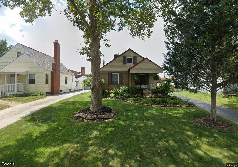
261 Demorest Rd Columbus, OH 43204
Westgate NeighborhoodEstimated Value: $210,564 - $247,000
3
Beds
2
Baths
1,035
Sq Ft
$219/Sq Ft
Est. Value
About This Home
This home is located at 261 Demorest Rd, Columbus, OH 43204 and is currently estimated at $226,891, approximately $219 per square foot. 261 Demorest Rd is a home located in Franklin County with nearby schools including Westgate Alternative Elementary School, Westmoor Middle School, and West High School.
Ownership History
Date
Name
Owned For
Owner Type
Purchase Details
Closed on
Aug 23, 2021
Sold by
Baker Thomas W and Baker Lori A
Bought by
Baker Thomas W and Baker Lori A
Current Estimated Value
Purchase Details
Closed on
Mar 17, 1989
Bought by
Baker Thomas W and Baker Lori A
Purchase Details
Closed on
Sep 1, 1983
Create a Home Valuation Report for This Property
The Home Valuation Report is an in-depth analysis detailing your home's value as well as a comparison with similar homes in the area
Home Values in the Area
Average Home Value in this Area
Purchase History
We collect this data history from publicly available records. To have your information removed, we recommend requesting removal directly through your county’s website.
| Date | Buyer | Sale Price | Title Company |
|---|---|---|---|
| Baker Thomas W | -- | Buskirk Jeffrey | |
| Baker Thomas W | $60,900 | -- | |
| -- | $46,000 | -- |
Source: Public Records
Tax History
| Year | Tax Paid | Tax Assessment Tax Assessment Total Assessment is a certain percentage of the fair market value that is determined by local assessors to be the total taxable value of land and additions on the property. | Land | Improvement |
|---|---|---|---|---|
| 2025 | $2,917 | $65,000 | $21,880 | $43,120 |
| 2024 | $2,917 | $65,000 | $21,880 | $43,120 |
| 2023 | $2,880 | $64,995 | $21,875 | $43,120 |
| 2022 | $2,202 | $42,460 | $8,230 | $34,230 |
| 2021 | $2,206 | $42,460 | $8,230 | $34,230 |
| 2020 | $2,209 | $42,460 | $8,230 | $34,230 |
| 2019 | $2,115 | $34,860 | $6,860 | $28,000 |
| 2018 | $2,010 | $34,860 | $6,860 | $28,000 |
| 2017 | $2,113 | $34,860 | $6,860 | $28,000 |
| 2016 | $2,103 | $31,750 | $7,600 | $24,150 |
| 2015 | $1,909 | $31,750 | $7,600 | $24,150 |
| 2014 | $1,914 | $31,750 | $7,600 | $24,150 |
| 2013 | $993 | $33,390 | $7,980 | $25,410 |
Source: Public Records
Map
Nearby Homes
- 174 Demorest Rd
- 139 Demorest Ave
- 268 S Southampton Ave
- 273 S Sylvan Ave
- 277 Josephine Ave
- 121 S Southampton Ave
- 182 S Sylvan Ave
- 129 S Sylvan Ave
- 66 Demorest Rd
- 136 S Sylvan Ave
- 32 S Southampton Ave
- 170 S Algonquin Ave
- 241 S Brinker Ave
- 0 S Brinker Ave
- 312 S Brinker Ave
- 3345 Parkside Rd
- 56 Broadlawn Ave
- 109 S Westgate Ave
- 3276 Sullivant Ave Unit 278
- 56 Florence Ave
- 233 Demorest Rd
- 239 Demorest Rd
- 227 Demorest Ave
- 227 Demorest Rd
- 221 Demorest Rd
- 255 Demorest Rd
- 213 Demorest Rd
- 234 Demorest Rd
- 240 Demorest Rd
- 228 Demorest Rd
- 220 Derrer Rd Unit 222
- 222 Demorest Rd
- 207 Demorest Ave
- 207 Demorest Ave
- 207 Demorest Rd
- 254 Demorest Rd
- 254 Demorest Ave
- 214 Demorest Rd
- 206-208 Derrer Rd
- 206 Derrer Rd Unit 208
Your Personal Tour Guide
Ask me questions while you tour the home.