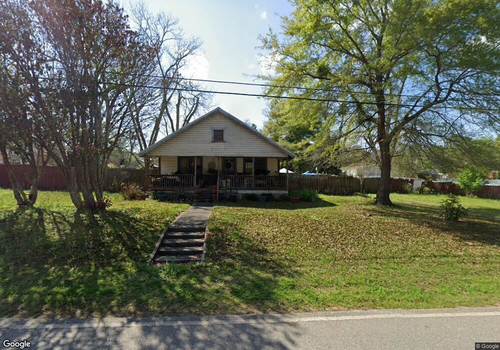
261 N McGriff St Whigham, GA 39897
Estimated Value: $82,000 - $178,000
3
Beds
1
Bath
1,436
Sq Ft
$88/Sq Ft
Est. Value
About This Home
This home is located at 261 N McGriff St, Whigham, GA 39897 and is currently estimated at $126,905, approximately $88 per square foot. 261 N McGriff St is a home.
Ownership History
We collect this data history from publicly available records. To have your information removed, we recommend requesting removal directly through your county’s website.
Date
Name
Owned For
Owner Type
Purchase Details
Closed on
Dec 23, 2003
Bought by
Current Estimated Value
Purchase Details
Closed on
Sep 6, 1991
Bought by
Create a Home Valuation Report for This Property
The Home Valuation Report is an in-depth analysis detailing your home's value as well as a comparison with similar homes in the area
Purchase History
We collect this data history from publicly available records. To have your information removed, we recommend requesting removal directly through your county’s website.
| Date | Buyer | Sale Price | Title Company |
|---|---|---|---|
| $15,000 | -- | ||
| $14,000 | -- |
Source: Public Records
Tax History
We collect this data history from publicly available records. To have your information removed, we recommend requesting removal directly through your county’s website.
| Year | Tax Paid | Tax Assessment Tax Assessment Total Assessment is a certain percentage of the fair market value that is determined by local assessors to be the total taxable value of land and additions on the property. | Land | Improvement |
|---|---|---|---|---|
| 2025 | $847 | $40,466 | $5,740 | $34,726 |
| 2024 | $847 | $36,616 | $5,740 | $30,876 |
| 2023 | $345 | $15,026 | $3,806 | $11,220 |
| 2022 | $345 | $15,026 | $3,806 | $11,220 |
| 2021 | $346 | $15,026 | $3,806 | $11,220 |
| 2020 | $491 | $15,026 | $3,806 | $11,220 |
| 2019 | $491 | $15,026 | $3,806 | $11,220 |
| 2018 | $466 | $15,026 | $3,806 | $11,220 |
| 2017 | $448 | $15,026 | $3,806 | $11,220 |
| 2016 | $393 | $13,166 | $3,806 | $9,360 |
| 2015 | $389 | $13,166 | $3,806 | $9,360 |
| 2014 | -- | $14,666 | $3,806 | $10,860 |
| 2013 | -- | $12,181 | $3,806 | $8,375 |
Source: Public Records
Map
Nearby Homes
- 206 Lodge Ln
- 302 Nottingham Dr NW
- 404 SE Ward St
- 384 Cleon Waldrop Rd
- 267 Providence Rd
- 491&501 Melton Brinson Rd
- Jowers Rd
- 274 Barrineau Rd
- 248 Due South Dr
- 219 Lady Bug Ln
- 1718 Old 179 S
- 0 Upper Hawthorne Trail
- 1520 Upper Hawthorne Trail
- 1137 Summerfield
- 1808 Upper Hawthorne Trail
- 00 W Lake Dr
- Lot 27 W Lake Dr
- 1382 Lake Front Dr
- 1385 Crine Blvd
- Lot 1 Crine Blvd
- 251 N McGriff St
- 275 N McGriff St
- 104 Harrell Ave NE
- 116 Harrell Ave NW
- 115 Laing Ave NW
- 114 NE Harrell Ave
- 132 Harrell Ave NW
- 388 Old 179 N
- 249 Cemetery St
- 301 Decatur St
- 211 N McGriff St
- 223 Cemetery St
- 144 Harrell Ave NE
- 319 N McGriff St
- 140 Laing Ave NW
- 199 N McGriff St
- 109 Christopher Ave NE
- 160 Harrell Ave NE
- 136 Christopher Ave NE
- 159 Harrell Ave NE
Your Personal Tour Guide
Ask me questions while you tour the home.