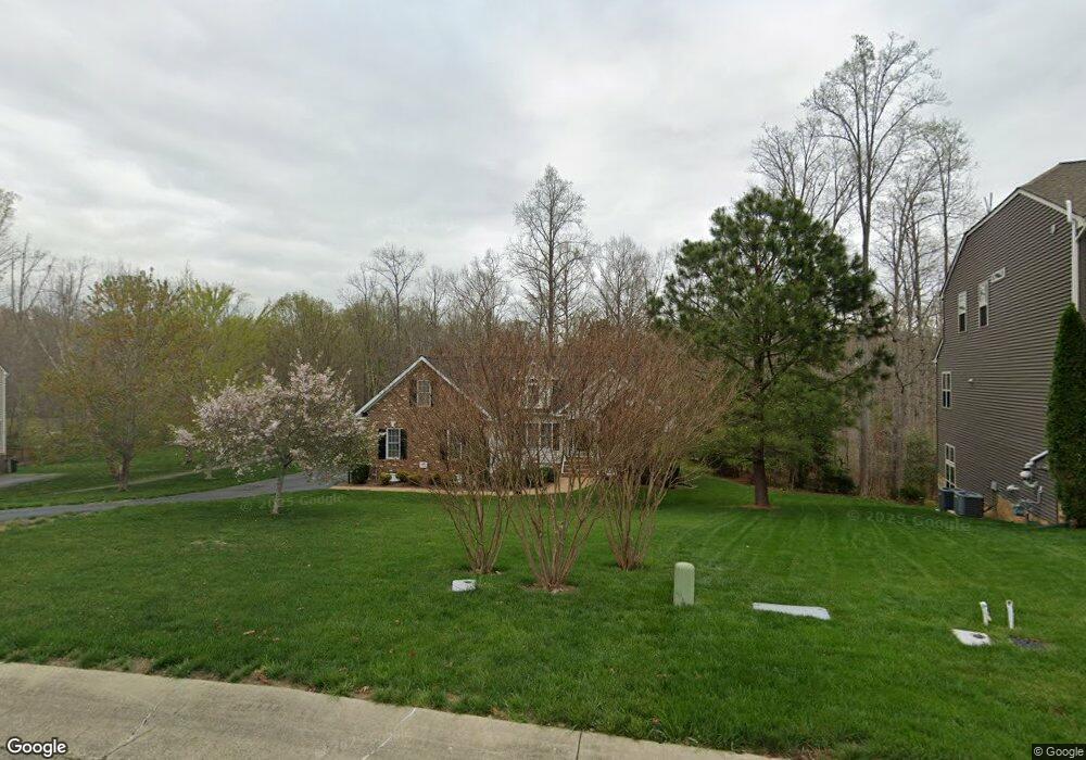
2619 Seabird Dr Midlothian, VA 23112
Estimated Value: $594,000 - $669,000
4
Beds
3
Baths
2,551
Sq Ft
$247/Sq Ft
Est. Value
About This Home
This home is located at 2619 Seabird Dr, Midlothian, VA 23112 and is currently estimated at $630,592, approximately $247 per square foot. 2619 Seabird Dr is a home located in Chesterfield County with nearby schools including Old Hundred Elementary School, Tomahawk Creek Middle School, and Midlothian High School.
Ownership History
Date
Name
Owned For
Owner Type
Purchase Details
Closed on
Apr 26, 2008
Sold by
Lifestyle Bldrs & Develop
Bought by
Cobb Glenn L
Current Estimated Value
Home Financials for this Owner
Home Financials are based on the most recent Mortgage that was taken out on this home.
Original Mortgage
$286,850
Outstanding Balance
$177,492
Interest Rate
6.22%
Mortgage Type
New Conventional
Estimated Equity
$453,100
Create a Home Valuation Report for This Property
The Home Valuation Report is an in-depth analysis detailing your home's value as well as a comparison with similar homes in the area
Home Values in the Area
Average Home Value in this Area
Purchase History
We collect this data history from publicly available records. To have your information removed, we recommend requesting removal directly through your county’s website.
| Date | Buyer | Sale Price | Title Company |
|---|---|---|---|
| Cobb Glenn L | $386,879 | -- |
Source: Public Records
Mortgage History
We collect this data history from publicly available records. To have your information removed, we recommend requesting removal directly through your county’s website.
| Date | Status | Borrower | Loan Amount |
|---|---|---|---|
| Open | Cobb Glenn L | $286,850 |
Source: Public Records
Tax History
| Year | Tax Paid | Tax Assessment Tax Assessment Total Assessment is a certain percentage of the fair market value that is determined by local assessors to be the total taxable value of land and additions on the property. | Land | Improvement |
|---|---|---|---|---|
| 2026 | $5,337 | $596,900 | $115,000 | $481,900 |
| 2025 | $5,337 | $548,000 | $106,000 | $442,000 |
| 2024 | $4,902 | $528,600 | $106,000 | $422,600 |
| 2023 | $4,540 | $498,900 | $101,000 | $397,900 |
| 2022 | $4,387 | $476,900 | $98,000 | $378,900 |
| 2021 | $3,864 | $404,100 | $96,000 | $308,100 |
| 2020 | $3,768 | $396,600 | $96,000 | $300,600 |
| 2019 | $3,663 | $385,600 | $96,000 | $289,600 |
| 2018 | $3,513 | $369,800 | $95,000 | $274,800 |
| 2017 | $3,453 | $359,700 | $95,000 | $264,700 |
| 2016 | $3,590 | $374,000 | $95,000 | $279,000 |
| 2015 | $3,575 | $369,800 | $90,000 | $279,800 |
| 2014 | $3,398 | $351,400 | $85,000 | $266,400 |
Source: Public Records
Map
Nearby Homes
- 2237 Wing Haven Place
- 3718 Wivenhall Dr
- 2524 Sailboat Place
- 14537 Sailboat Cir
- 3901 Graythorne Dr
- 2531 Water Race Terrace
- 3548 Alvecote Terrace
- 14408 Huntgate Woods Rd
- 2507 Water Race Terrace
- 3536 Alvecote Terrace
- 14310 Huntgate Woods Rd
- 14907 Distaff Rd
- 14825 Abberton Dr
- 15100 Litton Dr
- 3224 Barkham Dr
- 14316 Cove Ridge Terrace
- 3706 Enmore Place
- 2701 Spring Gate Place
- 3601 Glenworth Dr
- 15107 Heaton Dr
- 2625 Seabird Dr
- 2631 Seabird Dr
- 2624 Seabird Dr
- 2618 Seabird Dr
- 2637 Seabird Dr
- 2630 Seabird Dr
- 2613 Seabird Dr
- 2636 Seabird Dr
- 2607 Seabird Dr
- 2413 Graeme Hall Cir
- 28 Seabird Dr
- 15 Seabird Dr
- 2407 Graeme Hall Cir
- 2641 Seabird Dr
- 2419 Graeme Hall Cir
- 2401 Graeme Hall Cir
- 2601 Seabird Dr
- 9 Graeme Hall Cir
- 6A Graeme Hall Cir
- 11A Graeme Hall Cir
Your Personal Tour Guide
Ask me questions while you tour the home.