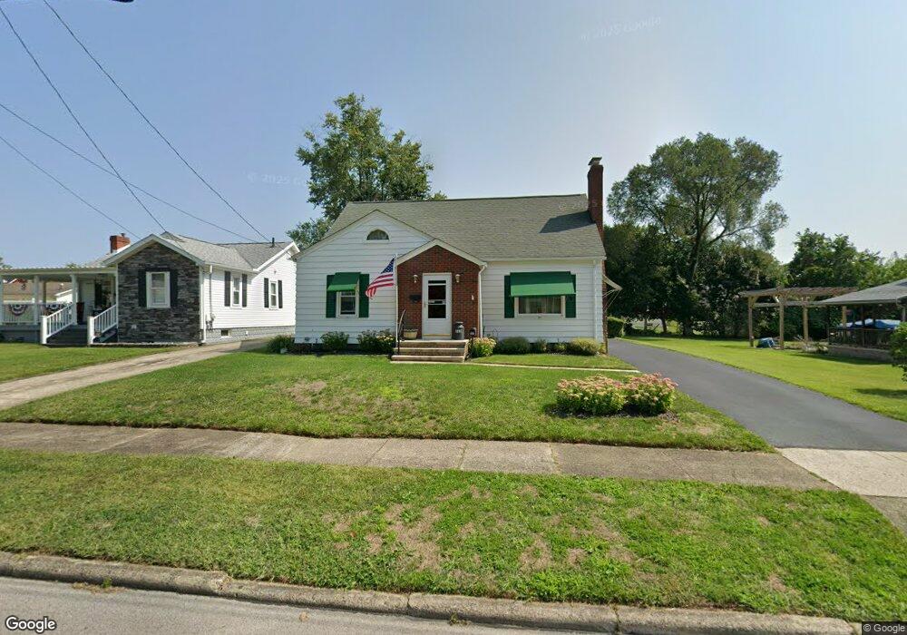
262 West St Conneaut, OH 44030
Estimated Value: $103,000 - $134,000
3
Beds
1
Bath
1,064
Sq Ft
$109/Sq Ft
Est. Value
About This Home
This home is located at 262 West St, Conneaut, OH 44030 and is currently estimated at $115,880, approximately $108 per square foot. 262 West St is a home located in Ashtabula County with nearby schools including Lakeshore Primary Elementary School, Gateway Elementary School, and Conneaut Middle School.
Ownership History
Date
Name
Owned For
Owner Type
Purchase Details
Closed on
Jul 23, 2009
Sold by
Fannie Mae
Bought by
Donley Linda S
Current Estimated Value
Purchase Details
Closed on
Jan 21, 2009
Sold by
Bates Jeffrey
Bought by
Federal National Mortgage Association
Purchase Details
Closed on
Feb 3, 2004
Sold by
Kaufman Joan and Graziano Roger W
Bought by
Bates Jeffrey and Nine Michele R
Home Financials for this Owner
Home Financials are based on the most recent Mortgage that was taken out on this home.
Original Mortgage
$74,000
Interest Rate
5.88%
Mortgage Type
Unknown
Create a Home Valuation Report for This Property
The Home Valuation Report is an in-depth analysis detailing your home's value as well as a comparison with similar homes in the area
Home Values in the Area
Average Home Value in this Area
Purchase History
We collect this data history from publicly available records. To have your information removed, we recommend requesting removal directly through your county’s website.
| Date | Buyer | Sale Price | Title Company |
|---|---|---|---|
| Donley Linda S | $45,100 | Accutitle Agency Inc | |
| Federal National Mortgage Association | $50,000 | None Available | |
| Bates Jeffrey | $74,000 | Franklin Blair Title Agency |
Source: Public Records
Mortgage History
We collect this data history from publicly available records. To have your information removed, we recommend requesting removal directly through your county’s website.
| Date | Status | Borrower | Loan Amount |
|---|---|---|---|
| Previous Owner | Bates Jeffrey | $74,000 |
Source: Public Records
Tax History
| Year | Tax Paid | Tax Assessment Tax Assessment Total Assessment is a certain percentage of the fair market value that is determined by local assessors to be the total taxable value of land and additions on the property. | Land | Improvement |
|---|---|---|---|---|
| 2024 | $2,110 | $28,840 | $4,200 | $24,640 |
| 2023 | $918 | $28,840 | $4,200 | $24,640 |
| 2022 | $678 | $21,490 | $3,220 | $18,270 |
| 2021 | $690 | $21,490 | $3,220 | $18,270 |
| 2020 | $689 | $21,490 | $3,220 | $18,270 |
| 2019 | $667 | $20,860 | $1,680 | $19,180 |
| 2018 | $636 | $20,860 | $1,680 | $19,180 |
| 2017 | $635 | $20,860 | $1,680 | $19,180 |
| 2016 | $629 | $21,880 | $1,790 | $20,090 |
| 2015 | $635 | $21,880 | $1,790 | $20,090 |
| 2014 | $560 | $21,880 | $1,790 | $20,090 |
| 2013 | $897 | $21,700 | $2,660 | $19,040 |
Source: Public Records
Map
Nearby Homes
Your Personal Tour Guide
Ask me questions while you tour the home.