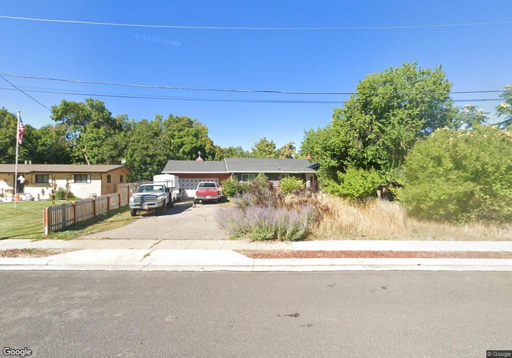
263 Lauralin Dr Logan, UT 84321
Wilson NeighborhoodEstimated Value: $437,000 - $501,000
Studio
--
Bath
1,514
Sq Ft
$310/Sq Ft
Est. Value
About This Home
This home is located at 263 Lauralin Dr, Logan, UT 84321 and is currently estimated at $469,915, approximately $310 per square foot. 263 Lauralin Dr is a home with nearby schools including Wilson School, Mount Logan Middle School, and Logan High School.
Ownership History
Date
Name
Owned For
Owner Type
Purchase Details
Closed on
Oct 19, 2016
Sold by
Neff James W and Neff Marilyn B
Bought by
Neff James W and Neff Marilyn B
Current Estimated Value
Purchase Details
Closed on
Oct 31, 2011
Sold by
Elder Dallas
Bought by
Neff David W
Home Financials for this Owner
Home Financials are based on the most recent Mortgage that was taken out on this home.
Original Mortgage
$151,500
Interest Rate
10%
Mortgage Type
Purchase Money Mortgage
Purchase Details
Closed on
Jul 27, 2010
Sold by
Vanbree James L and Vanbree Jacqueline
Bought by
Neff David W and Elder Dallas
Home Financials for this Owner
Home Financials are based on the most recent Mortgage that was taken out on this home.
Original Mortgage
$136,746
Interest Rate
4.71%
Mortgage Type
Purchase Money Mortgage
Create a Home Valuation Report for This Property
The Home Valuation Report is an in-depth analysis detailing your home's value as well as a comparison with similar homes in the area
Home Values in the Area
Average Home Value in this Area
Purchase History
| Date | Buyer | Sale Price | Title Company |
|---|---|---|---|
| Neff James W | -- | Cache Title Company | |
| Neff David W | -- | Accommodation | |
| Neff David W | -- | Hickman Land Title Company |
Source: Public Records
Mortgage History
| Date | Status | Borrower | Loan Amount |
|---|---|---|---|
| Previous Owner | Neff David W | $151,500 | |
| Previous Owner | Neff David W | $136,746 |
Source: Public Records
Tax History
| Year | Tax Paid | Tax Assessment Tax Assessment Total Assessment is a certain percentage of the fair market value that is determined by local assessors to be the total taxable value of land and additions on the property. | Land | Improvement |
|---|---|---|---|---|
| 2025 | $2,006 | $259,405 | $0 | $0 |
| 2024 | $2,071 | $259,405 | $0 | $0 |
| 2023 | $2,161 | $258,085 | $0 | $0 |
| 2022 | $2,093 | $233,335 | $0 | $0 |
| 2021 | $1,937 | $333,700 | $75,000 | $258,700 |
| 2020 | $1,767 | $274,000 | $75,000 | $199,000 |
| 2019 | $1,847 | $274,000 | $75,000 | $199,000 |
| 2018 | $1,651 | $223,624 | $75,000 | $148,624 |
| 2017 | $1,388 | $99,385 | $0 | $0 |
| 2016 | $1,439 | $99,385 | $0 | $0 |
| 2015 | $1,441 | $99,385 | $0 | $0 |
| 2014 | $1,302 | $99,385 | $0 | $0 |
| 2013 | -- | $87,985 | $0 | $0 |
Source: Public Records
Map
Nearby Homes
- 1045 Fox Farm Rd
- 2758 N Canyon Cove Dr
- 2738 N Canyon Cove Dr
- 27 Canterbury Ln
- 28 River Pointe Dr
- 684 Apple Dr
- 74 Canterbury Cir
- 83 Canterbury Cir
- 1164 E Mountain Rd
- 1246 Canyon Rd
- 622 Canyon Rd
- 1374 E 260 N
- 1147 Eastridge Dr
- 545 E Boulevard St
- 1131 E Lamplighter Dr
- 1054 Lamplighter Dr
- 327 N 1430 E
- 664 E Center St
- 45 River Circle Dr
- 640 E 600 N
- 277 Lauralin Dr
- 247 Lauralin Dr
- 293 Lauralin Dr
- 264 Lauralin Dr
- 248 Lauralin Dr
- 238 Lauralin Dr
- 278 Lauralin Dr
- 350 Lauralin Dr
- 354 Lauralin Dr
- 1035 Sumac Dr
- 1025 Sumac Dr
- 960 E 320 N
- 358 Lauralin Dr
- 1053 Fox Farm Rd
- 65 River Park Dr
- 35 River Park Dr
- 330 N 970 E
- 330 Lauralin Dr
- 55 River Park Dr
- 950 E 320 N
Your Personal Tour Guide
Ask me questions while you tour the home.