Estimated Value: $278,000 - $314,502
4
Beds
3
Baths
2,442
Sq Ft
$120/Sq Ft
Est. Value
About This Home
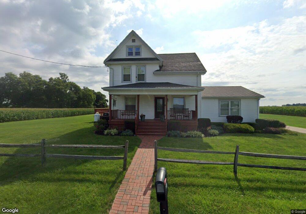
This home is located at 2632 Wayne Trace Rd, Eaton, OH 45320 and is currently estimated at $292,626, approximately $119 per square foot. 2632 Wayne Trace Rd is a home located in Preble County with nearby schools including William Bruce Elementary School, Hollingsworth East Elementary School, and Eaton Middle School.
Ownership History
Date
Name
Owned For
Owner Type
Purchase Details
Closed on
Jun 16, 1995
Sold by
Huehn Eric C
Bought by
Kochensparger Kevin P
Current Estimated Value
Home Financials for this Owner
Home Financials are based on the most recent Mortgage that was taken out on this home.
Original Mortgage
$54,400
Interest Rate
8.27%
Mortgage Type
New Conventional
Create a Home Valuation Report for This Property
The Home Valuation Report is an in-depth analysis detailing your home's value as well as a comparison with similar homes in the area
Purchase History
| Date | Buyer | Sale Price | Title Company |
|---|---|---|---|
| Kochensparger Kevin P | $68,000 | -- |
Source: Public Records
Mortgage History
| Date | Status | Borrower | Loan Amount |
|---|---|---|---|
| Closed | Kochensparger Kevin P | $54,400 |
Source: Public Records
Tax History
| Year | Tax Paid | Tax Assessment Tax Assessment Total Assessment is a certain percentage of the fair market value that is determined by local assessors to be the total taxable value of land and additions on the property. | Land | Improvement |
|---|---|---|---|---|
| 2025 | $2,593 | $71,830 | $8,440 | $63,390 |
| 2024 | $2,593 | $71,830 | $8,440 | $63,390 |
| 2023 | $2,564 | $71,830 | $8,440 | $63,390 |
| 2022 | $2,176 | $49,770 | $8,400 | $41,370 |
| 2021 | $2,282 | $49,770 | $8,400 | $41,370 |
| 2020 | $2,182 | $49,770 | $8,400 | $41,370 |
| 2019 | $1,878 | $41,830 | $7,630 | $34,200 |
| 2018 | $1,894 | $41,830 | $7,630 | $34,200 |
| 2017 | $1,893 | $41,830 | $7,630 | $34,200 |
| 2016 | $1,485 | $35,010 | $7,390 | $27,620 |
| 2014 | $1,436 | $34,800 | $7,390 | $27,410 |
| 2013 | $1,485 | $34,790 | $7,385 | $27,405 |
Source: Public Records
Map
Nearby Homes
- 409 Chestnut Dr
- 401 Chestnut Dr
- 350 Frizzell Ave
- 315 Evergreen Dr
- 321 Liberty St
- 218 Nation Ave
- 315 S Maple St
- 216 Vine St
- 216 S Franklin St
- 117 Vine St
- 600 E Somers St
- 113 S Barron St
- 0 Whisper Way
- 232 Goldenrod Dr
- 235 East Ave
- 922 E High St
- 224 N Barron St
- 115 E Decatur St
- 0-00 Washington Jackson Rd
- 512 Lincoln St
- 2609 Wayne Trace Rd
- 2441 Wayne Trace Rd
- 2721 Wayne Trace Rd
- 2727 Wayne Trace Rd
- 2976 Wayne Trace Rd
- 1689 Old Camden Pike
- 1681 Old Camden Pike
- 0 Brower Rd Unit 463010
- 3094 Wayne Trace Rd
- 1739 Old Camden Pike
- 737 Brower Rd
- 1076 E Consolidated Rd
- 3218 Wayne Trace Rd
- 0 Consolidated Rd Unit 1802665
- 0 Consolidated Rd
- 1184 E Consolidated Rd
- 529 Brower Rd
- 687 E Consolidated Rd
- 687 E Consolidated Rd
- 530 Brower Rd
Your Personal Tour Guide
Ask me questions while you tour the home.